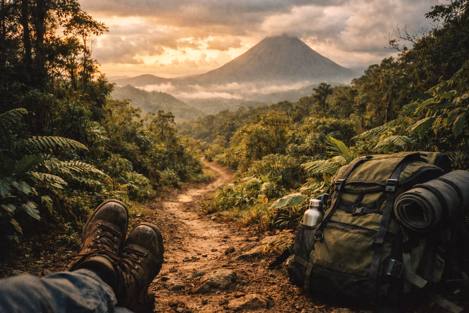
Hiking in Costa Rica punishes the wrong shoes, because rainforest trails stay muddy and slick more than half the year. Pack boots with aggressive tread plus cheap water shoes for river and waterfall crossings, then carry two to three liters with electrolytes. Interior trails often lose cell signal entirely, so bring a waterproof map and a GPS with spare power rather than trusting your phone. For volcanoes, start by 7 a.m. before clouds swallow the crater, and honor every closure during high activity.
Does Costa Rica Have Good Hiking Trails?
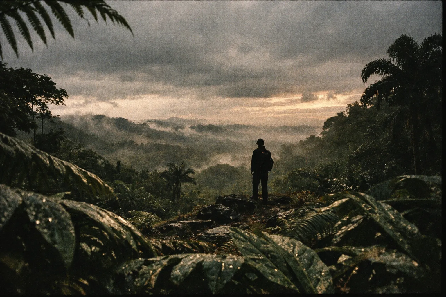
Hiking in Costa Rica offers an unusually varied experience for a country smaller than West Virginia. You can walk a flat coastal trail under almond trees in the morning and stand on a volcanic crater rim by afternoon. Costa Rica has more than 60 protected areas and over 200 volcanic formations, most threaded with signed trails (1)(3). The terrain ranges from beginner-friendly national park loops to multi-day routes like the Camino de Costa Rica, which crosses the country at 20-25 km per day (5).
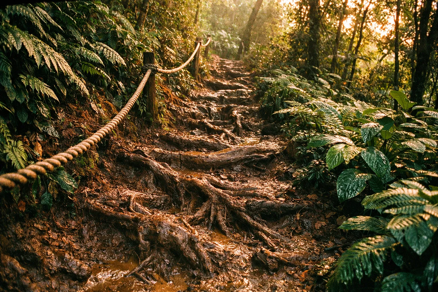
The catch is that “good” depends entirely on preparation. Trails are well-marked in the major parks, but interior routes often have limited or no cell coverage, and rainforest paths stay muddy or slick more than half the year (1)(4). The infrastructure is there. The margin for error on weather and footwear is thinner than most people expect.
Top Trails Worth Your Time in Costa Rica
These are the trails I’d point a first-timer toward, ranked by how much hauling yourself there actually pays off. I’ve grouped them by difficulty so you can match a trail to your fitness and your schedule.
Worth the detour - even on a tight itinerary:
- Arenal Volcano area (La Fortuna). Lava-field trails with the cone looming over you when clouds cooperate. Mostly easy-to-moderate, with viewpoints reachable in a half day.
- Monteverde Cloud Forest Reserve. Suspended walkways and birding through perpetual mist. Cool, wet, and unlike anywhere else in the country.
- Río Celeste at Tenorio Volcano National Park. A roughly 6 km round-trip to a waterfall whose blue color comes from volcanic minerals. Moderate, muddy, and worth every slick step.
Good if you have the days:
- Cahuita National Park on the Caribbean coast - flat, coastal, wildlife-dense (covered in detail below).
- Río Savegre waterfall hikes near San Gerardo de Dota - cool highland cloud forest with a payoff at the falls (also below).
- Manuel Antonio National Park - short jungle trails ending at beaches, with near-guaranteed monkey and sloth sightings. Crowded, but the wildlife density earns it a spot.
For experienced hikers only:
- Cerro Chirripó, the country’s highest peak at 3,820 m, requires a permit, an overnight at the Crestones base lodge, and serious cardio.
- Corcovado National Park on the Osa Peninsula - Costa Rica’s densest wildlife, but humid, remote, and best done with a guide.
- Sections of the Camino de Costa Rica, a coast-to-coast trek that demands you build up to 20-25 km days before you go (5).
The best hiking in Costa Rica isn’t a single trail - it’s matching the terrain type (coastal, cloud forest, volcanic) to what your legs and your calendar can handle.
Choosing Your Base: Costa Rica’s Main Hiking Regions
Think in regions, because where you base yourself determines what’s reachable without a long drive.
- Arenal / La Fortuna (north-central). The easiest hiking hub for first-timers. Volcano trails, waterfalls, and hot springs within a short drive, with ranger presence and clear signage.
- Guanacaste (northwest). Drier than the rest of the country, which means firmer trails. Rincón de la Vieja National Park has bubbling mud pots, fumaroles, and a summit trail. The dry season here is genuinely dry.
- Monteverde (cloud forest). Cool, misty, and the country’s best birding. Bring a fleece - it’s noticeably colder than the lowlands.
- Caribbean coast (Cahuita, Puerto Viejo). Flat coastal trails, fewer crowds, and a slower pace. Hotter and more humid than the highlands.
- Osa Peninsula (south Pacific). The wild end of the spectrum. Corcovado is here, and so is the most demanding logistics in the country.
For remote reserves and deep rainforest, hire a local guide - not for the scenery commentary, but because navigation and wildlife safety genuinely matter where trails fade and signal disappears (1)(3).
Navigating the trails: maps and GPS essentials
Many national parks have limited or no cell signal on interior trails, so don’t rely on your phone alone (1). I learned this the direct way at Rincón de la Vieja - the trail markers through the lower forest section were spaced far enough apart that without GPS and a downloaded offline map, I’d have been guessing at two separate junctions. What I carry on every hike here:
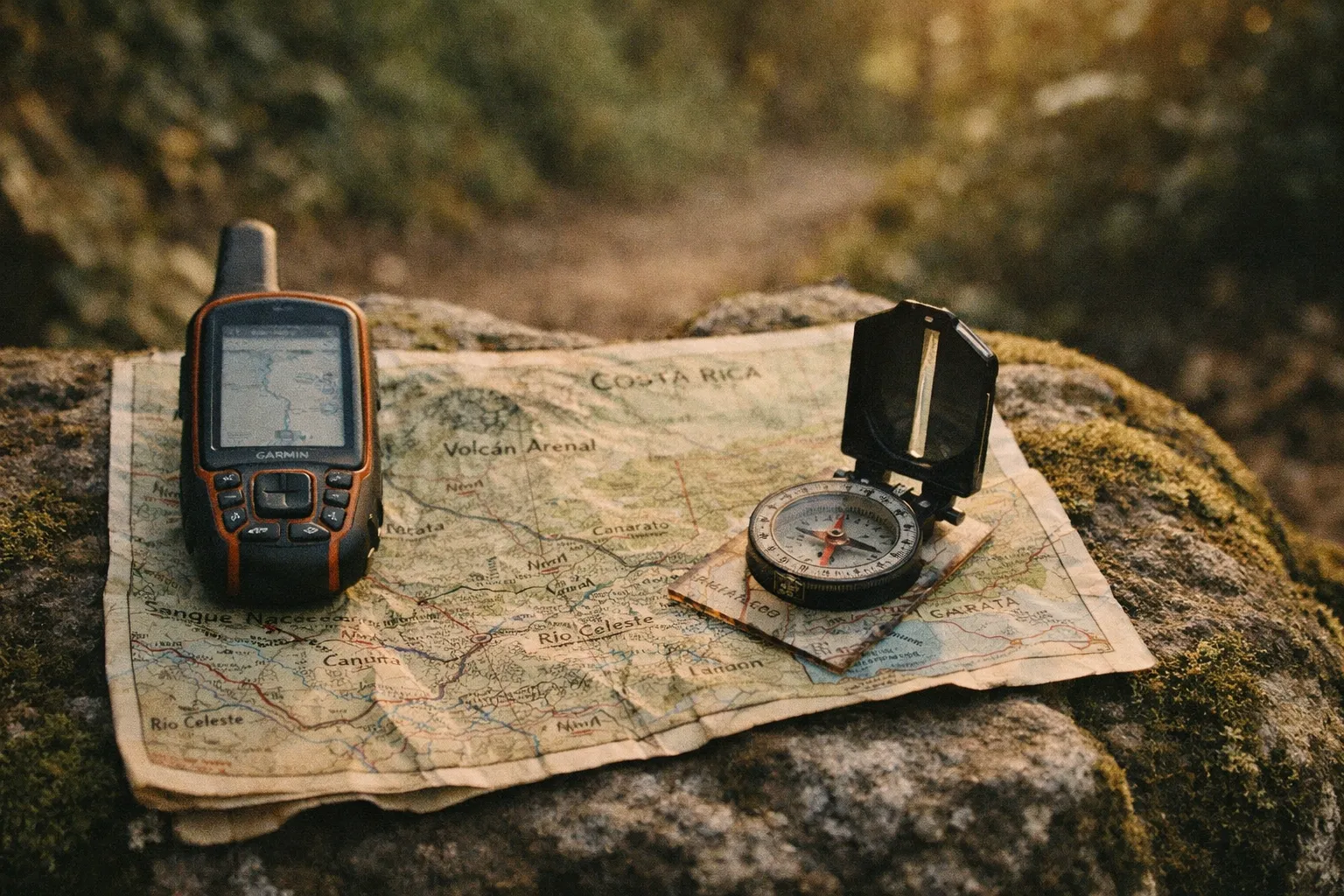
- A reliable, waterproof physical map of the area.
- A fully charged GPS device with spare batteries or a power bank.
- Offline maps downloaded on my smartphone as a backup.
One habit that’s saved me more than once: photograph the trail map at the park entrance and ranger station. Even if you lose the paper copy or your map app glitches, you’ve got a digital backup in your camera roll.
Visit Costa Rica’s official guidance is blunt and correct - stay on marked trails, tell someone your route and estimated return time, and keep your group together (3). Dense forest makes it easy to lose the path when you step off it, and the parks that generate search-and-rescue calls are almost always the ones where someone wandered off a marked route. Talk to rangers or park officials before you head out, too. They know which crossings are sketchy after recent rain and which sections are temporarily closed - information no GPS app carries.
The crucial role of weather awareness
Afternoon rain is common even in the “dry” season, and short downpours can turn trails muddy and rivers dangerous within 15-30 minutes (1). In recent years, climate patterns have brought more intense localized rain events, which makes the official advice - turn back if rivers rise or trails flood - more relevant than ever (1). I’ve tested this the hard way: a stream crossing that’s ankle-deep on the way in can be thigh-deep and moving fast on the way out. That’s not a risk worth taking.
Tips for staying ahead of the weather:
- Check multiple weather sources for the day of your hike and a few days following, in case you’re out longer than expected.
- Understand the regional climate - Guanacaste runs dry while the Caribbean side stays wet, and microclimates won’t show in a general forecast.
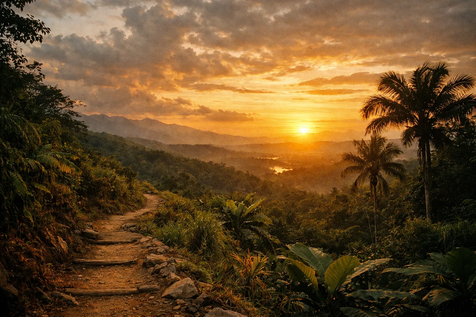
- Start at park opening (often 7-8 AM) to get the cooler hours and clear the trail before afternoon storms build (1)(5).
- Prepare for all conditions with layering, waterproof gear, and sufficient water and food.
The turn-around rule is non-negotiable: if a river is visibly rising, don’t cross it. Wait, or go back the way you came.
When I planned my Chirripó ascent, I built the itinerary entirely around the weather window. Afternoons on that mountain reliably bring rain and fog, which means slick rock and zero crater visibility. Starting before dawn isn’t dramatic - it’s just how you actually see what you came to see.
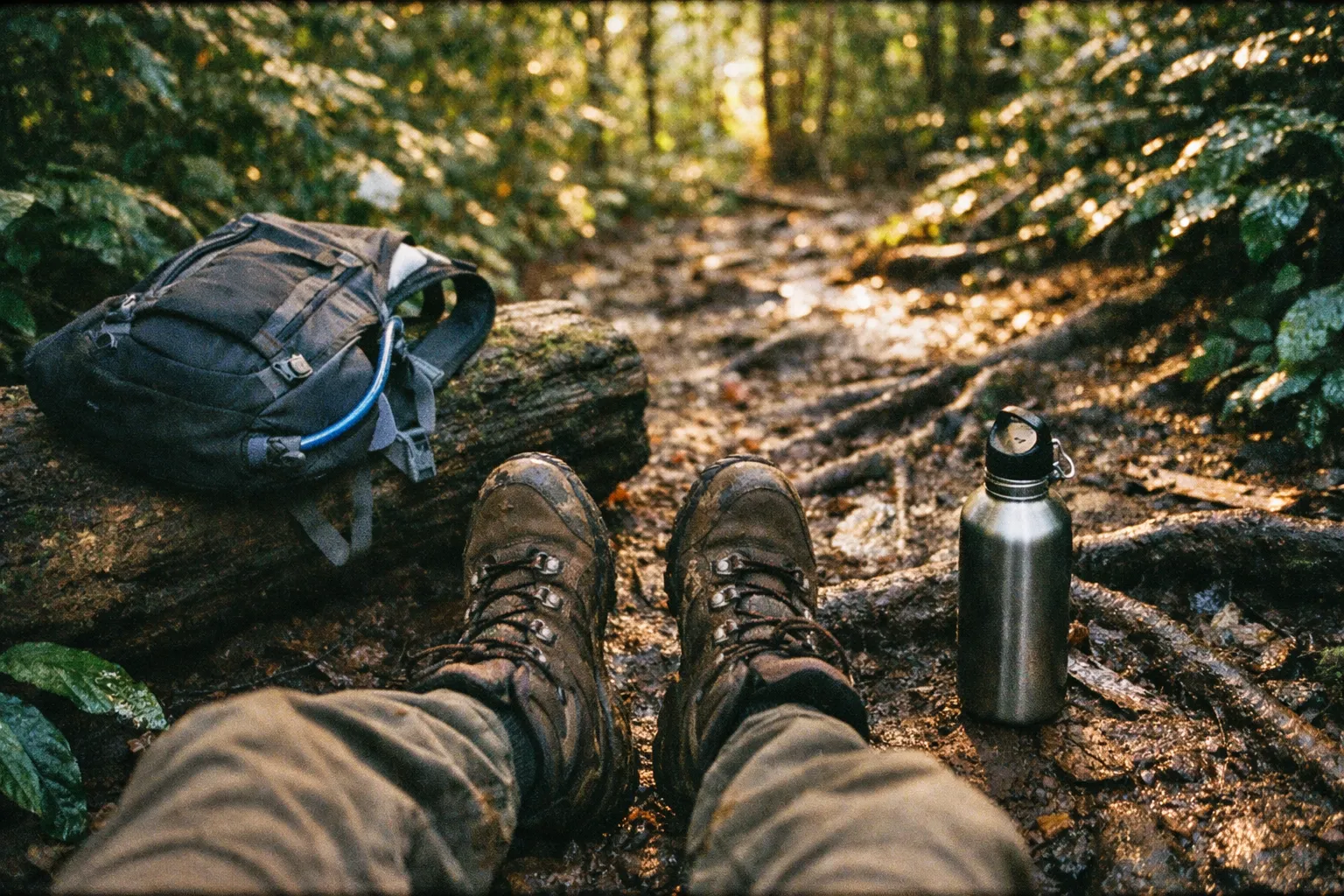
Proper preparation: footwear and hydration
Footwear is where most people get Costa Rica wrong. Trails in rainforest and cloud forest are muddy or slick more than 50% of the year (1)(4). Running shoes or - and I’ve seen this - flip-flops on wet roots are a sprained-ankle bet. Closed-toe shoes or boots with aggressive tread are the baseline (1)(2)(4). My system is a light boot or trail runner for the main trail plus separate water shoes for river and waterfall segments, so I can switch and keep my hiking footwear dry (4). In Corcovado, where you’re crossing streams every hour and the mud is relentless, that switch matters.
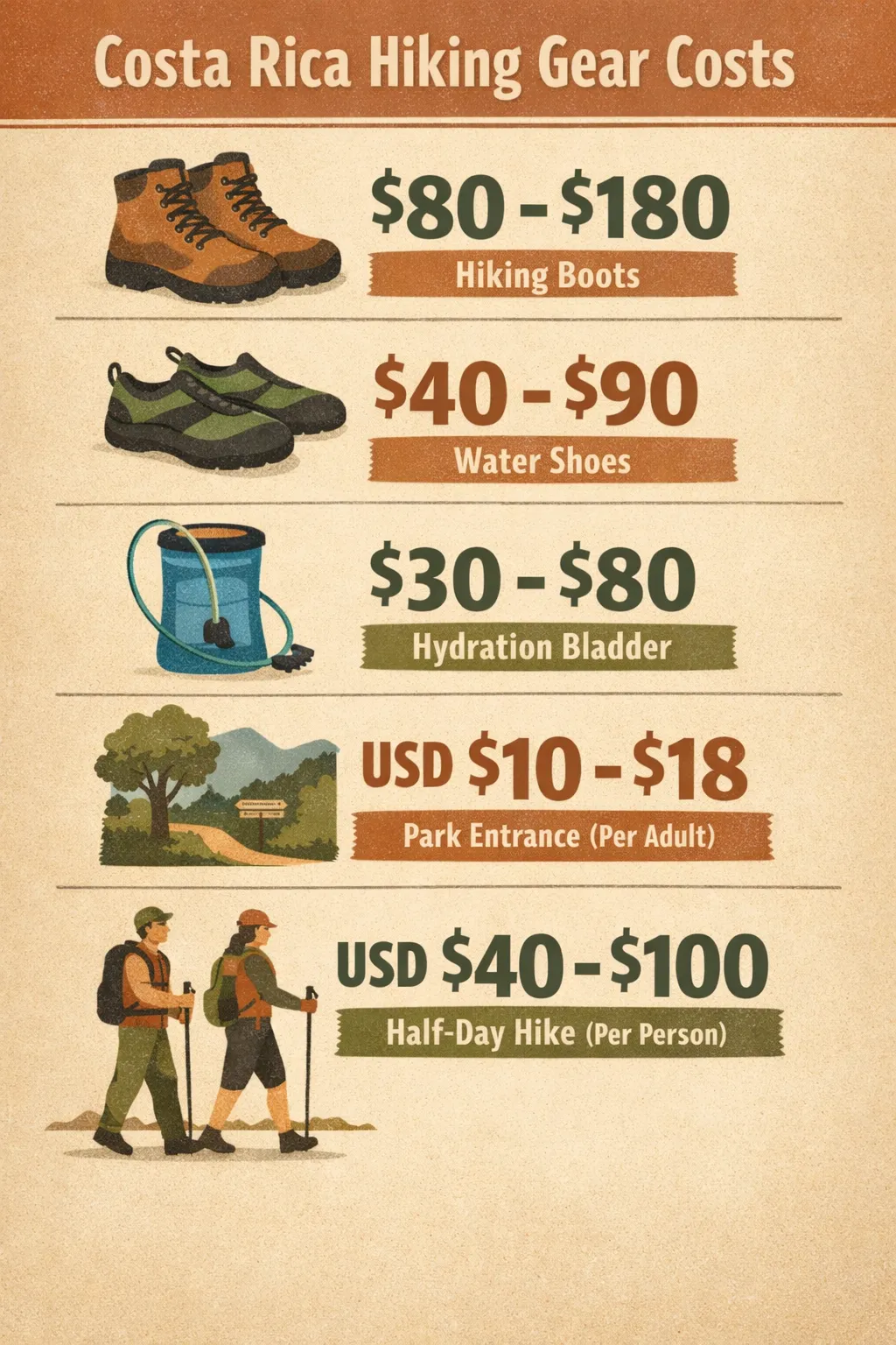 Gear costs for Costa Rica hiking include boots $80-$180, water shoes $40-$90, hydration bladder $30-$80, park entrance $10-$18, and half-day hike $40-$100 per person.
| Essential Gear | Description | Cost (USD) |
|---|---|---|
| Waterproof hiking boots/shoes | Durable, good ankle support and grip for wet, muddy conditions. Merrell, Salomon, Columbia. | $80-$180 |
| Water shoes/sandals with grip | For waterfall and river crossings; switch into these to keep boots dry. | $40-$90 |
| Hydration bladder (2-3 L) | Integrated into a daypack; carries more and lets you sip on the move. | $30-$80 |
| Insulated bottle (1-1.5 L) | Backup water; good for mixing electrolytes separately from bladder. | $20-$50 |
| Electrolyte tablets/powder | Replaces salts lost to heavy sweating; prevents cramps. | $10-$25 |
| Daypack (20-30 L) with rain cover | Carries water, layers, first aid, dry bag. | $40-$120 |
Pack extra socks. River crossings and rain-soaked trails mean blisters if you stay in wet socks, and dry feet are worth the few ounces.
Hydration is the other thing people underestimate. Heat index on lowland trails routinely exceeds 86-95°F (30-35°C) with humidity above 70-80% (1)(4). Carrying one small 500-750 ml bottle on a multi-hour hike in that heat is how people end up with heat exhaustion (2)(5). Plan for 2-3 liters of water per person on hot, humid hikes, and more where water sources are limited (2)(5). The Camino de Costa Rica’s training guidance is the right instinct even for day hikes: drink small sips constantly rather than waiting until you’re thirsty (5). Pre-hydrate with 500-750 ml an hour or two before you start so you’re not already behind. On longer hikes, water purification tablets or a portable filter let you safely refill from streams.
Add electrolytes. Sports drinks or tablets counter the salt you lose sweating and keep cramps away (5). Watch for the early signs of heat exhaustion - dizziness, nausea, a headache, stopping sweating - and rest in shade, sip electrolytes, and turn back if they don’t ease.
Hiking Volcanoes in Costa Rica
Hiking volcanoes in Costa Rica is a different animal from rainforest walking. The surface underfoot is often rugged lava flow or sharp, loose rock, and the weather on a volcano can swing from sunny to driving rain and wind in minutes (1)(4). Before my visit to Arenal - an active site with a documented eruption history - I checked the National Seismological Network of Costa Rica’s reports and monitored local news for activity updates. That’s not paranoia; it’s the minimum due diligence for an active volcanic area.
What changes on volcanic terrain:
- Boots over trail runners. Lava fields are uneven with sharp rocks; toe protection and ankle support genuinely matter here.
- Layer up. Volcano summits are colder and windier than the trailhead. A waterproof shell is not optional.
- Start early. Clouds obscure crater views fast. The cone you came to see is usually visible at 7 AM and gone by noon.
Steps to take for a safe hike around volatile areas:
- Visit local ranger stations for the latest updates and advice.
- Stay on marked trails, as these are monitored for safety.
- Have an emergency plan, including routes for evacuation.
Parks respect closures during high volcanic activity or heavy rain - so should you (1)(3). The landscapes here are genuinely impressive, but they’re not static. Treating them as such is how hikes go wrong.
Arenal volcano hikes
Arenal is the most accessible volcano hiking in the country, which makes it the right first volcano for most visitors. The trails sit inside Arenal Volcano National Park near La Fortuna, with park entrance fees around USD $10-$18 per adult.
The main draws are the lava-flow trails - the 1968 lava field, named for the eruption that reshaped the area - and several viewpoints. These are easy-to-moderate, walkable in a half day, and the footing is the uneven, sharp-rock kind that rewards real boots. The cone itself can’t be summited; the reward is standing on old lava with the volcano above you when the clouds part.
Booking note: you don’t need an advance reservation for the national park trails, but the popular guided hikes - often paired with a hot springs visit - fill up in high season (December-April). Half-day guided nature walks run roughly USD $40-$100 per person; full-day volcano hikes with transport run USD $90-$180 (1). Start early. The cloud cover that swallows Arenal’s summit usually rolls in by midday.
Cahuita National Park
Cahuita, on the southern Caribbean coast, is the antidote to volcano cardio. The main trail runs flat and coastal - sand, exposed roots, and jungle pressing up against the beach - making it one of the few genuinely easy national park hikes in the country.
What it lacks in elevation it makes up in wildlife. Howler and capuchin monkeys, sloths, coatis, and a remarkable density of birds live along the trail, often close enough that you don’t need binoculars. The full coastal route stretches several kilometers; you can turn around whenever you’ve had enough.
Don’t let “flat and coastal” fool you on gear. The heat and humidity here are intense, so water and electrolytes are vital even on level ground (1). Sand and roots still mean closed shoes with good grip - exposed roots get slick, and there’s nothing on this trail worth a face-plant. Entrance to the Cahuita sector works on a donation basis at the Kelly Creek entrance, which is unusual for Costa Rica’s parks and worth knowing before you arrive.
Río Savegre Waterfall Trails
The Río Savegre waterfall hikes sit in the highland cloud forest near San Gerardo de Dota, in the Talamanca mountains south of San José. This is cooler, quieter country than the tourist hubs - quetzal habitat, mossy forest, and a river running cold and clear.
The trail to the waterfall is moderate, with sections that turn slick near the falls themselves. Spray off the water cools you down but also wets the rocks and your soles, so non-slip footwear matters more here than the gentle elevation suggests. Trekking poles earn their weight on the descent - collapsible ones run USD $25-$60 and dramatically improve stability on slick clay mud (8).
Because this is highland terrain, mornings start cold. Bring a layer you can shed as you warm up, and time your hike early - the same afternoon cloud and rain pattern applies up here, and the light through the cloud forest is best in the morning anyway.
Other Trails Worth Knowing About
A few more trails worth knowing, depending on where your trip takes you:
- Cabo Blanco Absolute Nature Reserve (Nicoya Peninsula) - the country’s oldest protected area, with a forest trail down to a remote beach. Moderate, and quieter than the mainland parks.
- Curú Wildlife Refuge (Nicoya) - short, easy trails with reliable monkey and deer sightings; good for families.
- Rincón de la Vieja National Park (Guanacaste) - fumaroles, boiling mud pots, and a demanding summit trail. The lower loop is moderate; the summit is a serious full day.
- Mistico Hanging Bridges (Arenal) - suspended walkways through rainforest canopy; easy, accessible, and well-maintained (1).
- Bajos del Toro waterfall - a steep descent to a dramatic falls in a volcanic crater; short but knee-punishing on the climb out.
None of these change the core gear math: closed-toe shoes with grip, 2-3 liters of water, a rain layer, and an early start.
Costa Rica hiking tours
For first-time visitors, a guided tour is the safest way to hike here - and not because the trails are dangerous, but because a guide manages the variables you can’t. They monitor the weather, know which crossings are sketchy that day, handle navigation where signal drops, spot wildlife you’d walk right past, and usually carry first aid (1)(5).
Rough pricing:
- Group nature walks (half-day): USD $40-$100 per person, often including transport.
- Full-day volcano or waterfall hikes with transport: USD $90-$180 per person.
- Private guided hikes: USD $150+, depending on the park and group size.
There’s been a clear push by local operators toward guided hikes for first-timers, partly to cut down on search-and-rescue incidents and human-wildlife conflicts (1)(5). If you’re comfortable navigating, fit, and sticking to well-marked major-park trails, independent hiking is straightforward and far cheaper - entrance fees run USD $10-$18 per adult at most parks. For remote reserves, deep rainforest, or anything involving river crossings you can’t read, pay for the guide.
What to be cautious of in Costa Rica
The country is safe for hikers who respect a few real hazards:
- Weather and rivers. Intense showers, rising rivers, and dropping visibility are the top risks. Turn back if rivers rise or trails flood (1).
- Wildlife and plants. Snakes, biting insects, and stinging plants are why closed shoes and long pants matter. Don’t grab tree trunks, bamboo, or vines for balance - that’s how people meet a snake or a wasp nest by accident (1)(7). Never feed or touch wildlife; keep your distance (1)(5).
- Sun. Equatorial UV is brutal even under cloud. Use SPF 30-50+, a wide-brim hat, and UV sunglasses (2)(3)(4).
- Theft. Don’t leave valuables in cars at trailheads. Carry a passport copy and your essentials in a dry bag inside your daypack (1)(6).
- Ocean currents. If your hike ends at a beach, rip currents are a separate and serious risk. Don’t assume a calm-looking surf is safe.
A mini first-aid kit (USD $15-$35) with blister care, antiseptic, and pain relief covers the most common trail mishaps, and a headlamp (USD $15-$50) saves you if a hike runs long (1)(4)(6).
Frequently Asked Questions
- Is hiking good for high blood pressure?
- Moderate hiking can benefit people with high blood pressure, but Costa Rica's hot, humid, and sometimes steep trails require careful condition management. Start with shorter, moderate trails, avoid midday heat, pre-hydrate, rest frequently, and carry medication in your daypack. Always consult your doctor before strenuous hikes.
- Can I bring prescription medication to Costa Rica?
- Yes, but carry medications in original labeled containers with a printed prescription and doctor's note. Bring only personal-use quantities and keep meds in your daypack, not checked luggage. Check current regulations before travel as rules may change.
- Are guided hikes necessary in Costa Rica?
- Guided hikes are recommended for remote or complex trails where navigation and wildlife safety are concerns. For well-marked major parks and if you are fit and experienced, independent hiking is feasible and cheaper. Guided tours also reduce search-and-rescue incidents.
- What should I do if a river crossing becomes dangerous?
- Turn back immediately if a river is visibly rising or trails flood. Do not attempt to cross rising rivers. Wait for conditions to improve or return the way you came to avoid serious risk.
- How reliable are trail markers and GPS in Costa Rica?
- Trail markers are reliable in major parks but can be sparse in interior or remote areas. Cell signal is often unavailable, so carry a waterproof physical map, a GPS device with spare power, and offline maps on your phone. Photograph trail maps at park entrances as a backup.
Wrap up
Hiking in Costa Rica rewards preparation more than fitness. Get the footwear right - closed-toe shoes with real grip, plus water shoes for river segments. Carry 2-3 liters of water per person with electrolytes, and sip constantly instead of waiting to feel thirsty (2)(5). Download offline maps, photograph the trail map at the entrance, and stay on marked routes where signal drops (1)(3). Start at park opening to beat the afternoon storms, and turn back if a river rises - every time, no exceptions.
Match the trail to your day: Arenal or Cahuita if you want accessible and rewarding, Chirripó or Corcovado if you’ve trained for it. Book guided tours in advance during the December-April high season, and budget USD $10-$18 for park entrance or USD $40-$180 for a guided hike. The trails here will deliver - as long as you show up with the right gear and a realistic read on the weather.