Great Smoky Mountains National Park is free to enter, and yet plenty of first-timers still get caught out at the trailhead because a parking tag is required for any stop longer than 15 minutes (11). The best things to do at the Great Smoky Mountains span short paved waterfall walks, 11-mile scenic loops, backcountry summits, and roadside wildlife stops - all inside a park that covers Tennessee and North Carolina and stays open 24 hours a day, 365 days a year (4). The catch is scale: with more than 800 miles of maintained trails and traffic that clogs the main corridors by mid-morning, showing up without a plan usually means a day lost to bear jams and full parking lots. Conditions are also actively changing, with lingering Hurricane Helene impacts, so check the park’s current conditions page before you leave home.
✓ Pros
- Park entry is free; the only required fee is a $5/day parking tag (11)
- Enormous range of activities, from paved 20-minute walks to multi-day backcountry routes
- Open 24 hours a day, 365 days a year (4)
- Reliable wildlife viewing (black bears, elk) without driving to remote corners
- Historic cabins, scenic drives, and waterfalls all within one park
✗ Cons
- Summer traffic on the Spur runs into the tens of thousands of vehicles per day; timing your entry matters
- Popular trailhead parking fills by 9-10 a.m. on weekends
- Trail and road closures shift with little notice (Hurricane Helene impacts still active)
- Cell service is spotty to nonexistent; you need offline or printed maps
- Backcountry overnight stays require advance permits through Recreation.gov
Before You Go: Parking Tags, Permits, and Current Conditions
Smoky Mountains National Park charges no entrance fee, but it does require a parking tag for any vehicle stopped longer than 15 minutes - and that single rule catches out more visitors than anything else. Sort out three things before you drive in: your parking tag, any backcountry permit you need, and the day-of trail and road status.
Parking Tag - What It Costs and Where to Buy It
Parking tags cost $5 per day, $15 per week, or $40 per year (11). Entry to the park itself stays free; the tag is a separate requirement that applies at every trailhead and scenic pullout where you’ll park longer than 15 minutes. According to the National Park Service, you can buy daily and weekly tags online through Recreation.gov or at 24/7 parking tag machines and visitor centers, and each tag expires at 11:59 p.m. on the date printed (11). Vehicles with a disability license plate or placard are exempt, even when parked longer than 15 minutes (11).
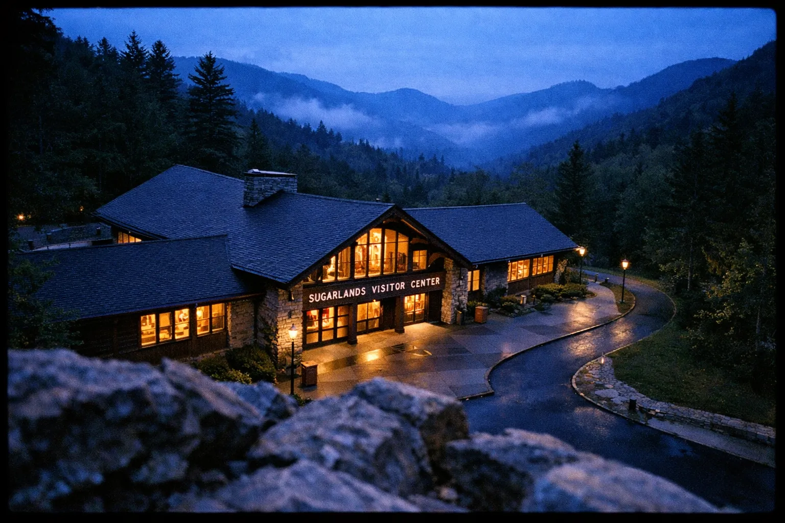
Don’t assume you can pay at the trailhead. Buy your tag online before you arrive, or budget time to stop at a kiosk at Sugarlands, Oconaluftee, or Cades Cove. The fees page was last updated July 7, 2026, so the rules above are current for the year.
Checking Trail and Road Conditions Before You Arrive
Overnight backcountry stays all require a permit, booked through Recreation.gov as of April 30, 2026. If you’re a thru-hiker on the Appalachian Trail, the park uses a stricter definition: you must start and end your hike at least 50 miles outside the park to qualify under thru-hiker permit rules. Get the permit type right before you book, because the process differs.
The NPS current conditions page is updated frequently - often daily during active closure periods. As of July 18, 2026, several trails carried temporary closures or damage cautions from Hurricane Helene, and Bullhead Trail is closed Monday through Thursday from May 4 through November 19, 2026 for rehabilitation work. The seasonal road schedule was last updated April 20, 2026, so don’t plan around a static guidebook. Cell service is spotty to nonexistent across most of the park; download offline maps in Gaia GPS or AllTrails before you lose signal, and grab a printed map at any visitor center as a backup.
How to Get to Great Smoky Mountains National Park
The park straddles the Tennessee-North Carolina border and has no single main entrance - where you enter depends on which side you’re visiting. From the Tennessee side, the primary gateway is Gatlinburg, reached via US-441 south from Pigeon Forge. From the North Carolina side, Cherokee is the entry point, also on US-441. The two are connected by Newfound Gap Road through the park itself, a 33-mile drive that takes 45-70 minutes without stops.
The nearest major airports are McGhee Tyson Airport (TYS) in Knoxville, about 45 miles from Gatlinburg, and Asheville Regional Airport (AVL) in North Carolina, roughly 60 miles from Cherokee. Both require a rental car - there is no meaningful public transit to or within the park. From Knoxville, take I-40 east to US-66 south to US-441 south into Gatlinburg. From Asheville, take I-40 west to US-19 to US-441 north into Cherokee.
If you’re driving from the mid-Atlantic, a road trip from Pennsylvania to Tennessee via I-81 and the Blue Ridge Parkway is a natural way to build in stops before you reach the park entrance.
Best Time to Visit Great Smoky Mountains
October is the best overall month to visit. Fall foliage peaks across the park’s elevation range from mid-October through early November, visibility at Kuwohi is at its clearest, and wildlife activity picks up ahead of winter. The tradeoff is crowds - October weekends rival summer for traffic on the Spur and the Cades Cove loop, so the early-arrival rule matters even more than usual.
Spring (late March through May) is the second-best window: wildflower season peaks in April, waterfalls run high from snowmelt and rain, and crowds are lighter than summer. Summer brings the highest visitor numbers and the worst Spur congestion, but it’s also when all roads and trails are open. Winter is genuinely quiet, with Clingmans Dome Road closed and some higher trails icy, but Cades Cove and Newfound Gap Road stay open and the park is far less crowded than any other season.
Things to Do at the Great Smoky Mountains, Organized by Time Budget
The smartest way to plan things to do at the Great Smoky Mountains is by time budget rather than a flat wish list, because the park’s size and traffic punish anyone who tries to cram everything into one day. Think in three tiers: a couple of hours, a half day, or a full day and beyond.
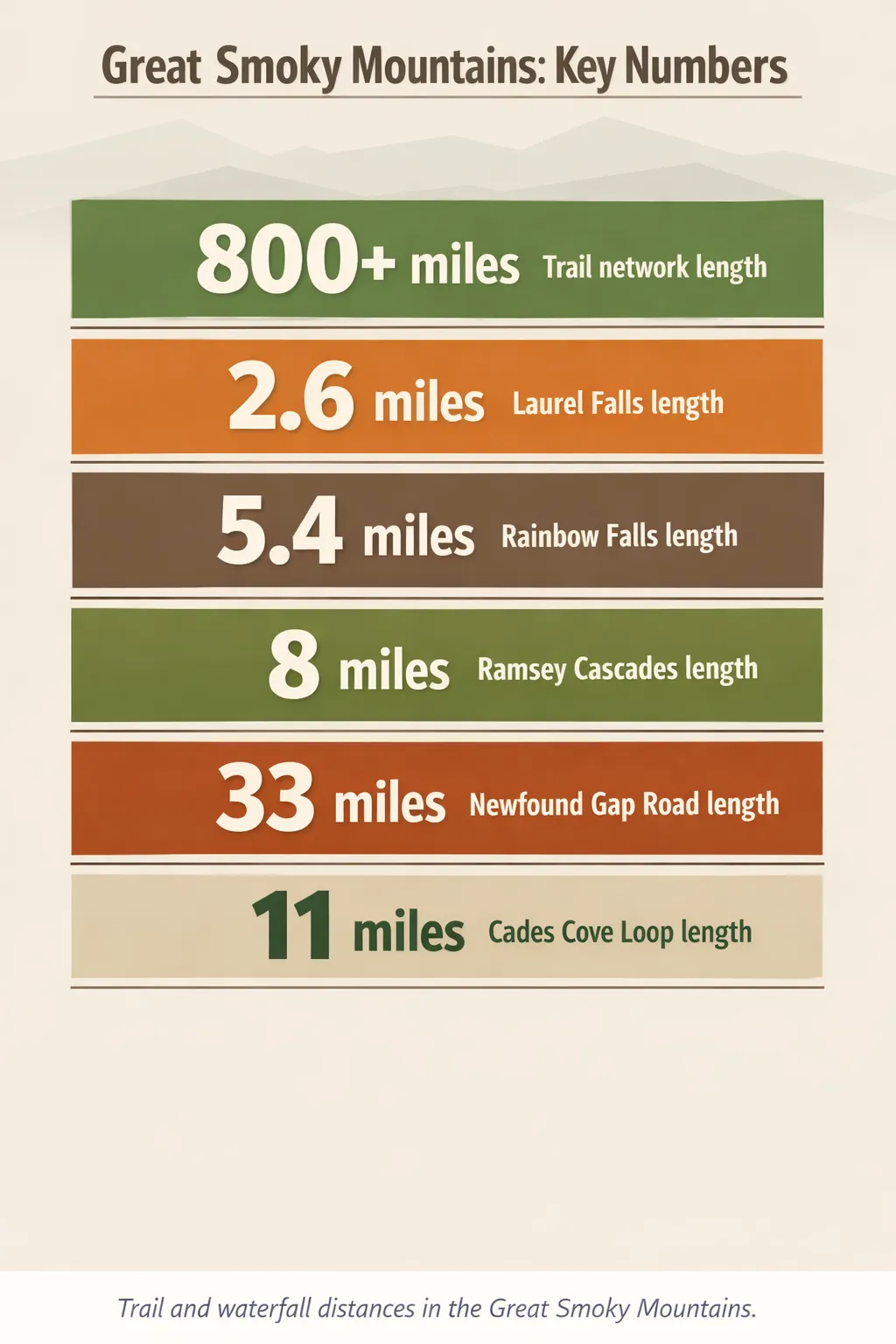 Six park data figures show trail lengths and road distances in Great Smoky Mountains National Park (Laurel Falls 2.6 miles; Rainbow Falls 5.4 miles; Ramsey Cascades 8 miles; Newfound Gap Road 33 miles; Cades Cove Loop 11 miles; Trail network 800+ miles).
If You Only Have a Few Hours
With two to three hours, drive Newfound Gap Road (US-441), the 33-mile route connecting Gatlinburg, Tennessee, to Cherokee, North Carolina. Budget around two hours with overlook stops. No hiking required, and it’s the best low-effort option for fall foliage. Stop at Newfound Gap itself, where the Appalachian Trail crosses the road.
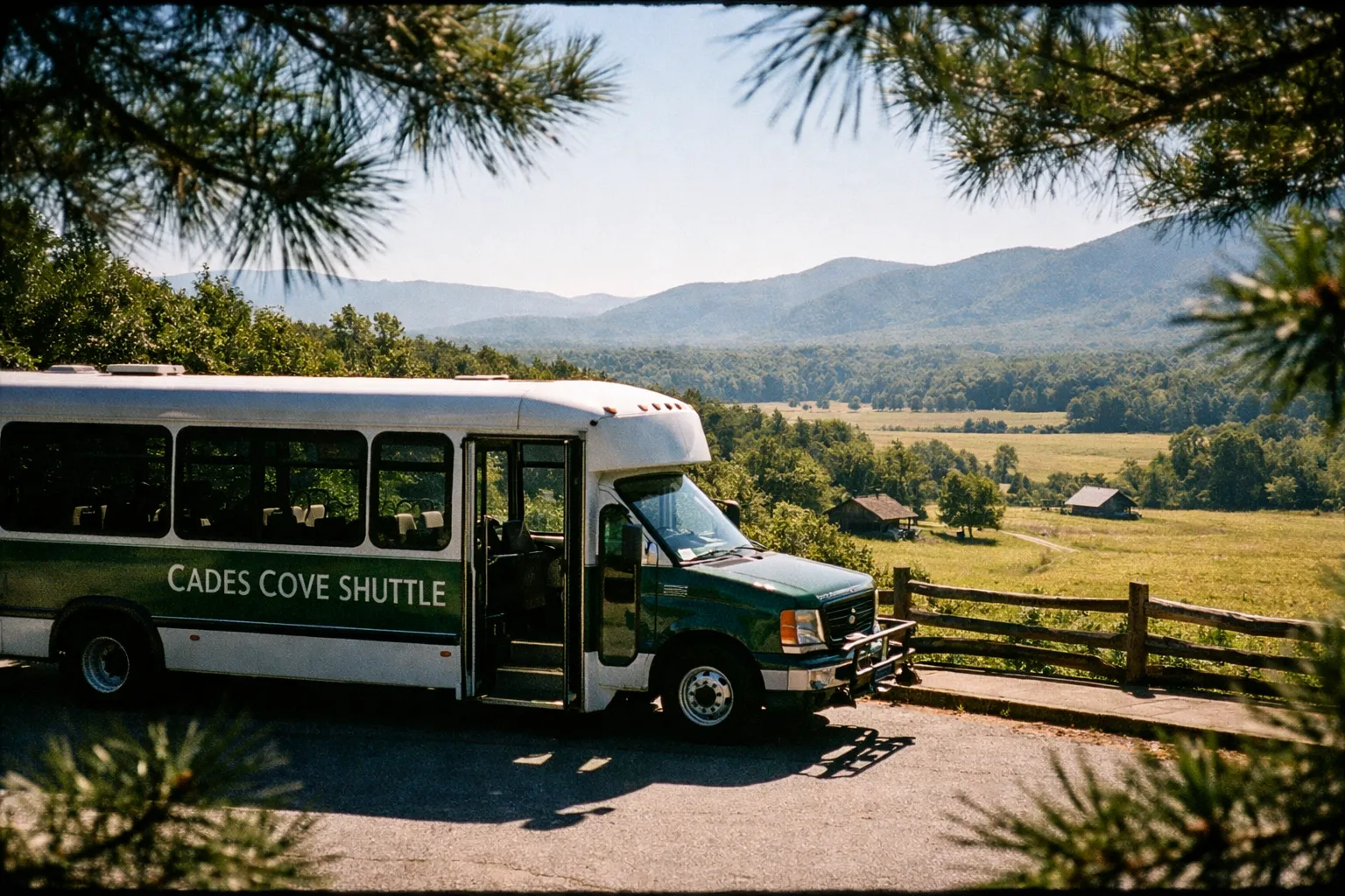
If you’d rather stay on one loop, the Cades Cove Loop Road is an 11-mile one-way paved road through a valley ringed by mountains, with historic cabins and churches visible from your car. Arrive by 7-8 a.m. to beat the bear jams and traffic that build mid-morning. Some days include bike- and pedestrian-only hours, so check the schedule before you go.
Planning a Full Day or Weekend
A full day lets you pair one signature hike - Alum Cave Trail or Rainbow Falls - with a scenic drive segment and a wildlife stop at dusk. Over two to three days, split the park: spend day one on the Tennessee side (Cades Cove, Laurel Falls, Kuwohi), day two on the North Carolina side (Cataloochee Valley for elk, Oconaluftee Visitor Center), and day three on a longer summit hike or backcountry route.
One practical warning: the Spur between Pigeon Forge and Gatlinburg carries tens of thousands of vehicles per day in summer. Enter before 8 a.m. or after 5 p.m. and you’ll save real time over a mid-day arrival.
How to Plan a Day Trip to Great Smoky Mountains National Park
About 6 hoursStep-by-step guide to organize your visit efficiently
- 1
Check current conditions
Visit the NPS current conditions page the morning of your trip and note any trail closures or road restrictions.
- 2
Buy your parking tag
Purchase online or at a kiosk before arriving; $5/day covers most day-trip needs.
- 3
Choose your entry point
Gatlinburg/Sugarlands side (Tennessee) for Cades Cove, Laurel Falls, and Kuwohi; Cherokee/Oconaluftee side (North Carolina) for Cataloochee and the Mountain Farm Museum.
- 4
Arrive early
Target trailhead arrival before 8 a.m. on weekends; lots fill by 9-10 a.m. in summer and fall.
- 5
Download offline maps
Load Gaia GPS or AllTrails before you leave the hotel; grab a printed map at the visitor center.
- 6
Pick one or two activities
One hike plus one scenic drive is a realistic, satisfying day; stacking more usually means traffic and rushed stops.
- 7
Time your exit
Leave before 4 p.m. or after 6 p.m. to avoid peak Spur congestion heading back toward Pigeon Forge and Gatlinburg.
Scenic Drives Worth the Windshield Time
The park’s scenic drives are among its most rewarding great smoky mountains attractions for anyone who wants ridge views and wildlife without committing to a long hike. Four routes cover most of what matters, and each has a distinct personality. One thing most guides get wrong about the Smokies: they treat every attraction as equally worth your time. They’re not. The Cades Cove loop and Newfound Gap Road are genuinely worth the detour for almost any visitor. Cataloochee Valley is worth the effort if elk are on your list. Kuwohi is worth it on a clear day only. The Roaring Fork Motor Nature Trail and Foothills Parkway are solid backups when the main corridors are jammed - skip them if you’re short on time and the weather is clear.
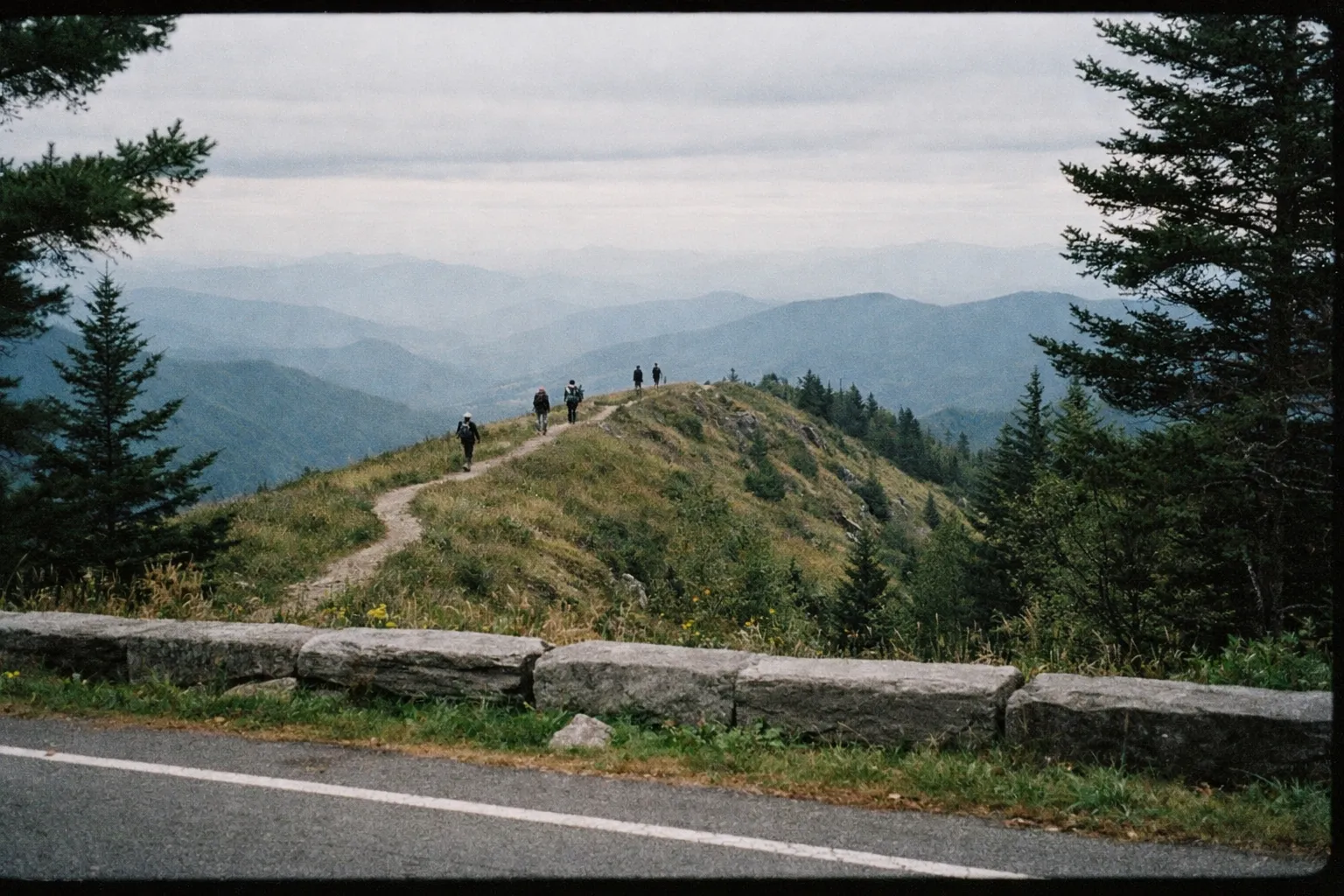
Cades Cove Loop - Timing and What to Expect
Cades Cove Loop is an 11-mile one-way paved road where white-tailed deer, black bears, and wild turkeys are commonly seen from vehicles, especially in early morning and late evening. Historic cabins and churches sit within view of the road. The tradeoff is congestion: this is the park’s most popular loop, and mid-morning bear jams can stretch a two-hour drive well past that.
Arrive by 7-8 a.m., or accept the delays.
Newfound Gap Road - Overlooks and Stops Worth Making
Newfound Gap Road runs about 33 miles between Gatlinburg and Cherokee and usually takes around two hours with scenic stops. Newfound Gap itself is the headline overlook, but Ben Morton Overlook is a quieter fall-foliage stop that draws far fewer crowds than Cades Cove at peak color.
Two other drives are worth knowing. The Roaring Fork Motor Nature Trail is a narrow, one-way, 5.5-mile loop near Gatlinburg that passes historic farmsteads and several small waterfalls - it’s the drive to choose when the main overlooks are fogged in. The Foothills Parkway now covers more than 30 miles of completed ridge-line segments built for panoramic views without Newfound Gap’s traffic; it’s a good option approaching from the Tennessee side.
For elk, Cataloochee Valley on the North Carolina side is worth the effort. It’s reached via a winding road off I-40, roughly 90 minutes from Gatlinburg, and sees far less traffic than Cades Cove. One note on access: the NPS announced major safety upgrades to the Spur in May 2026 (10), so expect possible active construction on that corridor, though the road remains open.
Great Smoky Mountains Hikes for Every Fitness Level
Great Smoky Mountains hikes run the full range - from a 2.6-mile paved waterfall walk to a 10-mile summit climb - across more than 800 miles of maintained trails (9). Most are open, but check conditions the morning you go. Here’s how to self-select by fitness and time.

Short and Paved - Trails for Families and Casual Walkers
Laurel Falls Trail is 2.6 miles round trip, mostly paved, and ends at an 80-foot waterfall; the trailhead sits about 3.5 miles west of Sugarlands Visitor Center along Little River Road. It’s the default choice for non-hikers and families. The catch is parking, which fills before 9 a.m. on weekends - arrive early or go after 5 p.m.
Two more easy trails matter if you’re traveling with a dog, because they’re the only two that allow leashed pets: the Gatlinburg Trail (about 2 miles one way) and the Oconaluftee River Trail (about 1.5 miles one way), both riverside walks with minimal elevation.
Moderate Hikes with a Payoff
Alum Cave Trail to Alum Cave Bluffs is 4.6 miles round trip, climbing roughly 1,100 feet from the 3,834-foot trailhead to the bluffs at 4,950 feet, passing Arch Rock - a natural rock arch - on the way. You can turn around at Arch Rock for a 2.8-mile option. Temperatures can swing 20-30°F between the trailhead and the bluffs, so bring layers. This is also the route to LeConte Lodge, the park’s only hike-in lodge, which requires reservations well in advance.
Rainbow Falls Trail is 5.4 miles round trip with about 1,685 feet of gain, ending at the park’s tallest single-drop waterfall, an 80-foot curtain. Sun angle is best late morning to early afternoon. Strong hikers can extend to Mt. LeConte for a demanding roughly 13-mile round trip.
Full-Day and Strenuous Routes
Ramsey Cascades Trail is 8 miles round trip ascending more than 2,000 feet, per the National Park Service - and it’s one of the harder day hikes in the park. Don’t underestimate it based on the gentle name; the terrain is steep and rocky.
Mount LeConte via Alum Cave is approximately 10 miles round trip and reaches 6,593 feet - the park’s third-highest peak. Plan a full day, start by 7 a.m., and expect 6-10 hours on trail for strong hikers. For any of these, wear sturdy shoes, carry 1-2 liters of water per person minimum plus a rain jacket, and bring trekking poles for Alum Cave and Ramsey Cascades.
Great Smoky Mountains Hikes at a Glance
| Laurel Falls Trail | Alum Cave Trail (to Bluffs) | Rainbow Falls Trail | Ramsey Cascades Trail | Mt. LeConte via Alum Cave | Gatlinburg Trail | Oconaluftee River Trail | |
|---|---|---|---|---|---|---|---|
| Distance (RT) | 2.6 miles | 4.6 miles | 5.4 miles | 8 miles | about 10 miles | about 2 miles | about 1.5 miles |
| Elevation Gain | Moderate (paved) | about 1,100 ft | 1,685 ft | about 2,000 ft | about 2,800 ft | Minimal | Minimal |
| Difficulty | Easy | Moderate | Moderate-Strenuous | Strenuous | Strenuous | Easy | Easy |
| Key Feature | 80-ft waterfall | Arch Rock, 80-ft bluffs | 80-ft single-drop falls | Tallest park waterfall | 6,593-ft summit | River corridor | Riverside walk |
| Pet-Friendly? | ✗ | ✗ | ✗ | ✗ | ✗ | ✓ | ✓ |
Wildlife Viewing - Where to Go and When to Show Up
Great Smoky Mountains National Park holds an estimated 1,500 black bears - about two per square mile - so sightings are genuinely common, especially in Cades Cove and along Roaring Fork. NPS rules require you to stay at least 50 yards (46 m) from bears and elk, and 150 yards from deer and coyotes. Getting too close can earn you a citation, and rangers do enforce it.
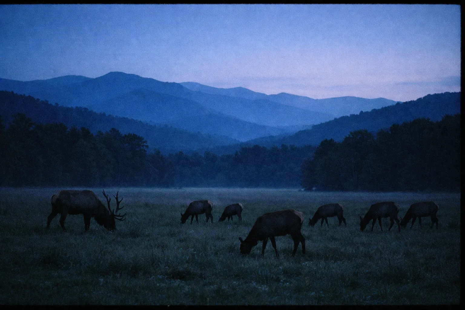
Cades Cove is the most reliable bear-viewing location in the park. Arrive at or before 7-8 a.m. to see animals before traffic builds; bear jams mid-morning can cost you an hour or more on that loop. On the North Carolina side, Cataloochee Valley supports an elk herd of around 200 animals, with the best viewing at dawn and dusk during the September through November rut. It’s far less crowded than Cades Cove, and the drive in - winding off I-40, roughly 90 minutes from Gatlinburg - keeps the casual visitors away.
Early morning is consistently the highest-probability window for wildlife across the whole park. Plan your day around that rather than around sleeping in.
One seasonal event worth flagging: the synchronous fireflies near Elkmont Campground occur in late May to early June, and access is managed by a lottery on Recreation.gov. This is not a walk-up experience; plan months ahead. For photography, a polarizing filter helps with glare at waterfalls, and for wildlife a longer lens plus patience beats any other technique.
Historic Sites and Cultural Stops Inside the Park
The park protects one of the largest collections of historic log buildings of any U.S. national park, with more than 90 structures including homes, churches, schools, and mills. For visitors who aren’t primarily hikers, these give a strong reason to spend a full day here.
Cades Cove is the densest cluster. It holds the John Oliver Cabin (built in the 1820s), several 19th-century churches, and the Cable Mill, all reachable from the 11-mile loop road with short walks. On the North Carolina side, the Oconaluftee Visitor Center hosts the Mountain Farm Museum - a collection of original log farm buildings relocated from around the park. Plan a 30-45-minute self-guided walk.
For something quieter and more remote, the Walker Sisters Place in the Little Greenbrier area preserves the homestead of five sisters who lived there until the 1960s, reached by a short hike from Metcalf Bottoms. It gives a clearer sense of pre-park life than the busier Cades Cove structures - the kind of stop that actually makes you think about what was here before the park boundary went up.
Along the Roaring Fork Motor Nature Trail, the Ephraim Bales Cabin is well-preserved and accessible right from the road, with far fewer crowds. If you’re already on the Cades Cove loop, the Primitive Baptist Church cemetery is the most-visited of the park’s maintained cemeteries and worth a brief stop.
Waterfalls Worth the Walk
Laurel Falls is the default family waterfall: an 80-foot drop at the end of a 2.6-mile round-trip mostly paved trail, and the easiest to reach in the park. If you want the most accessible payoff with kids in tow, start here.
Rainbow Falls is the classic moderate-to-strenuous option - an 80-foot single-drop waterfall at the end of a 5.4-mile round-trip trail with significant elevation gain. The trailhead sits on Cherokee Orchard Road near Gatlinburg. Go on a sunny day, late morning to early afternoon, when light hits the spray and produces the rainbow effect the trail is named for.
Ramsey Cascades is the tallest waterfall in the park, reached via a strenuous 8-mile round-trip trail over steep, rocky terrain ascending more than 2,000 feet, per the National Park Service. The distance is the price of admission, and it’s worth it if you’re fit enough.
For a no-hike option, Meigs Falls is visible directly from a roadside pullout along Little River Road; it’s easy to miss if you’re not watching for it. Along the Roaring Fork Motor Nature Trail, the Place of a Thousand Drips is a roadside cascade whose flow is strongest after rain - a stop rather than a destination.
One caveat across all of these: waterfall flow is best in spring and after significant rain. Late summer can leave the smaller falls genuinely disappointing.
Kuwohi (Clingmans Dome) - The Park’s Highest Point
Kuwohi (formerly Clingmans Dome) rises to 6,643 feet, making it the highest point in Great Smoky Mountains National Park and the highest point on the entire Appalachian Trail. The walk to the observation tower is a paved but steep 0.5-mile climb from the parking area, with about 330 feet of elevation gain. Short, but visitors who show up in flip-flops routinely underestimate it.
The tower delivers 360-degree views on a clear day, but fog and low cloud are common at this elevation, so check the forecast before you commit to the drive. October is the best month for visibility. Clingmans Dome Road is closed seasonally in winter and typically open April through late November, with exact dates on the park’s seasonal road schedule. The tower stays open 24 hours when the road is open, which makes sunrise and sunset visits genuinely worth the effort - the summit at first light, with the ridgelines dropping away in every direction, is one of the better payoffs in the park.
Pair the trip with a stop at Newfound Gap, where the Appalachian Trail crosses the road, on the same drive.
A Practical Smoky Mountains Itinerary - 1 Day, 2 Days, and 3 Days
A good Great Smoky Mountains itinerary picks one or two things to do well each day rather than ten things badly, and it never tries to cover both states in a single day. Here are three concrete plans.
One Day in the Smokies - A Realistic Plan
Enter from the Gatlinburg side and park at Sugarlands Visitor Center early. Hike Laurel Falls first thing; the 2.6-mile round trip takes most visitors 1.5-2 hours, so you can be done by 10 a.m.. Then drive Newfound Gap Road toward Kuwohi for the views, and return via the Roaring Fork Motor Nature Trail for a waterfall and a historic cabin stop. Aim to exit by late afternoon before traffic builds on the Spur.
Two Days - Tennessee Side and North Carolina Side
Day one, stay on the Tennessee side: drive the Cades Cove loop at dawn (arrive by 7 a.m.), tackle the Alum Cave Trail mid-morning, and finish with sunset at Kuwohi. Day two, cross to North Carolina: Cataloochee Valley at dawn for elk, then the Oconaluftee Visitor Center and Mountain Farm Museum, and Rainbow Falls in the afternoon.
That two-day split works well precisely because it keeps you from spending half a day in the car between states. The drive between Gatlinburg and Cherokee via Newfound Gap Road takes 45-70 minutes without stops - with overlooks and traffic, plan on more than two hours of driving plus your activities.
Three Days - Adding Depth Without Rushing
Add a strenuous hike on day three: Ramsey Cascades, or the full Mount LeConte via Alum Cave (approximately 10 miles round trip, around 2,800 feet of gain, requiring an early start and 6-10 hours on trail). Or use day three for a slower pace - the Roaring Fork Motor Nature Trail, the Meigs Falls roadside stop, and a longer wildlife session at Cades Cove.
Check current trail conditions the morning of each hike. Closures can appear with 24-48 hours’ notice, and the July 2026 pattern of Helene-related updates showed how quickly the trail status page can change.
Insider Tips to Make the Most of Your Visit
Check the NPS current conditions page the morning of your visit, not the night before. Trail status can change overnight - as the July 2026 closures demonstrated - and the page is updated frequently during active closure periods.
Keep a backup plan for bad weather. The year-round picnic areas at Cades Cove, Deep Creek, Greenbrier, and Metcalf Bottoms have tables, grills, and restrooms, and they stay open even when higher-elevation trails are closed. A few more hard-won pointers:
- Mix one short trail with one scenic road segment per day rather than stacking a long hike plus multiple visitor center stops. The park’s size and traffic make that combination punishing.
- Parking lots at Laurel Falls and Alum Cave commonly fill by mid-morning in peak seasons. Arriving before 8 a.m. is not optional if you want a space.
- Dogs are allowed only on the Gatlinburg Trail and Oconaluftee River Trail, plus campgrounds, picnic areas, and roadways. Violations on other trails are enforced and can result in fines.
- If you’re backpacking the Appalachian Trail, understand the 50-mile outside-the-park rule for thru-hiker permit status before booking on Recreation.gov.
- Download offline maps before you lose signal. Gaia GPS and AllTrails both work; pick up a printed map at any visitor center as a backup.
Frequently Asked Questions About Great Smoky Mountains
- What not to miss in the Smoky Mountains?
- Prioritize the Cades Cove loop early in the morning, a drive along Newfound Gap Road, at least one waterfall hike (Laurel Falls for easy, Rainbow Falls for moderate), and Kuwohi at sunrise or sunset. If you only have one day, do the Cades Cove loop and one hike well rather than racing to see everything.
- How many days do you need for Great Smoky Mountains?
- One full day covers a scenic drive plus one or two short stops. Two to three days lets you hike, see wildlife, and visit historic sites without rushing. More than three days is worthwhile if you're doing backcountry or want to explore both the Tennessee and North Carolina sides at a relaxed pace.
- What is the main attraction of the Great Smoky Mountains?
- There's no single answer; the appeal is breadth. The Cades Cove loop is the most visited single feature, Newfound Gap Road is the most-driven corridor, and Kuwohi is the signature viewpoint. Wildlife - black bears and the Cataloochee elk - is what many repeat visitors come back for specifically.
- Do you need a parking pass for Great Smoky Mountains National Park?
- Yes. Park entry is free, but a parking tag is required if you stop for more than 15 minutes. Buy online through Recreation.gov or at a kiosk before you arrive; don't assume you can pay at the trailhead. See the 'Before You Go' section above for the full fee breakdown.
- Are dogs allowed on trails in Great Smoky Mountains?
- Only on a limited set of routes. Most backcountry trails do not allow pets, and the rule is enforced. See the 'Insider Tips' section for the specific trails and areas where dogs are permitted.
- What trails are currently closed in Great Smoky Mountains?
- Trail status changes frequently. Bullhead Trail is closed Monday through Thursday through November 19, 2026, and several trails carry damage cautions from Hurricane Helene. Check the NPS current conditions page the day of your visit, not the week before.
- Is it safe to visit Great Smoky Mountains after Hurricane Helene?
- Most trails are open, but some have tread damage or temporary closures, and the NPS is actively updating trail status. Check the official conditions page before each hike and be ready to adjust plans if a specific trail is listed as discouraged or closed.
Two things make or break a Smoky Mountains visit: timing and current conditions. Arrive at popular trailheads and the Cades Cove loop before 8 a.m., avoid the Spur mid-day, and you sidestep most of the frustration people tend to blame on the park itself. Check the NPS conditions page the morning you go, because trail closures and seasonal road schedules shift with little notice.
The good news is that free entry and year-round access make this an easy park to return to. A first visit rarely covers everything, and that’s fine - the park isn’t going anywhere, and neither is the parking tag requirement.
Before you drive out, do three concrete things: bookmark the NPS current conditions page, buy your parking tag online, and pick one or two activities to do well rather than ten to do badly.