As of October 27, 2026, every inner-canyon water station on the Bright Angel Trail is turned off. NPS posted the shutoff on September 6, 2026 to conserve the South Rim’s limited water supply, and its Key Hiking Messages page still lists all of them off in its October 27 update (1)(2). The usual seasonal refills at the resthouses from May through October don’t apply this year. The August 29, 2026 flash flood still keeps both river bridges, Phantom Ranch and the North Kaibab Trail closed, while the Bright Angel Trail to River Resthouse, the Plateau Point Trail and the River Trail between River Resthouse and the South Kaibab Trail are open; NPS gives no reopening date for the closure areas (2)(5). You can still plan a good day hike here, but you carry all your water, pick a turnaround that fits your legs and your clock, and check closure notices the morning you go.
✓ Pros
- Resthouses give you clear, practical places to pause and reassess.
- Morning and afternoon shade make this a more forgiving first canyon route than South Kaibab.
- Several realistic turnaround options let you match the outing to your time and fitness.
✗ Cons
- The return climb can take at least twice as long as the descent.
- With inner-canyon water shut off, you must carry your full supply from the rim.
- Flood damage has closed the river crossings and routes beyond River Resthouse.
Bright Angel Trail route overview and what’s open after the flood
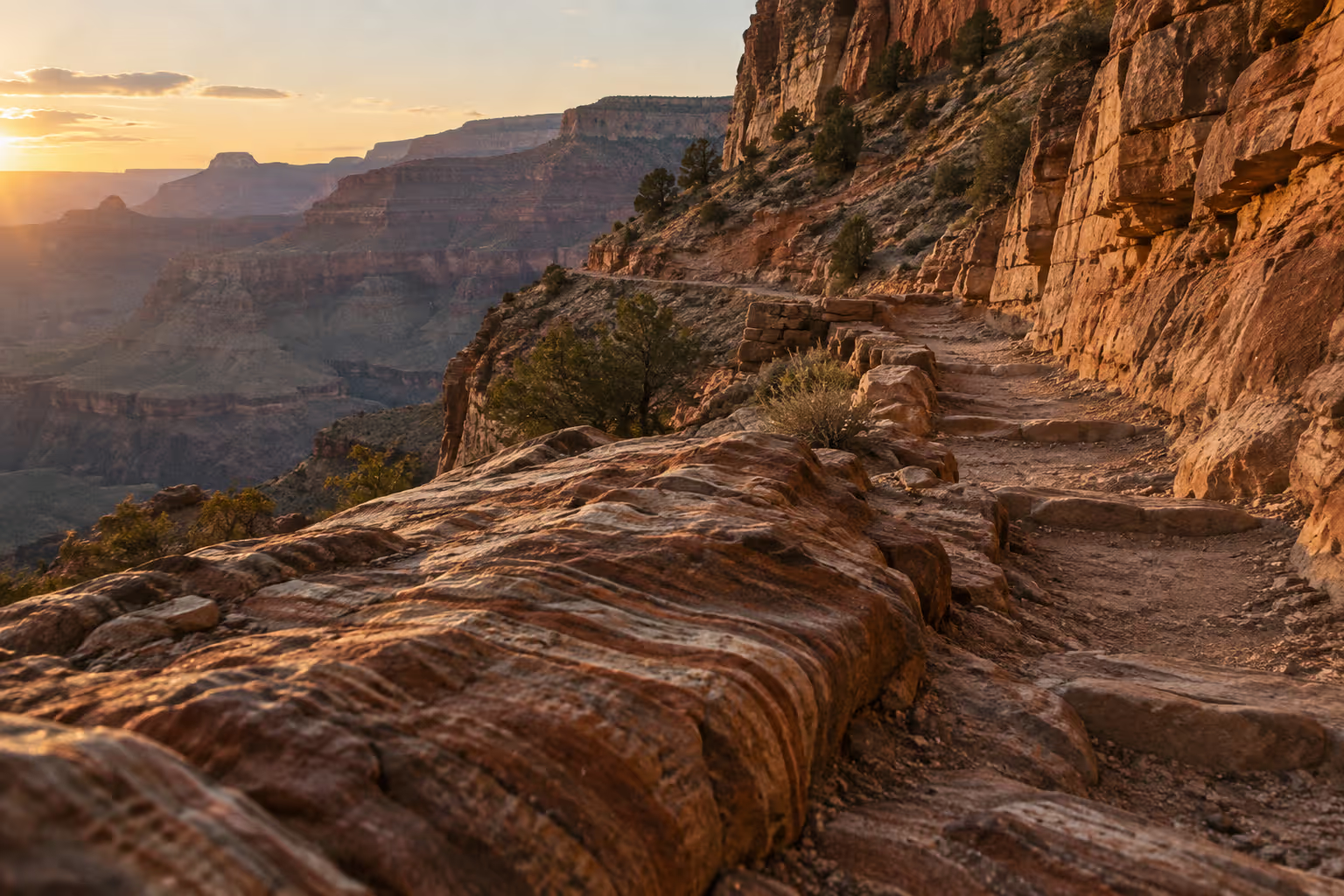
The Bright Angel Trail is the most popular hiking trail into Grand Canyon. It is a steep South Rim corridor trail that drops from Grand Canyon Village toward the Colorado River, with resthouses at set intervals (1). It follows a route used by the canyon’s Indigenous peoples, then by miners and early tourists. It gets shade in the morning and afternoon, which matters more than you’d expect on the climb out (1).
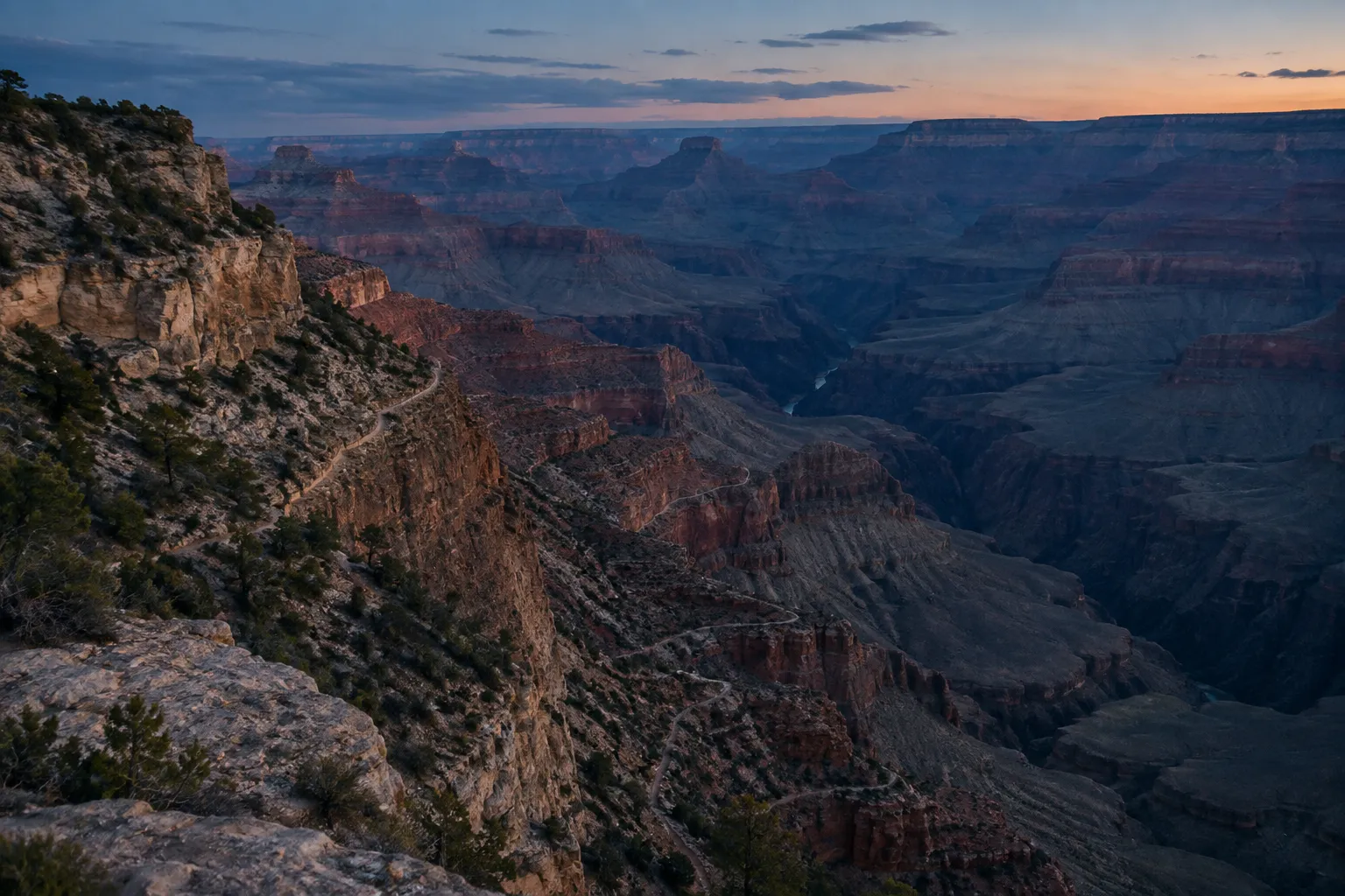
As of October 27, 2026, the NPS Key Hiking Messages page lists these segments as open (2):
- Bright Angel Trail from the Bright Angel Trailhead to River Resthouse
- Plateau Point Trail to Plateau Point
- River Trail between River Resthouse and the South Kaibab Trail
- South Kaibab Trail from the South Kaibab Trailhead to the Black Bridge (the bridge itself is closed)
- Tonto Trail between the Tip-Off and Havasupai Gardens
For a day hiker, every published turnaround point sits inside that open stretch. Second Tunnel, both resthouses, Havasupai Gardens and Plateau Point are all reachable. The closures affect what lies across the Colorado: the two river bridges, Phantom Ranch, and the routes to the North Rim. If your plan involves crossing the Colorado or reaching Phantom Ranch, it isn’t possible as of October 27, 2026.
What the August 29, 2026 flash flood closed
The August 29 flash flood caused significant damage in Bright Angel Canyon and the Phantom Ranch area, destroying or damaging trails, bridges and utilities (5). The closure list, as of October 27, 2026, includes (2):
- Black Bridge and Silver Bridge across the Colorado River
- All of Phantom Ranch, including Bright Angel Campground, the Canteen and the cabins
- The entire North Kaibab Trail, including Cottonwood Campground
- Boat Beach, except for emergencies and brief scouting of the new rapid at the mouth of Bright Angel Creek
NPS states there is no estimated reopening for these areas (2). The status has shifted more than once since the flood. A September 3, 2026 news release closed the Bright Angel Trail below its intersection with the Tonto Trail (5). The current Key Hiking Messages listing shows the trail open to River Resthouse, and the River Trail and the South Kaibab Trail down to the Black Bridge open again (2). Because the boundary keeps moving, check the current page and the trailhead signs before you start.
Choosing your turnaround point for a day hike
The right turnaround for a Bright Angel Trail day hike depends on your fitness and time budget. NPS lists six day-hike destinations on this trail. Leave out First Tunnel, a 0.1-mile, 20-minute walk from the rim, and the five real turnarounds range from Second Tunnel at 1.8 miles round trip to Plateau Point at 12 miles round trip (1). Use the hiking time as your planning number, not the mileage. Six miles on this trail is not six miles on a flat rail-trail.
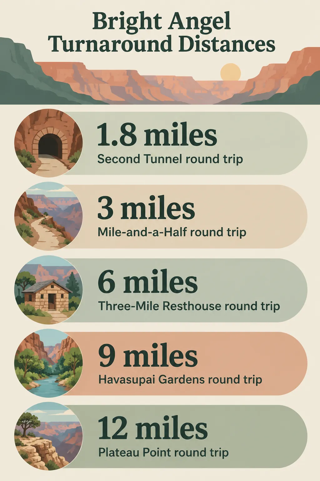 Round-trip distances NPS gives for five Bright Angel Trail turnarounds, from 1.8 miles at Second Tunnel to 12 miles at Plateau Point.
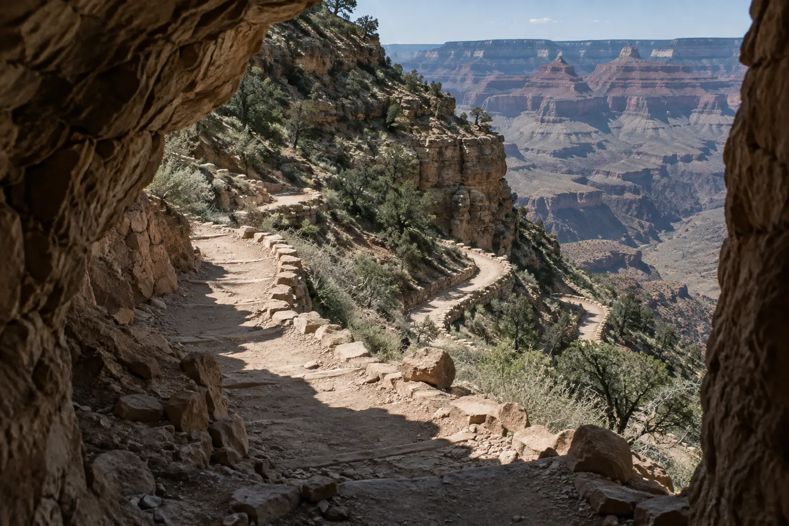
A simple decision rule:
- Two hours or less: Second Tunnel
- Half a day: Mile-and-a-Half Resthouse
- A full day: Three-Mile Resthouse
- Longer: Havasupai Gardens or Plateau Point, and only after talking to a ranger (1)
Whatever you pick, decide on it at the rim. Don’t decide halfway down when you feel great, because the descent is when you’ll feel your best all day. The same discipline applies on other Southwest canyon hikes where the clock matters more than the map, such as the Zion Subway Trail.
Second Tunnel
Second Tunnel is 1.8 miles (2.9 km) round trip with 590 ft (180 m) of elevation change. NPS estimates 1 to 2 hours (1). It’s the right call if you have a morning, kids, or no real hiking legs yet. You still get a taste of the switchbacks and the climb back up.
Mile-and-a-Half Resthouse
Mile-and-a-Half Resthouse is 3 miles (4.8 km) round trip with 1,120 ft (340 m) of elevation change. NPS estimates 2 to 4 hours (1). This is the half-day option. Its water station is currently off (2).
Three-Mile Resthouse
Three-Mile Resthouse is 6 miles (9.6 km) round trip with 2,120 ft (645 m) of elevation change, taking 4 to 6 hours by NPS estimates (1). It works as a full day for fit hikers. Most people underestimate how much 2,120 ft of climbing takes out of them at the end of a hot morning. The water here is also currently off (2).
Havasupai Gardens
Havasupai Gardens is 9 miles (14.4 km) round trip with 3,040 ft (925 m) of elevation change. NPS estimates 6 to 9 hours (1). NPS says to check with a park ranger before attempting it as a day hike (1). Treat that as a required step. The water station here is off as well (2).
Plateau Point
Plateau Point is 12 miles (19.6 km) round trip with 3,080 ft (940 m) of elevation change, and NPS estimates 9-12 hours (1). The side trail from Havasupai Gardens is fairly flat. That makes it look like an easy add-on, but it adds a 3-mile (4.8 km) round trip on exposed ground, at the point in the day when you have the farthest to climb. NPS’s listing for Plateau Point carries a reminder to consult a park ranger (1).
In table form, the five options compare like this:
- Second Tunnel: 1.8 mi (2.9 km), 590 ft (180 m), 1-2 hours
- Mile-and-a-Half Resthouse: 3 mi (4.8 km), 1,120 ft (340 m), 2-4 hours, water off
- Three-Mile Resthouse: 6 mi (9.6 km), 2,120 ft (645 m), 4-6 hours, water off
- Havasupai Gardens: 9 mi (14.4 km), 3,040 ft (925 m), 6-9 hours, ranger check, water off
- Plateau Point: 12 mi (19.6 km), 3,080 ft (940 m), 9-12 hours, ranger consultation, exposed
How difficult is the hike, and how it compares to South Kaibab
NPS notes that all trails into the canyon are steep and difficult (1). Its day-hiking page warns that there are no easy trails into or out of the canyon, and that more than 300 people are rescued from the canyon each year (6). Bright Angel Trail difficulty comes from its upside-down structure. The easy part comes first, and the hard part comes when you’re tired, hot and lower on water.
NPS says to plan for at least twice as much time going up as going down (1). If it took you 90 minutes to reach Mile-and-a-Half Resthouse, budget three hours or more for the return. Let the slowest hiker in your group set the pace, and put that person in front so the group can’t pull them along faster than they can sustain.
For the same reason, don’t plan a rim-to-river day hike. NPS warns against it. Destinations below Havasupai Gardens involve about 5,000 ft (1,500 m) of elevation change each way, plus extreme temperature changes (1). NPS is especially blunt about this between May and September (6). Given the current closures, it’s off the table regardless.
Bright Angel vs. South Kaibab: South Kaibab is the less forgiving of the two. It opens with steep, narrow switchbacks known as “the chimney” (7). It follows exposed ridgelines with little shade, and there is no water anywhere on the trail. As of October 27, 2026, the Key Hiking Messages page lists a large tank of potable water at the South Kaibab Trailhead, as at Bright Angel (2), and the trail is open down to the Black Bridge (2). The Tip-Off is 9 miles (14.5 km) round trip with 3,280 ft (about 1,000 m) of elevation change, but NPS does not recommend hiking below Skeleton Point, 6 miles (9.6 km) round trip, as a day hike (7). Bright Angel has more shade and resthouses for breaks, and NPS calls it an excellent first trip into the canyon (1). With all the inner-canyon water off right now, though, the gap between the two is smaller than usual.
Water stations: current status and what to carry
As of October 27, 2026, all three Bright Angel Trail water stations are off: Mile-and-a-Half Resthouse, Three-Mile Resthouse and Havasupai Gardens. NPS posted the shutoff, made to conserve water, on September 6, 2026, and its Key Hiking Messages page still lists them off in its October 27 update (1)(2).
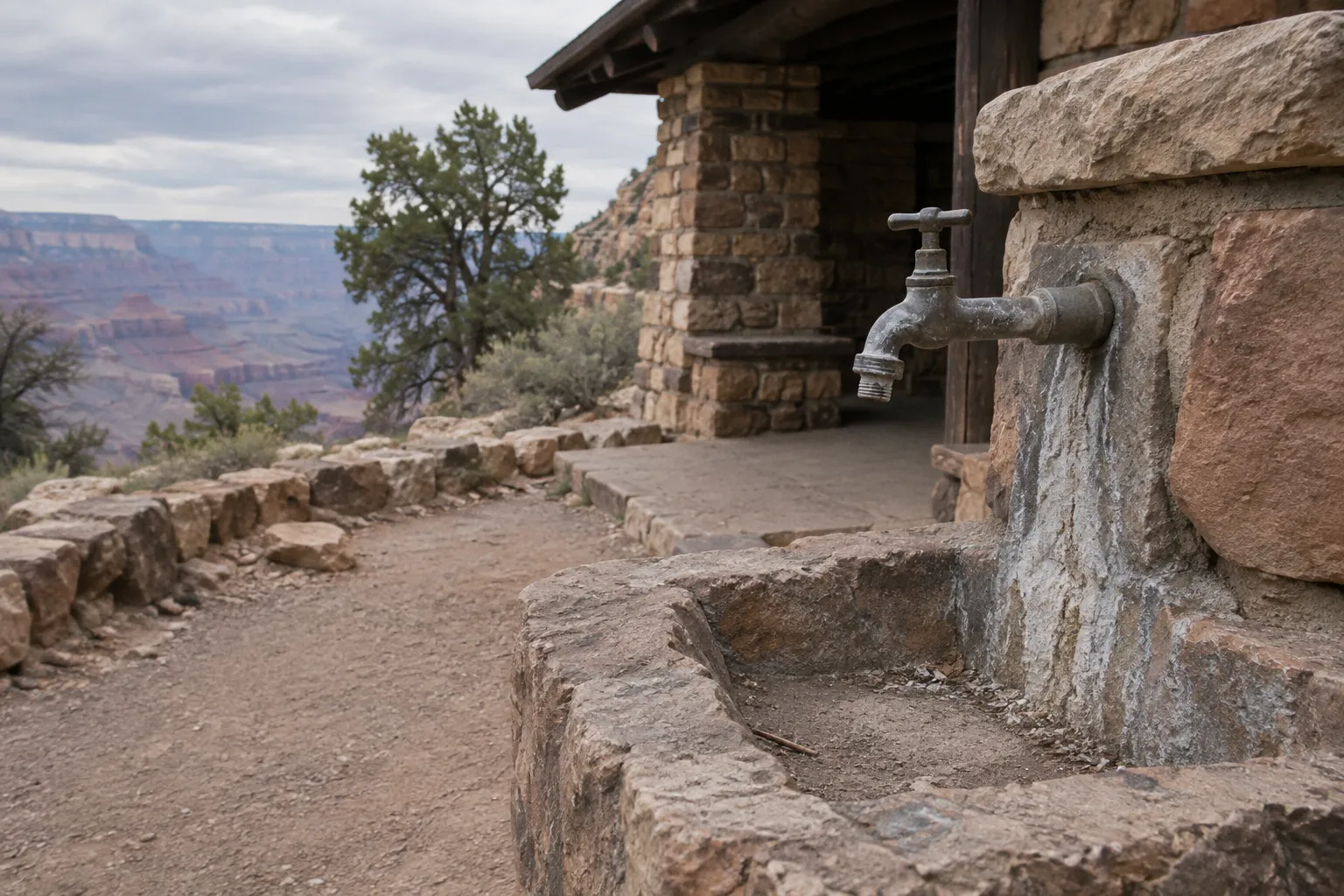
In a normal year, water runs seasonally, May through October, at Mile-and-a-Half and Three-Mile Resthouses, and year-round at Havasupai Gardens (1). Don’t plan on that pattern this year: NPS tells day hikers to carry all the water they will need and not to rely on water along the trail (1).
The one fill point on this route is a large black tank of potable water next to the restrooms at the Bright Angel Trailhead (2). Fill every bottle and bladder there before you take your first step down. Plan your water around your full round-trip time, not your descent time. The climb out is when you’ll drink the most.
Even in years when the stations run normally, NPS says water can be cut off by pipeline breaks or weather (1)(2). The rule doesn’t change with the season: carry what you need from the start, and treat any refill as a bonus.
NPS directs hikers to carry enough water or be prepared to collect and properly treat natural water. It recommends that every hiker carry a reliable treatment method (2). A Sawyer Squeeze is a reasonable choice because it’s light enough that you won’t leave it in the car, and it lets you treat creek water if your carry runs short. Grand Canyon Conservancy noted on September 10, 2026 that natural water may be available in the creek near the Havasupai Gardens day-use area, and that it must be treated before drinking (10). Ask a ranger before you count on it.
Heat safety and the best hours to hike
Summer shade temperatures in the canyon routinely exceed 100°F (38°C). NPS advises against hiking between 10 a.m. and 4 p.m. (7)(1). In summer, start early enough to finish your climb before 10 a.m., or wait to hike in the evening. For a three-to-six-hour outing, that usually means starting at dawn.
Heat warning: if you’re still climbing in full sun at midday in summer, stop in the shade and wait it out. Pushing on is how a manageable day turns into a rescue. Summer monsoon storms can also bring lightning (1). If you hear thunder, stay off exposed points and get away from rim edges, including the open ground around Plateau Point.
Food matters as much as water. NPS advises packing snacks high in calories and salt, and eating and drinking while you rest (1). Too much water with too little salt causes hyponatremia, which NPS describes as a seizure-producing electrolyte disorder (1). Its early symptoms mimic heat exhaustion (9). Pack salty food you’ll want to eat in the heat, and eat at every resthouse whether you feel hungry or not.
Permits and camping below the rim
Noncommercial day hikes on the Bright Angel Trail do not require a permit (6)(1). Any camping below the rim requires a permit, and camping is limited to designated sites (1). Pitching a tent off-trail is not allowed.
Right now, overnight options on this corridor are sharply reduced. Bright Angel Campground is closed as part of the Phantom Ranch closure, and Cottonwood Campground on the North Kaibab Trail is closed too (2). Havasupai Gardens Campground is not on the NPS closure list, but it has no water: NPS tells overnight visitors there to carry enough for their stay or be prepared to treat water from natural sources (1). As of October 2026, the Backcountry Information Center near Maswik Lodge is open 8 a.m. to 5 p.m. daily, closed noon to 1 p.m. (8): check with it before you build a trip around an overnight. If a ranger is the only person who can confirm your plan, assume it needs confirming.
A day hike is also the choice NPS itself frames as safer and more enjoyable than an overnight trip that’s beyond any one member of your group’s ability (6).
Mule right of way on the trail
Mules always have the right of way on the Bright Angel Trail. NPS sets a specific protocol: step uphill away from the edge, and don’t move again until the last mule is 50 feet (15 m) past you (1). As of October 27, 2026, the stretch between Mile-and-a-Half Resthouse and Havasupai Gardens is closed to stock while crews repair trail damage (2). A spooked mule on a narrow switchback is a danger to the rider, the animal and you.
Don’t take this as a cue to step onto the downhill side for a photo. Uphill is the rule because a mule that shies will push toward the outside of the trail.
How to yield to mules on Bright Angel Trail
Move uphill away from the edge, stay still and quiet, and wait for the entire mule train to pass before continuing.
- 1
Move uphill
Step to the uphill side of the trail, away from the edge.
- 2
Follow the wrangler
Do what the wrangler directs, even if that means waiting in place.
- 3
Stay quiet and still
Stand completely still and keep quiet while the mules pass.
- 4
Wait for the last mule
Do not return to the trail until the last mule is 50 feet (15 m) beyond you.
Getting there: parking and shuttle options
If the trailhead lots are full, NPS directs you to Parking Lot D near Maswik Lodge, about 0.4 mile (0.6 km) from the trailhead (1). This matters most on the early starts that heat safety requires. A full lot shouldn’t push your start back an hour into the hot part of the day.
You can also ride the Village (Blue Route) shuttle to the Hermit Road Interchange and walk a short way uphill to the trailhead (1). On the fall schedule, September 12 to November 30, 2026, the first Village (Blue) Route bus runs at 7 a.m. (8). If you want to start earlier than that, drive to the trailhead lots or Lot D.
In late fall, winter and early spring, the upper sections of the trail can become dangerously icy, and NPS recommends over-the-shoe traction devices (1). Kahtoola MICROspikes are a common choice. They grip packed ice on the shaded upper switchbacks, where ordinary trail runners or boots will slide. The ice usually sits near the top of the trail, so you’ll need them on the way down and on the last stretch of the climb out.
Frequently Asked Questions
- How long should you allow for the climb back to the rim?
- Allow at least twice as much time for the ascent as the descent; fatigue, heat and the sustained climb can slow your return.
- Is any part of Bright Angel Trail closed to day hikers?
- As of October 27, 2026, NPS lists the trail open from the trailhead to River Resthouse, with the River Trail open beyond it to the South Kaibab Trail; both river bridges and Phantom Ranch are closed. Boundaries have moved since the flood, so verify the NPS Key Hiking Messages page and trailhead signs before starting.
- Which trail is a better first Grand Canyon hike, Bright Angel or South Kaibab?
- Bright Angel is the more forgiving first choice because it has more shade and resthouses; South Kaibab is more exposed and has no trail water.
- What should you do if you reach your planned turnaround feeling strong?
- Stick to the turnaround you chose at the rim; feeling fresh on the descent does not predict how you will handle the climb out.
- Can you rely on a water source below the Bright Angel Trailhead?
- No; treat every inner-canyon refill as unavailable unless a ranger confirms otherwise, and carry enough for your full round trip.
- Do you need a permit for a noncommercial Bright Angel day hike?
- No permit is required for a noncommercial day hike, but check with a ranger before attempting Havasupai Gardens as a day hike.
- What should you do if the upper trail is icy?
- Use over-the-shoe traction devices on icy upper sections; ordinary boots or trail runners can slide on packed ice.
Planning your Bright Angel Trail day hike
Pick your turnaround at the rim, based on your fitness and the hours you have. Then budget twice the descent time for the climb out. Fill everything at the trailhead tank, because nothing below it is running. Carry a treatment method, salty food and, in the cold months, traction devices. In summer, be off the trail or in shade between 10 a.m. and 4 p.m. Recheck the Key Hiking Messages page and the trailhead signs the morning you go, since both the water status and the closure boundary have changed since the August 29 flood. If the canyon is one stop on a longer Southwest trip, our guide to the best national parks in the USA by region and season helps you fit it into the route.