In December and January, the valley floor of Death Valley National Park averages highs in the mid-60s°F (about 18°C) and lows around 40°F (4°C) (15). In summer, the same ground can reach 130°F (54°C) (4). That gap is why the cool season is when Badwater Basin, Zabriskie Point, and the Mesquite Flat dunes become comfortable walks instead of heat hazards. This guide covers which stops to prioritize, what entry and camping cost, where to sleep, and how heat and flash floods can still catch you out. For how Death Valley compares with other parks when planning a wider trip, see our guide to the best national parks in the USA.
✓ Pros
- A single base can put several major sights within reach without changing lodging.
- Winter daylight makes it practical to combine short walks with longer drives.
- The landscape changes sharply between salt flats, badlands, dunes, and canyons.
✗ Cons
- A storm can invalidate a carefully planned route before the next morning.
- Cold starts and mild afternoons call for layers that are easy to shed.
- Limited cell service makes last-minute navigation and help harder to rely on.
Here is the quick scope. Most visitors start from Las Vegas: the NPS puts the fastest route, via Pahrump, at about 120 miles and 2 hours (22), and the sights are spread along some 300 miles of paved roads, so you need your own car (14). If you have a spare evening at the start or end of the trip, our guide to things to do on the Las Vegas Strip covers the city end. Entry is $30 per private vehicle for 7 days, as of November 2026 (7). The best month is January: valley-floor highs sit in the mid-60s°F, and Furnace Creek Campground is inside its reservation season. The thing most guides get wrong is treating the road network as fixed. Flood damage from major storms in 2022, 2023 and 2025 has closed, reopened, and re-closed roads repeatedly (9), and a printed itinerary from last year can send you down a road that is not there anymore.
Death Valley National Park: Size, History, and Climate Extremes
Death Valley National Park covers over 3.4 million acres (about 1.4 million hectares), making it the largest national park in the lower 48 states (14). Most of it lies in eastern California, with a small portion in Nevada (21). The NPS also describes it as a 5,000-square-mile (about 13,000 km²) desert park (15). That figure matters more for trip planning than for trivia. Driving distances between sightseeing and lodging can be long, so where you sleep determines what you can reach comfortably in a day (5).
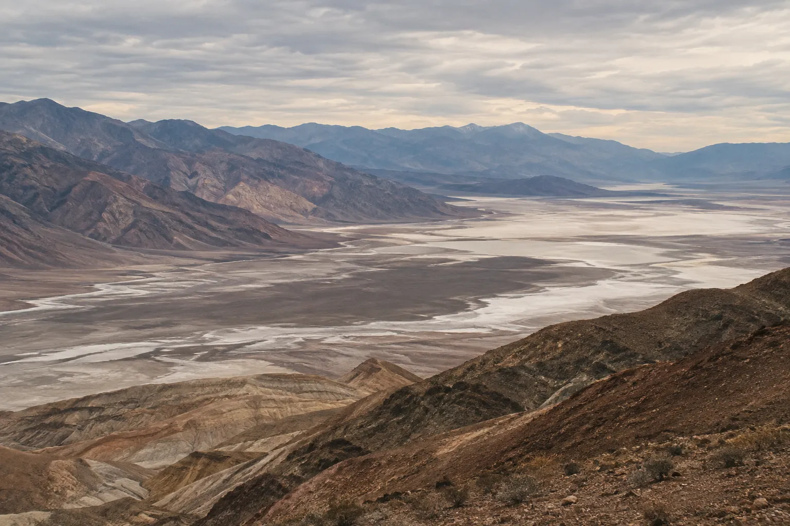
The landscape is a below-sea-level basin surrounded by mountain ranges. Inside it you find salt flats, badlands, sand dunes, and canyons cut into the surrounding slopes. The climate is the reason the place is famous. The world-record highest air temperature, 134°F (57°C), was recorded at Furnace Creek on July 10, 1913, and summer temperatures often top 120°F (49°C) in the shade (12). Rain is scarce: the park averages about 2.15 inches (54.6 mm) a year (11). When rain does come, it tends to arrive hard. On August 20, 2023, a single 2.2-inch (56 mm) event caused massive flooding and damage throughout the park (11), and the road closures that followed shape your trip today.
How the Park Became the Largest in the Lower 48
Death Valley’s protection came in two stages. Death Valley National Monument was created in 1933 after years of effort to protect it from mining and other interests, but Congress did not designate it a national park until 1994 (14). The designation date was October 31, 1994, with the passage of the California Desert Protection Act (21). Part of the long wait came from how Americans saw the desert: as an inhospitable, threatening wasteland rather than something worth preserving (14). Today that same emptiness is the draw. At over 3.4 million acres, it is not hard to find places with no one else around (14).
A Note on Timbisha Shoshone History
Long before the monument or the park existed, this was inhabited land. The NPS describes Death Valley National Park as the homeland of the Timbisha Shoshone (8). The Timbisha Shoshone Village sits at Furnace Creek today, on land transferred to the tribe (21). If you want context beyond the scenery, rangers at the Furnace Creek Visitor Center are the place to start your questions.
Badwater Basin: Walking the Lowest Point in North America
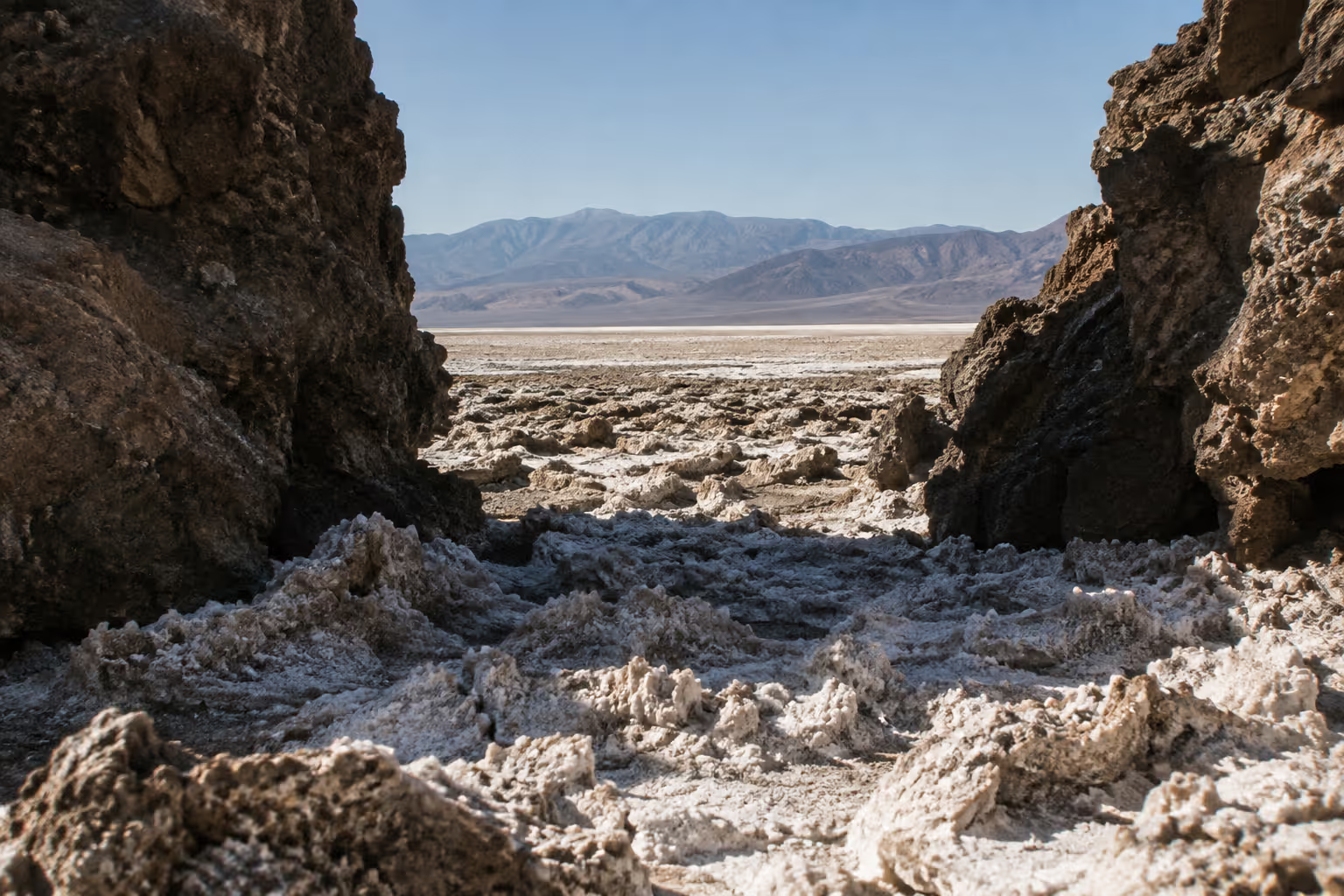
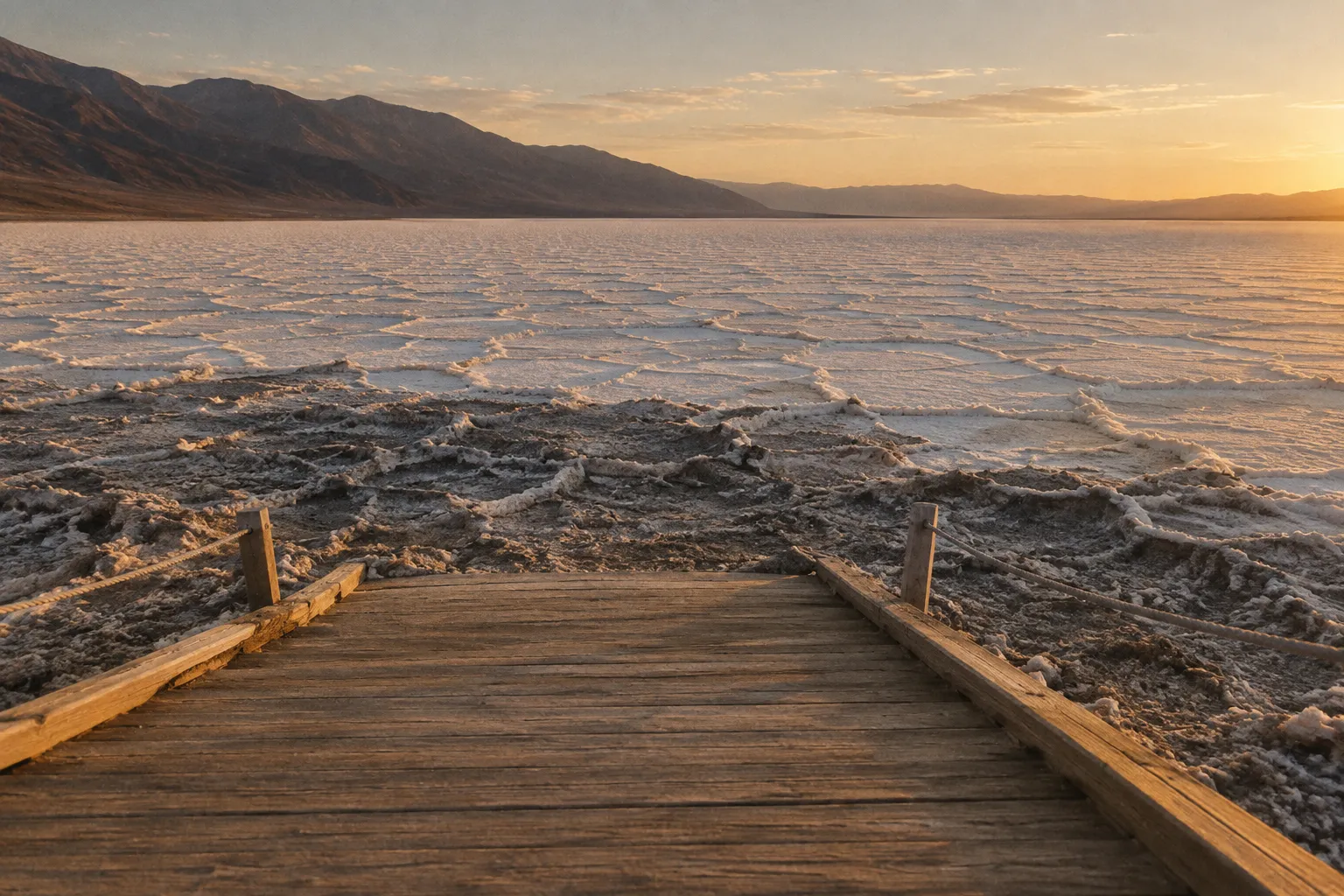
Badwater Basin sits 282 feet (86 m) below sea level, the lowest point in North America (11), and you walk onto it from a paved parking lot on Badwater Road, about 30 minutes (17 mi/27 km) south of Furnace Creek (18). The salt flat covers more than 200 square miles (518 km²) of the valley floor (18). From the edge, the white crust runs out toward the mountains on the far side of the valley.
For scale, Mount Whitney, the highest summit in the contiguous United States, rises in the Sierra Nevada to the west. On a single trip you can stand at the continent’s lowest ground and then drive within sight of the range that holds the country’s highest outside Alaska.
In ranking terms, Badwater Basin is worth the detour. In winter you can walk it at midday; the NPS rates the salt flat easy but warns not to attempt it when it is hot (18).
The Boardwalk and How Far to Walk Onto the Salt Flat
An ADA-accessible ramp leads from the parking area down to a boardwalk at the edge of the flat (18). Beyond the boardwalk, there is no set route or turnaround point. You walk out onto the salt as far as you like and return the same way.
The first stretch from the lot is packed down and grayish from foot traffic. The cleaner white crust, with its raised polygon patterns, starts farther out, so plan to keep walking past the crowd if you want the photo most people come for. The surface is flat but crunchy, and the NPS warns of large holes where the boardwalk ends and the salt flat begins (20). Sunglasses help, because the glare off white salt is strong even under a winter sun. Bring water even for a short walk. The NPS recommends carrying at least 2 liters (about half a gallon) for a short winter day hike (18).
A road note: the flood damage on South Badwater Road lies south of Badwater Basin toward Shoshone, where the reopened southern segment still has missing pavement, loose gravel, eroded shoulders, and short drop-offs at the pavement edge (8). Coming from Furnace Creek to the basin, you are on the northern stretch. If you plan to continue south and exit toward Shoshone, drive that segment slowly.
If you have only a couple of hours, the NPS suggests the Badwater Road drive: Devils Golf Course and Badwater, then Artists Drive on the way back to Highway 190, about 1½ hours round trip, adding Zabriskie Point if you continue east or the dunes if you head west (22). Artists Drive reopened in December 2025 (19).
Why the Basin Sits Below Sea Level
The valley floor is a block of crust that has dropped between faults while the mountain ranges on either side rose. That subsidence is why the basin sits below sea level instead of at the level of the surrounding desert.
The salt comes from water with nowhere to go. Runoff from the surrounding slopes collects at the lowest point and then evaporates in the dry heat, leaving dissolved minerals behind as a crust. Pacific storms lose most of their moisture crossing the mountain ranges to the west before they reach Death Valley, which is part of why it stays so dry (12). After rare heavy rain, a shallow temporary lake can form on the flat. Those standing-water conditions don’t last.
Zabriskie Point: The Badlands Overlook Everyone Stops For
Zabriskie Point is a badlands overlook near Furnace Creek, reached by a short, steep paved walk from its parking lot (20). If you have time for a single viewpoint, make it this one. It ranks firmly in the “worth the detour” column.
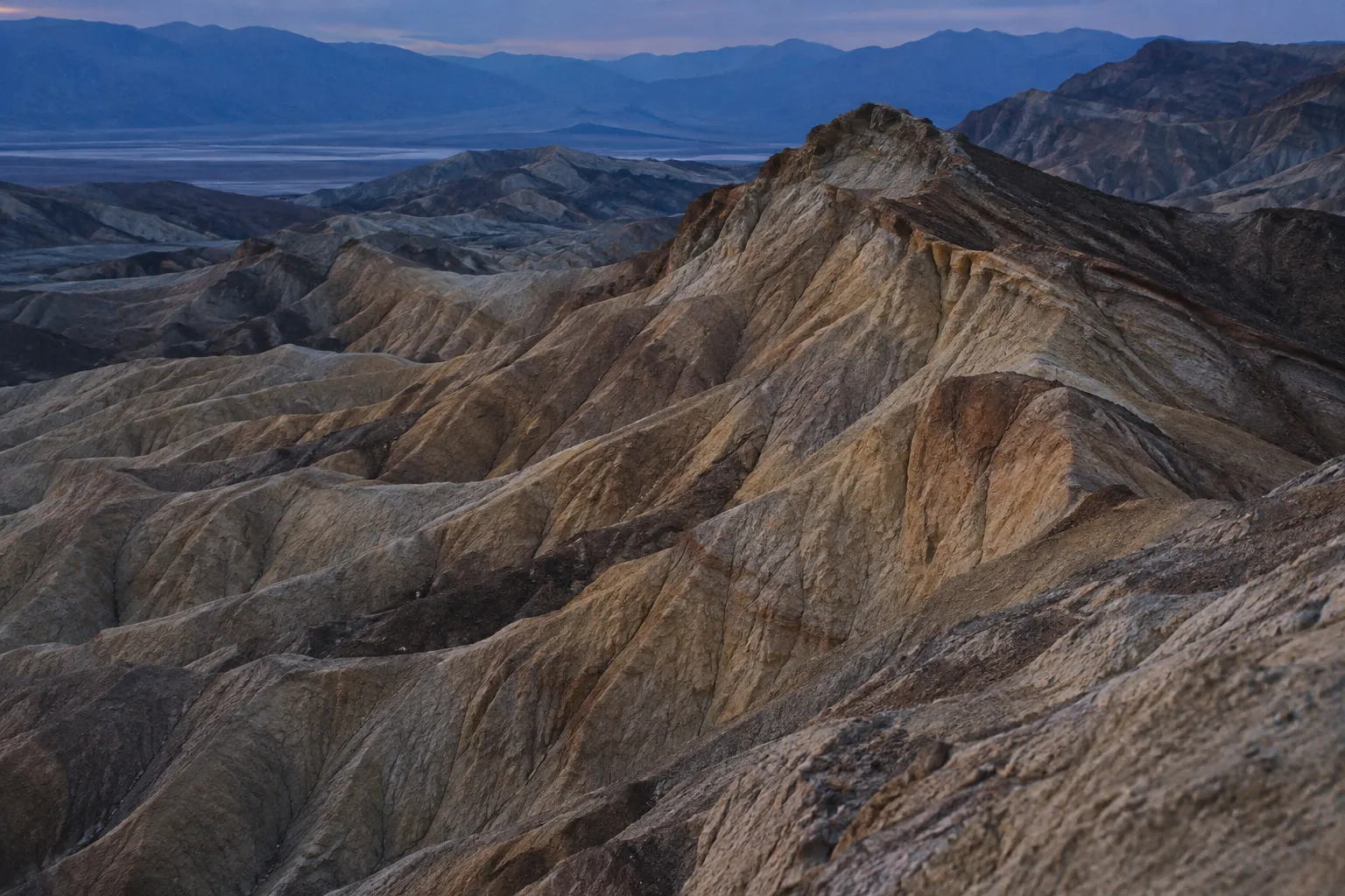
The view looks over eroded, folded hills in bands of gold, tan, and brown, with no vegetation to soften the ridgelines. The pointed formation in the foreground is Manly Beacon. Beyond it, the badlands drop toward the salt pan on the valley floor, with the Panamint Range rising behind. The terrain does not look like the rest of the valley, and it shows how much erosion a few rare storms can do to soft sediment.
Best Time of Day for the View
Sunrise is the time to be here, and rangers list Zabriskie Point among their sunrise favorites (11). Low morning light comes across the badlands from the east and picks out every ridge and gully, and the colors are at their warmest in the first hour. Midday light flattens the same scene into pale tones. Late afternoon is a reasonable second choice if you can’t make the early start, but the morning light is why photographers line the overlook before dawn.
In the cool season, the timing works in your favor. Sunrise comes later than in summer, so you can catch it without a pre-dawn alarm, and the overlook is close to Furnace Creek lodging and the campground. Pack a warm layer, because a winter morning near the 40°F (4°C) overnight average feels colder in wind (15).
Getting to the Overlook
Zabriskie Point sits on CA-190, 3.5 miles east of the Badwater Road junction (18), so it slots into almost any itinerary. From the parking lot, a steep paved grade climbs to the viewpoint (20). The walk is brief, but it is a climb, so take it slowly if you are not used to hills.
For a longer outing, the Golden Canyon, Gower Gulch and Badlands Loop routes start from the Zabriskie Point parking area as well as from the Golden Canyon trailhead (18). Those routes run through drainages, so they carry the same flash-flood caution as any canyon hike. Skip them if rain is in the forecast.
Mesquite Flat Sand Dunes and Canyon Hikes
The Mesquite Flat Sand Dunes walk to the high dune is about 2 miles (3.2 km) round trip and takes about 1.5 hours, with no formal trail and soft sand on the final approach (18). Use that as your benchmark for what a single highlight stop costs in time. The dunes sit at Stovepipe Wells Village, 30 minutes (24 mi/39 km) west of Furnace Creek, so add the drive to your plan (18).
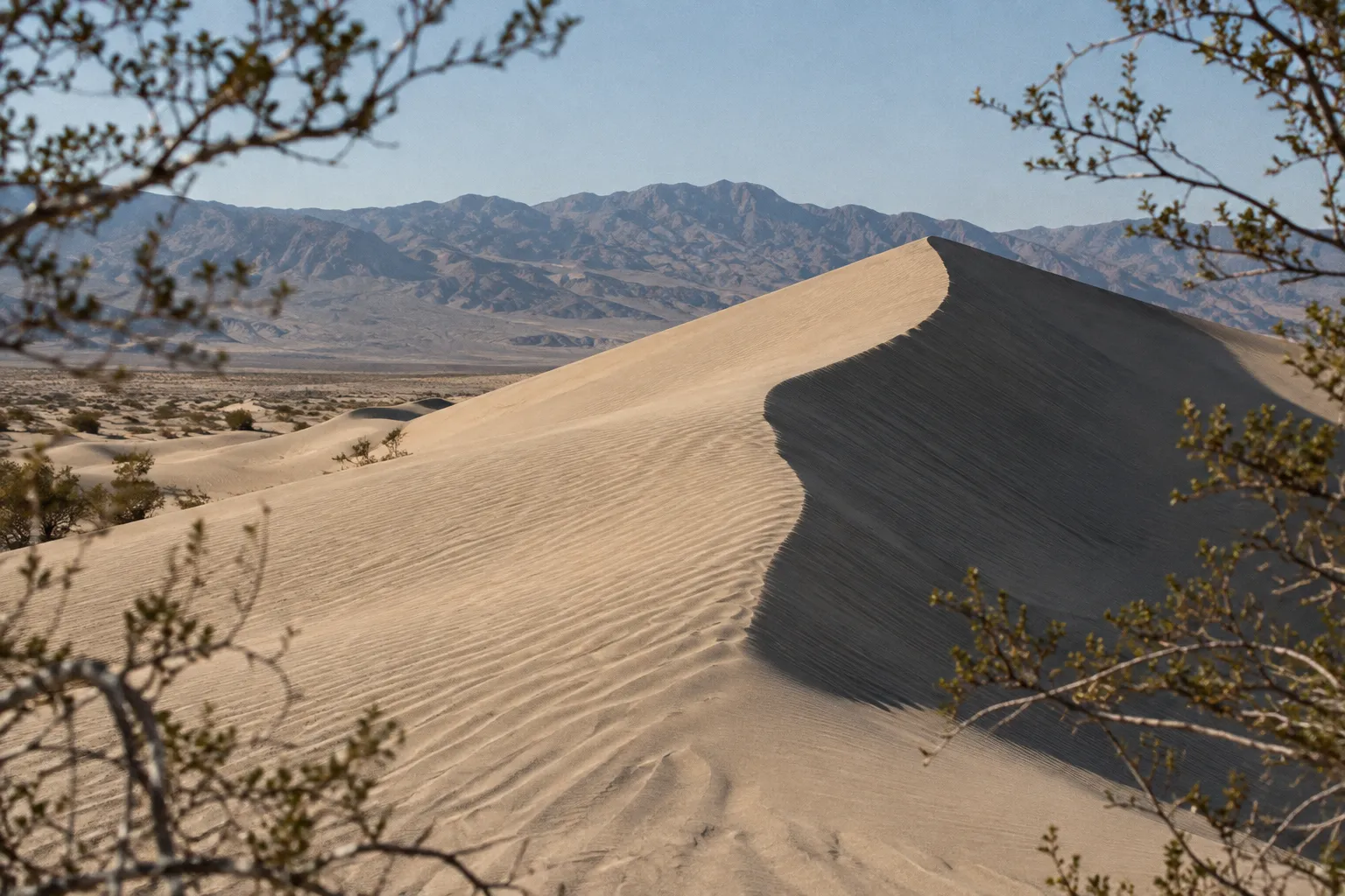
Mesquite Flat Sand Dunes: Distance, Time, and Terrain
The NPS rates the route easy to moderate, with about 185 feet (56 m) of elevation gain (18). Those numbers undersell the effort. Walking in deep sand takes more energy than the same distance on a trail, and each step up a dune face slides back part of the way. Expect your pace to slow sharply on the last climb.
Because there is no maintained trail, you pick your own line from the paved lot toward the tallest dune (18). That is easy in clear weather, since the high dune is visible from the parking area. Wind changes the picture. Wind is common in the desert, especially in spring, and dust storms can blow up suddenly with approaching cold fronts (12). Blowing sand on the dunes stings exposed skin and wrecks visibility, so check the forecast and save the walk for a calm day.
Early morning and late afternoon give the best conditions: long shadows across the ridges, softer light, and cooler sand. Wear shoes you don’t mind filling with grit, and carry the same 2 liters of water you would for any short winter hike (18). The dunes rank as worth the detour if you have a full day. On a tight schedule, they are the first headline stop to drop, simply because of the extra drive.
Canyon Hikes and When to Skip Them
Most hiking in the park is cross-country, up canyons, or along ridges, with few constructed trails (18). Canyons are where the flood risk concentrates. Rain falling in the mountains funnels into these drainages, and a flash flood can arrive quickly carrying rocks and branches (4). The rule is simple: do not enter a canyon during active rain or when precipitation is likely (4). Clear skies over your trailhead are not enough if storms are building in the mountains upstream.
Golden Canyon, with its trailhead 2 miles south of CA-190 on Badwater Road, is the classic canyon walk near Furnace Creek, with routes of 3 to 8 miles (18), and a good fit for a dry winter morning. Technical canyoneering is a different activity entirely. Many of the park’s canyons take more than 10 hours for a fast-moving group to descend, with rappels of up to 200 feet (61 m) and more (10). That is specialist territory, not something to try on a sightseeing trip.
Two canyon options are off the table or harder to reach right now. Titus Canyon Road closed for repairs on October 2, 2026, with work expected to continue through May 2027 (6). The road to Darwin Falls is closed and is likely to stay that way until summer 2027, though hikers can park on the shoulder of CA-190 and walk in (2).
Death Valley in Winter: Weather and the Best Time to Visit
Death Valley in winter offers mild days at low elevations, with valley-floor highs averaging in the mid-60s°F (about 18°C) in December and January (15). The NPS describes winter and spring as very pleasant, with cool nights that only occasionally reach freezing (12). The best time to hike in the park is November through March (18). In November, Furnace Creek averages highs of 77°F (25°C) and lows of 48°F (9°C), so late-autumn days run warmer than December and January (12).
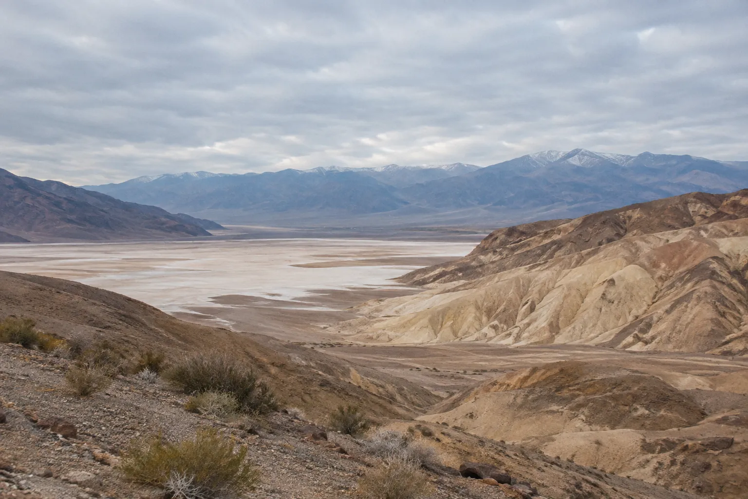
December to January Averages on the Valley Floor
In December and January, the valley floor averages daily highs in the mid-60s°F and overnight lows around 40°F (4°C) (15). That swing of roughly 25 degrees means you will start a sunrise stop in a jacket and be in a T-shirt by midday at Badwater Basin. Layering matters more than any single warm piece of gear.
Elevation changes everything. Temperatures drop 3 to 5°F (2 to 3°C) for every 1,000 feet (305 m) you climb (12). The high peaks that offer a summer escape from the heat are usually covered in snow in winter and spring, and anyone climbing them in that season needs adequate winter clothing, an ice axe, and crampons (18). Stick to the valley floor and you won’t need any of that.
Winter is not uniformly sunny either. Sunny skies are the norm, but winter storms can bring cloud cover and rain (12), and those storms are what cause the flood damage covered later in this guide. Build a spare day into a multi-day trip so a wet day doesn’t cost you a headline stop.
If you want to pick a single month, choose January. Valley-floor highs are in the mid-60s°F (15), you are inside the Furnace Creek Campground reservation season (3), and the low-elevation walks are as comfortable as they get all year.
Why Winter Beats Summer for Walking the Sights
The summer numbers explain why the cool season is the practical window. Summer temperatures often top 120°F (49°C) in the shade, with overnight lows dipping only into the 90s°F (mid-30s°C) (12). In 2024, the park set a summer record with an average high of 117.3°F (47.3°C), including 37 days over 120°F (11). The NPS advises against hiking at low elevations in summer heat (4), and even in spring and autumn the heat can be unbearable for most people (18).
If summer is your only option, skip low-elevation hikes entirely, stay near your car on paved roads, and carry at least 1 gallon (about 4 liters) of water per person per day (4)(11). The main points of interest stay open in summer, and the NPS recommends staying on paved roads and close to your vehicle (11).
Wildlife, Wildflowers, and Dark-Sky Stargazing
Death Valley’s quieter attractions, including desert pupfish, rain-triggered wildflowers, and some of the darkest night skies in the country, are the reasons people stay beyond the three headline stops. None of them is guaranteed on a given trip, and that uncertainty is part of the appeal.
Wildflowers depend on rain. If several storms fall through winter and spring, the low elevations may bloom in late March and early April (22); a dry winter means little bloom. Treat a strong bloom as a bonus you check for close to your travel dates, not something to plan around months ahead.
Where to Spot Pupfish and Other Wildlife
The park’s oases act as refuges for wildlife, and Salt Creek is the place to look for pupfish. Its 0.5-mile (0.8 km) boardwalk loop is open year-round, but water reaches the boardwalk only from November through May, and the best time is February to April, when the Salt Creek pupfish spawn (18). The boardwalk walk is short and flat either way, which puts Salt Creek in the “skip if short on time” column unless wildlife is your main interest.
Elsewhere, the wildlife is mostly what you notice at the edges of the day: tracks on the dunes in early morning, birds around oases near Furnace Creek and Stovepipe Wells. Never feed animals, including the ravens and coyotes that scavenge around campsites and the Furnace Creek area (1)(4).
Best Spots for Stargazing
Death Valley is a Gold Tier Dark Sky Park, far enough from cities to have little light pollution, and the dry climate means clouds are unlikely to block the view (15). Schedule your trip around a crescent or new moon to see the most stars (15). In the 2025 season, rangers ran Night Sky Talks most Friday and Saturday evenings through March, with programs posted on the park website about two weeks ahead (15). Check the current schedule before you go.
You don’t need a special location. Most roadside pullouts away from the lights of Furnace Creek and Stovepipe Wells work (11), and Mars Hill is one spot the park has featured for night-sky viewing (15). The NPS also lists Badwater Basin, the Mesquite Flat Sand Dunes and Harmony Borax Works among its viewing spots, with wide horizons in most directions (11). Bring a headlamp with a red-light mode and a warm layer, because the temperature falls quickly toward that 40°F (4°C) average low (15).
Heat and Flash-Flood Safety: What Can Actually Hurt You
Most deaths in Death Valley come from single-vehicle rollover crashes on the park’s long, winding roads, according to the NPS safety page, which also singles out heat at low elevations and flash floods (4). Follow posted speed limits, and against the heat drink at least 1 gallon (about 4 liters) of water a day (4). Remote driving adds to all three, because help takes longer to arrive and cell service is limited (4).
Heat is mostly a summer problem, but it sets the tone for the whole park. Summer temperatures can reach 130°F (54°C) with nights of up to 90°F (32°C) (4). The NPS rules are blunt: do not hike in the valley or lower elevations when it is hot, drink plenty of water, eat balanced meals, and keep your electrolytes in check (4). The mountains are generally cooler in summer and provide some refuge (4). Water is available at Furnace Creek, Stovepipe Wells, and Panamint Springs (4). Fill up whenever you pass one.
Don’t treat winter as risk-free. The park can see high winds and flooding as well as heat (4), and higher elevations are cooler than the valley floor (12). A winter visitor is more likely to meet a washed-out road or a dust storm than heat exhaustion. Occasional thunderstorms, especially in late summer, cause flash floods (12). Winter storms bring rain too (12), and storms from late August 2025 through early January 2026 repeatedly damaged South Badwater Road (8).
On steep downhill grades, the NPS advises shifting into low gear and wearing a seat belt (4). Low gear lets the engine slow the car so you aren’t riding the brakes for miles. Overheated brakes fade, and a long descent with weak brakes is the bigger danger on these roads.
What to Do If Caught in a Flash Flood
If you are caught in a flood event, move to higher ground immediately (4). Don’t wait to see how high the water gets, and don’t try to retrieve gear from the canyon floor. Flash floods can arrive quickly and carry rocks and branches (4). The leading edge is a churning mass of debris, not clear water.
Prevention is far easier than escape. Do not enter a canyon during a storm or when precipitation is likely (4). Check the forecast for the mountains upstream, not only the sky over your trailhead. On the road, never drive through water running across a dip or wash. You can’t see whether the pavement underneath is still there, and even after reopening South Badwater Road the NPS warned of missing pavement and eroded shoulders (8).
Entrance Fees and Getting Around by Car
Death Valley National Park charges $30 for one private, non-commercial vehicle, covering 7 days with re-entry, as of November 2026, according to the NPS fee page (7). For most visitors that is the only cost of entry. Driving is the only practical way to see the park, and its size makes fuel, water, and road conditions part of the plan.
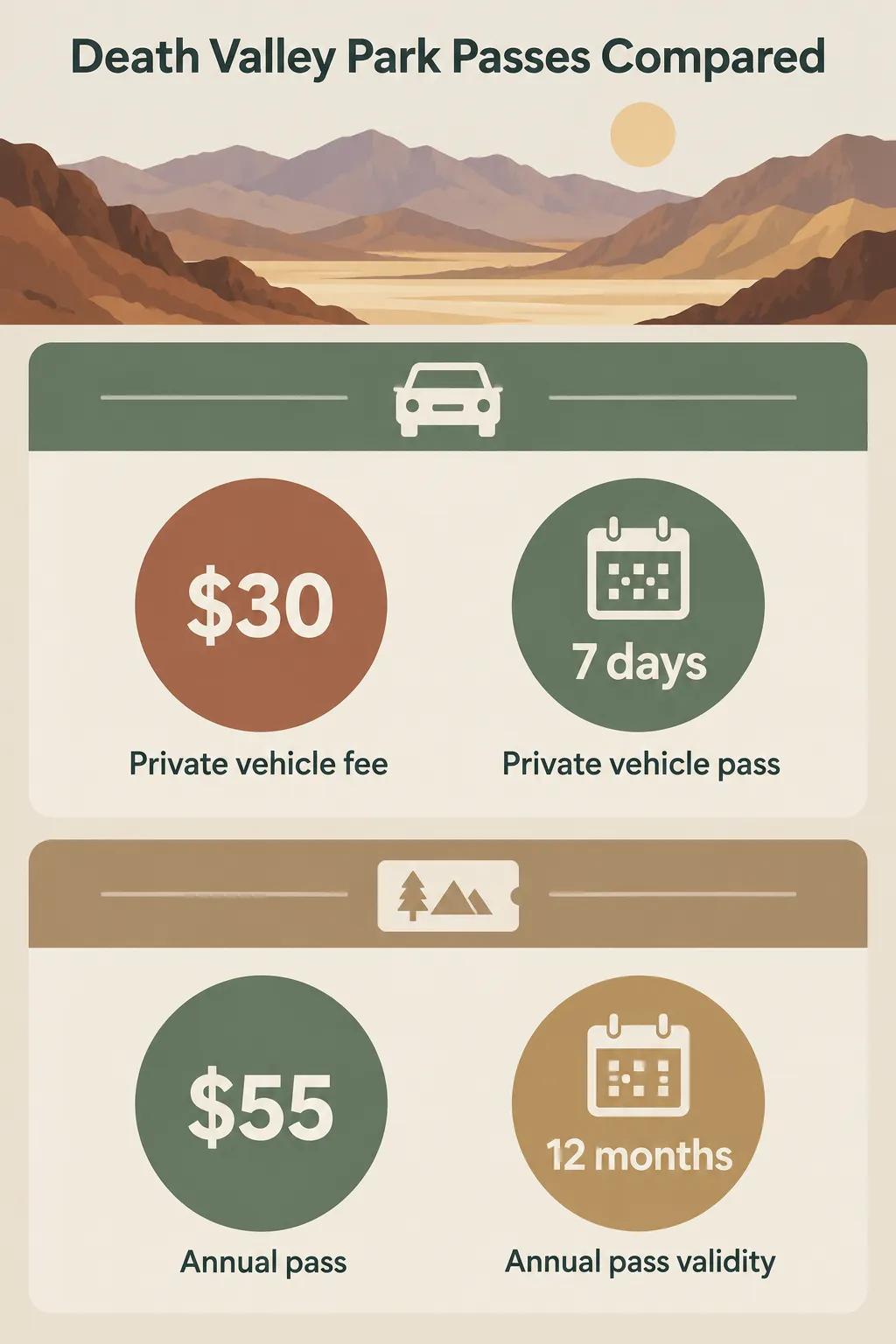 Death Valley National Park entry is $30 for 7 days by private vehicle, while the $55 annual pass is valid for 12 months.
Current Entrance Fee and Annual Pass Prices
As of November 2026, the NPS lists these entrance options (7). A standard pass for a private vehicle costs $30 and covers 7 days, including re-entry. A Death Valley annual pass costs $55 and is valid for 12 months from purchase for eligible occupants traveling with the pass holder. If you already have an America the Beautiful pass, the national pass covering federal recreation lands, that is the only entrance pass you need (7).
The park does not accept cash (7). Pay by card or buy your pass online before you arrive. The 7-day pass suits a single trip. The annual pass makes sense only if you plan to come back within the year, and if you are visiting several national parks, the America the Beautiful pass is worth comparing.
Driving Steep Grades and Remote Roads
You can drive a regular passenger car through Death Valley on its paved roads, which reach Badwater Basin, Zabriskie Point, the Mesquite Flat dunes, and Furnace Creek. Primitive campgrounds and backcountry routes are a different matter: they sit on unpaved roads that require a high-clearance 4x4 (1). Rental agreements often forbid unpaved driving, so check yours before leaving pavement.
Plan around distance and services. Lodging, food, and fuel are concentrated in a few areas, including Furnace Creek and Stovepipe Wells, where the gas station runs 24 hours (5). Fill up when you can. Cell service is limited, so the NPS advises checking forecasts and road conditions before you travel (4). On remote drives, carry water and be prepared for assistance to take a long time (4)(11).
Electric vehicle drivers should note one rule. EV charging is not supported at Furnace Creek Campground’s hookup pedestals, and plugging in there can damage your vehicle and the campground’s electrical system. Chargers are available at the Oasis Ranch and Inn nearby (3).
Flood damage also affects paved roads you can still use. As of November 2026, the NPS asked drivers on the North Highway to watch for flood debris on the road (2), and the reopened southern segment of South Badwater Road still has missing pavement, loose gravel, eroded shoulders, and short drop-offs at the edge (8). Drive these at reduced speed and stay off the edges.
A one-day cool-season loop from Furnace Creek looks like this:
- Check the NPS Alerts & Conditions page (2) and the weather forecast the night before, while you still have a signal, since cell service is limited (4).
- Buy your $30 vehicle pass online or by card, since the park is cashless (7).
- Fill your water containers in Furnace Creek, at least 2 liters per person for short winter walks (18).
- Catch sunrise at Zabriskie Point, with a warm layer for the morning chill.
- Drive 17 miles (27 km) south to Badwater Basin (18) and walk the salt flat from mid-morning into midday, when December and January highs average in the mid-60s°F (15).
- Head back through Furnace Creek, top off fuel and water, and drive 30 minutes (24 mi/39 km) west to Stovepipe Wells (18).
- Walk the Mesquite Flat Sand Dunes in late afternoon, budgeting about 1.5 hours for the 2-mile round trip (18), and skip the walk if wind is blowing sand.
- Stay out after dark for stars if the moon is new or a thin crescent (15).
Plan a one-day cool-season loop in Death Valley
1 daySequence the main valley-floor stops around light, temperatures, and current road conditions.
- 1
Verify conditions
Check NPS alerts and the forecast before leaving, then confirm road status again when you have a signal.
- 2
Sort entry and supplies
Buy the vehicle pass by card or online, and fill water containers before heading away from Furnace Creek.
- 3
Start at Zabriskie Point
Arrive for sunrise and bring a warm layer for the chilly morning overlook.
- 4
Walk Badwater Basin
Visit later in the morning or around midday, and choose how far to walk beyond the boardwalk.
- 5
Finish at Mesquite Flat
Allow about 1.5 hours for the dune walk near late afternoon; skip it if blowing sand makes conditions poor.
- 6
Stay for dark skies if conditions suit
After checking the moon phase and current conditions, choose a pullout away from lodging lights and bring a red-light headlamp and warm layer.
Where to Stay: Furnace Creek Campground and Nearby Lodging
Furnace Creek Campground is open year-round and takes reservations for the October 15 to April 15 season, booked at least 2 days and up to 6 months in advance (1)(3). In recent years, reservations have filled the campground to capacity most days (3). If you want a guaranteed place to sleep in the park during the cool season, that reservation is the first thing to lock in.
Furnace Creek Campground’s Reservation Window
Reservations are made through recreation.gov or by calling 1-877-444-6777 (3). The window works on a rolling six-month basis, so a mid-January arrival can be booked starting in mid-July. Set a reminder for the date your window opens, because popular winter weekends go fast.
RV travelers face a tighter squeeze. The campground has only 18 sites with full hookups (30/50 amp electric plus water and sewer), and those are often booked 6 months in advance (3). Multiple dump stations operate in the Furnace Creek area, as well as at Stovepipe Wells and Mesquite Spring campgrounds (3).
All other NPS campgrounds in the park are first-come, first-served when open (3). That can work on a weekday. In a normal cool season, Texas Springs is typically full on weekends and holidays, while Sunset, the park’s largest campground, almost always has sites, even in peak season (1). As of November 2026, though, the NPS lists both Sunset and Texas Springs under seasonal closure, and Emigrant as closed indefinitely for water system repairs; Furnace Creek, Stovepipe Wells, Mesquite Spring and Wildrose (no water) are open (2). Outside the cool season, the picture changes: lower-elevation campgrounds such as Sunset, Texas Springs, and Stovepipe Wells regularly close in mid-April, and the campgrounds that stay open are first-come, first-served, with fees paid by card at a self-service kiosk (1).
The decision rule: if certainty matters, book Furnace Creek inside its reservation window and at least two days ahead. Without that reservation, check which first-come campgrounds are open before you drive in (2): with Sunset closed as of November 2026, Stovepipe Wells is the nearest open one to Furnace Creek, and private lodging is the fallback. The Furnace Creek Visitor Center, open daily from 8 AM to 5 PM as of November 2026, is where to talk with a ranger about current conditions and plan your days once you arrive (4).
Private Lodging Options Nearby
Private lodging inside the park is concentrated in three places. In Furnace Creek, The Oasis at Death Valley runs two properties, both open all year: The Inn at Death Valley, with lodging and food, and The Ranch at Death Valley, with lodging, restaurants, shopping and a gas station (5). Stovepipe Wells Village is open all year and offers renovated rooms, limited RV camping with full hookups, a restaurant and saloon, a gift shop, and a 24-hour gas station (5). Call 760-786-7090 for Stovepipe Wells reservations (5). On the west side, Panamint Springs Resort offers rooms, camping, a restaurant and a gas station (5). Check directly with each operator for current availability and booking terms.
Pick your base by what you want to see. Driving distances inside the park can be long, so match lodging to the parts of the park on your list (5). Furnace Creek puts you closest to Zabriskie Point and Badwater Basin, which makes sunrise at the overlook easy. Stovepipe Wells sits next to the Mesquite Flat dunes, which suits early-morning or sunset dune walks. For a two- or three-day trip, either base works, and you will drive between them at least once.
Road Closures and Current Conditions to Check Before You Go
Death Valley road conditions change after every significant storm, and as of November 2026 several roads and sites, including Bonnie Clare Road and Scotty’s Castle, were closed for flood recovery with no reopening date (2). A guide written even a year ago can send you toward a road that is shut, damaged, or newly reopened with hazards. Treat any static itinerary, including this one, as a starting point to verify.
Roads Closed as of Late 2026
The status as of November 2026 breaks down this way.
Bonnie Clare Road and Scotty’s Castle remain closed for flood recovery work. No access is permitted, including on foot, and reopening depends on project completion (2). If an older guide puts Scotty’s Castle on your route, cross it off.
Titus Canyon Road closed for repairs and strengthening on October 2, 2026, after extensive flood damage, and the NPS expects the work to run through May 2027 (6). As of November 2026, the closure covers the whole road, with no cyclists or hikers allowed, and the NPS gives May 2027 as the anticipated reopening (2). It is one of the park’s most popular backcountry drives, so expect older itineraries to include it (6).
The road to Darwin Falls is washed out in many places and likely to stay closed until summer 2027. Hikers can park on the CA-190 shoulder and walk in (2). Backcountry road closures apply to all motorized vehicles, including motorcycles, though bicycles are permitted (2).
Some routes have come back. South Badwater Road reopened January 31, 2026, after its southern 45-mile (72 km) segment had been closed since August 25 of the previous year (8). Crews cleared rock and sand piles up to five feet (1.5 m) deep, but the NPS warned of missing pavement, loose gravel, eroded shoulders, and short drop-offs at the pavement edge (8). Lower Wildrose Road reopened in 2026 after nearly three years closed by flash flooding from the remnants of Hurricane Hilary in August 2023 (9), but a storm on October 22, 2026 washed it out again in places: as of November 2026 it stays open with a caution, no vehicles longer than 25 ft, and the NPS does not recommend low-clearance cars or street tires (2). Ubehebe Crater Road reopened in December 2025, along with the North Highway, Artists Drive, Cottonwood Canyon Road, Marble Canyon Road, and Twenty Mule Team Canyon Road (19). Cottonwood and Marble closed again after flooding on November 1, 2026 (2).
Ubehebe Crater itself, a volcanic crater in the far north of the park, ranks as “skip if short on time.” It’s a long drive from Furnace Creek, and the North Highway approach still carried a flood-debris caution as of November 2026 (2).
How to Check Conditions Right Before You Leave
Check the NPS Alerts & Conditions page (2) within a day or two of departure, and again the morning you drive in if you have a signal. The page lists open roads, closed roads, and caution notes for damaged-but-open routes. Pair it with a weather forecast. The NPS weather page points to NOAA’s Death Valley forecasts and radar (12). A storm can undo a reopening overnight: in December 2025, the park reopened several roads while warning that predicted rain could cause new closures (19).
Because cell coverage is limited (4), download offline maps and save the NPS park map before you lose signal. When you arrive, stop at the Furnace Creek Visitor Center between 8 AM and 5 PM to confirm road status with a ranger (4). Five minutes there can save you a two-hour detour.
Frequently Asked Questions
- How many people have died in Death Valley National Park?
- Most deaths in Death Valley come from single-vehicle rollover crashes on the park's long, winding roads, according to the NPS; follow speed limits, use low gear on steep descents and wear a seat belt. Heat and flash floods are the other main hazards.
- Why should drivers turn off the air conditioning on some Death Valley roads?
- Switching off the AC reduces engine load during a sustained climb, lowering the chance of overheating when a vehicle is already working hard.
- How much time should I allow for Death Valley?
- Allow one full day for the headline valley-floor stops; add days if you want slower hikes, night-sky viewing, or room for weather delays.
- Can an ordinary car drive through Death Valley?
- An ordinary passenger car can use the park's paved routes, but backcountry roads may require high clearance and four-wheel drive.
- How did Death Valley get its name?
- Pioneers lost in the valley in the winter of 1849-1850 gave it the name: as the party climbed out over the Panamint Mountains, one of them looked back and said 'goodbye, Death Valley.'
- Where is Death Valley National Park?
- Most of Death Valley National Park lies in eastern California, with a small portion in Nevada; the fastest drive from Las Vegas is about 120 miles, or 2 hours, via Pahrump.
- Where can I stargaze in Death Valley?
- Choose a safe pullout away from Furnace Creek and Stovepipe Wells; a darker moon phase and clear forecast matter more than finding one designated viewpoint.
- What wildlife and plants might I see in Death Valley?
- Look for Salt Creek pupfish in spring, coyotes and ravens around Furnace Creek, and animal tracks on cool morning sand; wildflower displays depend on several winter and spring rainstorms.
Plan the Dates, Then Verify the Roads
Lock in two things early: a Furnace Creek Campground reservation, bookable up to 6 months ahead for the October 15 to April 15 season (3), or a room at Furnace Creek or Stovepipe Wells (5). Then, in the days before you leave, check the NPS Alerts & Conditions page (2). Roads like South Badwater have closed and reopened on short notice, others like Titus Canyon and Bonnie Clare stay shut for months, and the current list decides which version of this itinerary you can drive.