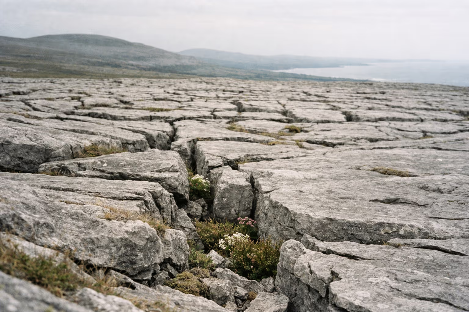
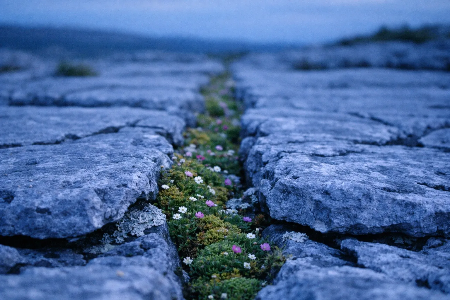
The Burren looks like a moonscape from the road: bare grey limestone stretching to the horizon, cracked into slabs, with barely a tree in sight. That first impression is wrong in an important way. This is one of the most botanically rich landscapes in Ireland, where Arctic-alpine and Mediterranean plants grow side by side (14). Understanding that contradiction, ancient rock below and living surface above, is the whole point of visiting, and it changes how you plan the trip.
How to get there: the Burren National Park Information Point is in Corofin village, 8 km from the park, and during the visitor season it runs a free shuttle bus into the park (3). Outside that season, plan on driving between the park, the caves and the coast.
Best month to visit: May. The wildflowers are pushing up through the limestone, the free park shuttle has started its season, and the crowds have not yet reached July levels. Early June is a close second.
What most guides get wrong: they treat Burren National Park and the region as the same place. The park covers about 1,500 hectares inside a landscape of roughly 350 km² (14), around 4% of the whole. An afternoon in the park is a start, not a visit to the region.
What the Burren actually is (and why it looks the way it does)
This is a limestone region in northwest County Clare that covers about 1% of the land surface of Ireland, roughly 350 km² (14). What you see is exposed limestone pavement, low hills and seasonal lakes. NPWS describes the pavement as part of Europe’s largest karst landscape, a terrain carved by water dissolving soluble rock (3), and UNESCO singles it out as a glacio-karst landscape of international importance within its Global Geopark (15). It confuses people who expect either a mountain range or a nature reserve, and get something that is neither.
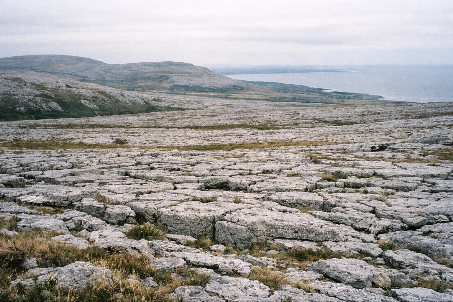
Limestone laid down 350 million years ago, shaped 10,000 years ago
The rock is Carboniferous (Visean) limestone that formed as sediment in a tropical sea covering most of Ireland about 350 million years ago, and it still holds fossil corals, sea urchins and sea-lilies (14). The surface you walk on is far younger. The last ice age wiped out the effects of earlier erosion, so the karst you see today has only been forming since then, roughly 10,000 years (14).
That gap matters. Glaciers stripped away soil and weak rock and exposed the limestone, which water then eroded into pavement (15). Rainwater works along the fractures, widening them into the deep vertical cracks called grikes and leaving the flat blocks between them, the clints. It is a landscape still being carved, just very slowly.
✓ Pros
- Free admission to Burren National Park
- Extraordinary plant diversity
- Internationally recognised glacio-karst geology
- Walks from 30-minute loops to multi-day treks
- UNESCO Global Geopark status
- Year-round Information Point in Corofin
✗ Cons
- Shuttle bus is a pilot scheme and may not run every year
- Show caves require separate planning and tickets
- Limited public transport outside shuttle season
- Weather is unpredictable and can change rapidly
Why it’s called the Burren
The name comes from the Irish “An Bhoireann,” meaning a rocky place (11), a fair description given the lack of soil and the extent of bare pavement. Some sources render it more emphatically as “the great rock” (9). Yet the same landscape has also been called “fertile rock,” a nod to the nutrient-rich mix of herbs and flowers that grows in the limestone (14). Both names are accurate: it’s rock and garden at once.
The national park vs the wider region
Burren National Park is about 1,500 hectares in the southeastern corner of the region (14), made up of state-owned land in separate blocks within the wider landscape (3)(16). That is the single most common source of visitor confusion, so get it straight before you plan anything. The park is superb and worth your time, but it is a protected cross-section, not the whole thing. It’s also one of Ireland’s national parks, and the only one built on limestone karst.
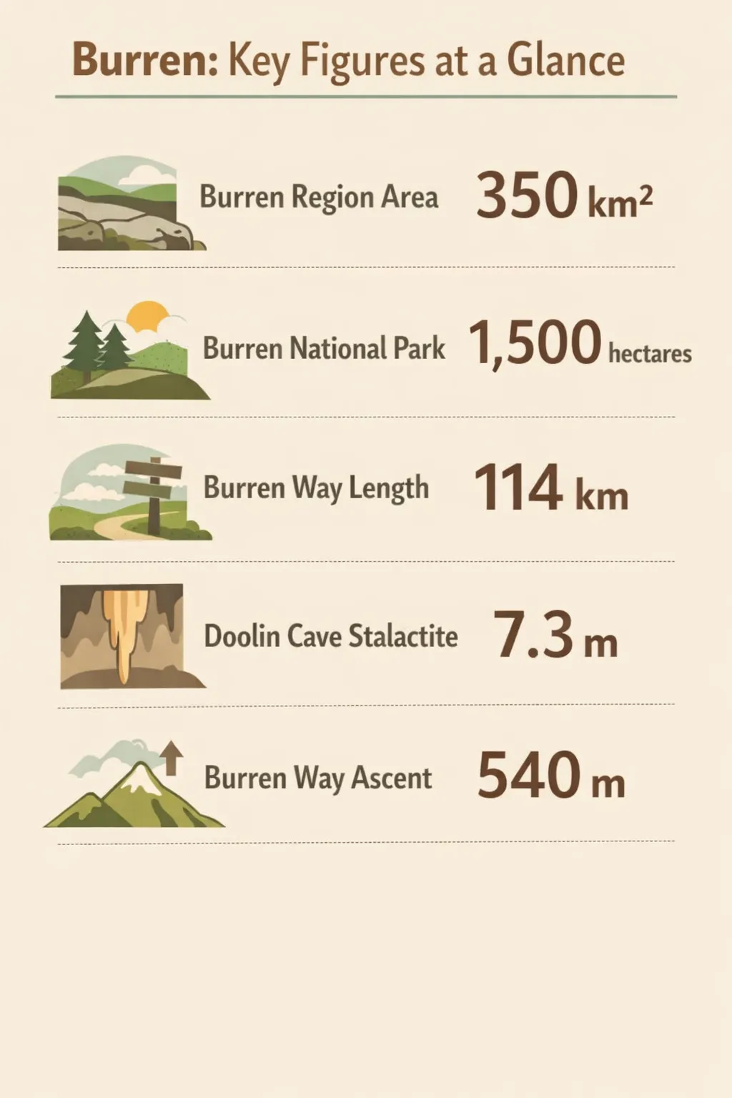 Key Burren figures: 350 km² region, 1,500 hectares in the park, Burren Way length 114 km, Doolin Cave stalactite 7.3 m, and Burren Way ascent 540 m.
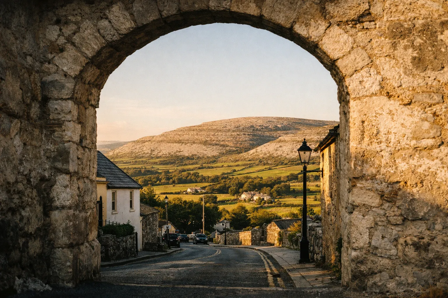
What the national park protects
The park contains examples of all the region’s major habitats: limestone pavement, calcareous grassland, hazel scrub, ash and hazel woodland, turloughs (seasonal lakes that fill and drain through the rock), lakes, petrifying springs, cliffs and fen (14). The area around Mullaghmore is considered the richest butterfly site in Ireland, with 27 of the country’s 33 resident and regular migrant butterflies recorded (14).
Because it is a working conservation area rather than a manicured visitor site, access is deliberately low-impact: the intended way in is through the Information Point in Corofin, with its free seasonal shuttle (3).
Flora, fauna, and why ‘barren’ is the wrong word
Calling the place barren because it is limestone gets it exactly backwards. Arctic-alpine plants grow beside Mediterranean ones, lime-loving and acid-loving plants grow next to each other, and woodland plants flower out in the open with no tree nearby (14). This botanical mix is the region’s real headline, more than the caves.
Wildlife includes the pine marten, which has always had a stronghold here and is now recovering across Ireland, along with badgers, foxes and red squirrels in the hazel scrub (14). Conservation is active: a 2026 government funding round for community conservation projects included work on Marsh Fritillary butterflies in the region (4). Admission to the national park is free (3).
Walking in the Burren: trails from 30 minutes to 5 days
Walks here run from half-hour loops in the national park to Burren Way, a linear trail of about 114 km that takes five days (8). That range is your main planning tool: for a half-day, use the park’s waymarked trails; commit to the long-distance route only if you have a multi-day trip.
Short and half-day walks in the national park
The park’s trailheads are about 8 km northwest of the Corofin Information Point (3). The orange and white trails are easy to moderate walks of 30 minutes to just under an hour, while the red, blue and green trails are hikes over rugged terrain that take 2.5 to 3.5 hours and all reach the top of Mullaghmore (3).
Underestimating walk times is a classic mistake. The terrain is uneven, the limestone gets slick when wet, and there is little shade or shelter, so a trail rarely goes as fast as the map suggests. Wear proper footwear, not trainers, and keep to the marked trails (14).
Outside the park, the Geopark’s walking network adds variety. The Ballyvaughan Wood Loop runs about 8 km over 2 to 2.5 hours on roads, green roads and tracks, rated easy, and the Caher Valley Loop covers 14.5 km in 3 to 4 hours at moderate difficulty (10).
Burren Way for multi-day walkers
Burren Way runs about 114 km from Lahinch to Corofin with 540 m of ascent, graded moderate and walked over five days (8). It’s a point-to-point trek that needs planned overnight stops, luggage logistics and a decent level of fitness, and the most complete way to cross the landscape on foot.
For anyone with only a day or two, the honest advice is to skip it and concentrate on the park trails plus one or two Geopark loops. Sampling a fraction of a five-day trek rarely satisfies.
Comparison of Burren walking options
| Orange and white park trails | Red, blue and green park trails | Geopark loops | Burren Way (114 km) | |
|---|---|---|---|---|
| Duration | 30 minutes to under an hour | 2.5 to 3.5 hours | 2 to 4 hours | About 5 days |
| Difficulty | Easy to moderate | Rugged hike | Easy to moderate | Moderate |
| Best for | Families and quick visits | Mullaghmore summit and a full habitat cross-section | Variety outside the park | Committed multi-day walkers |
| Starting point | Park trailheads, 8 km from Corofin | Park trailheads, 8 km from Corofin | Ballyvaughan and Caher Valley trailheads | Lahinch, finishing in Corofin |
| Shuttle accessible | Yes, in season | Yes, in season | Check the season's stops | Partly, along the route |
A note on safety: conditions shift fast between the hills and the coast, so plan the route, check the forecast, and carry waterproofs, water, snacks and a charged phone.
Caves worth visiting: Doolin Cave and Aillwee Cave
There are two show caves, and they offer different experiences. Worth the detour for most visitors: Doolin Cave, for a single record-breaking formation. Skip Aillwee if you are short on time and caves are not your priority; go if you want a longer, family-friendly outing with extras above ground.
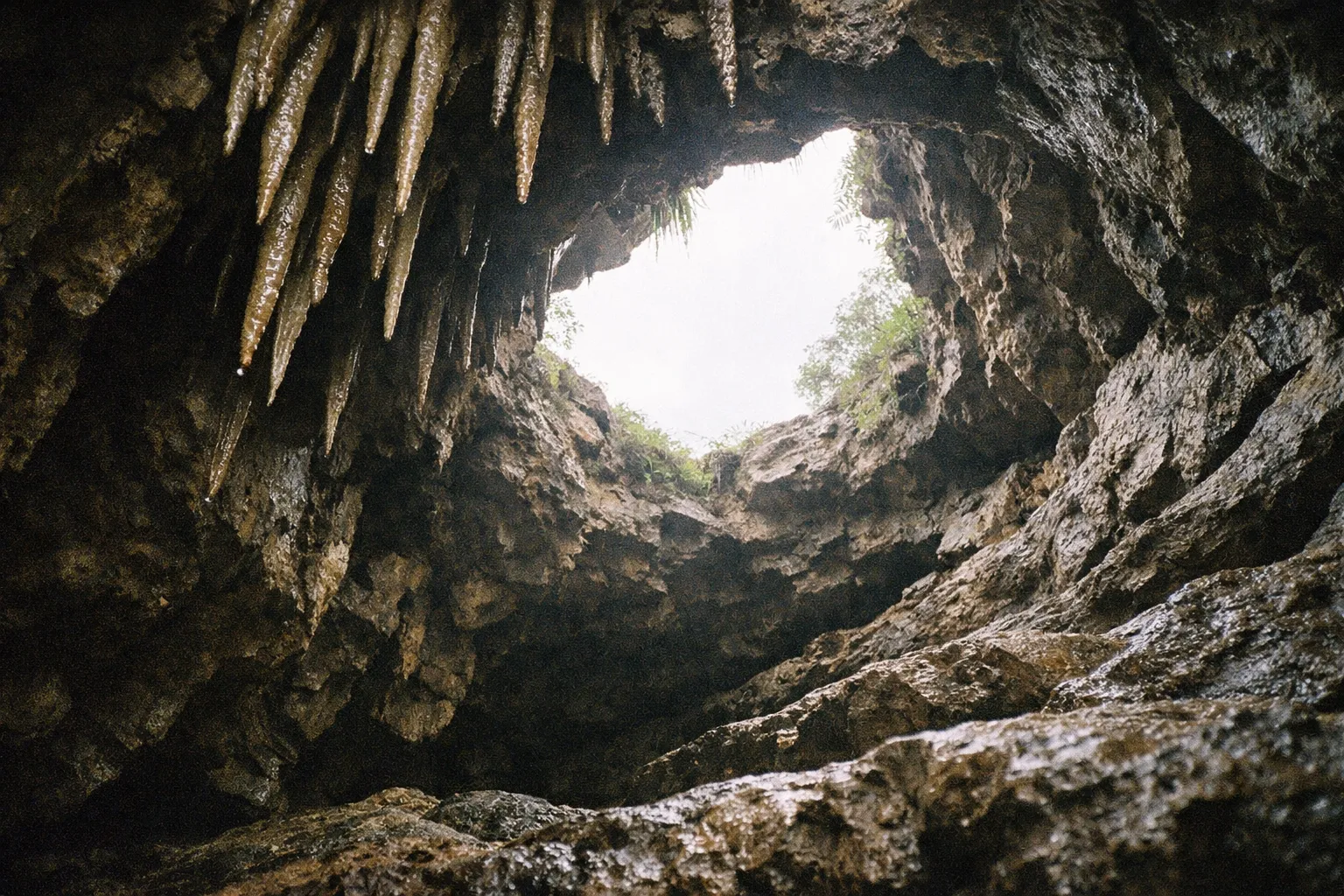
Doolin Cave: worth the detour
Doolin Cave’s centrepiece is a 7.3 m stalactite, which UNESCO describes as the largest known in the northern hemisphere (15). That superlative is the reason to go: the visit builds toward this single enormous formation, and nothing else in the region matches it. It is a more focused experience than Aillwee: you are there for the stalactite, and it delivers.
Aillwee Cave: skip if short on time, worth it if you have a full day
Aillwee Cave, near Ballyvaughan, offers a broader day out. According to Tourism Ireland, the signature experience is a 45-minute guided tour through an 850-metre passageway beneath 90 metres of limestone, past waterfalls, caverns and formations (7). Above ground, Aillwee runs a Birds of Prey Centre with daily flying displays and a farm shop where you can watch Burren Gold cheese being made (12). The cave marks 50 years in 2026 and has welcomed more than seven million visitors since opening in 1976 (7). If you want more than one thing to do at a single stop, it earns its place; if you are choosing between the two on a tight schedule, Doolin’s stalactite is the harder thing to see elsewhere.
Comparison of Doolin Cave and Aillwee Cave
| Doolin Cave | Aillwee Cave | |
|---|---|---|
| Headline feature | 7.3 m stalactite | 45-minute guided tour through an 850 m passageway |
| Distinction | Largest known stalactite in the northern hemisphere | 50 years open to visitors in 2026 |
| Location | Near Doolin | Near Ballyvaughan |
| Visitor access notes | Focused visit built around one formation | Longer visit with Birds of Prey Centre and cheese-making |
| Best paired with | Doolin coast and Cliffs of Moher | Northern Burren and Galway Bay |
The two caves sit in different parts of the region with different access and opening patterns, so check current details before you travel. Both are geosites of the UNESCO Global Geopark (13), and pairing one with the surface karst nearby is the best way to see the visible and hidden halves of the landscape in a day.
Getting around: shuttle bus, parking, and logistics
The practical starting point for any national park visit is the Burren National Park Information Point in Corofin, a village 8 km from the park, where you collect maps, meet the park guides and pick up the free shuttle bus during the visitor season (3). The Information Point is open year-round, 09:00 to 17:30 from May to September and 10:00 to 17:00 from October to April (3). Make it your first stop even if you’re an experienced walker: staff can match a trail to the conditions and your time.
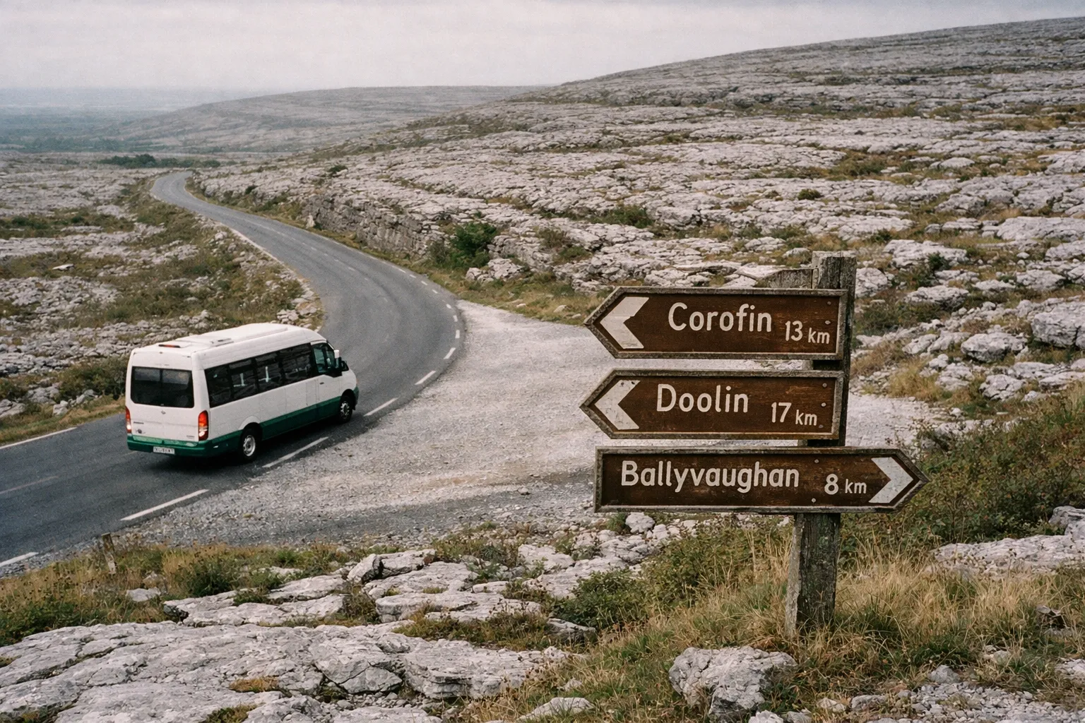
The 2026 shuttle expansion and what it means
The free, hop-on hop-off Burren & Cliffs Explorer shuttle (3) ran from 21 May to 20 September 2026 and served 11 places: Ballyvaughan, Corofin, Carran, Kilfenora, Doolin, Liscannor, Lahinch, Lisdoonvarna, Ennistymon, Miltown Malbay and Spanish Point, linking passengers to the national park and the Cliffs of Moher Experience (1). Ennistymon and Spanish Point were new for 2026, added after community feedback (1).
Two things to keep in mind. First, the shuttle lets you connect several sites in a day without driving between them, which matters given how tight parking gets at the busiest spots. Second, and this is the catch, 2026 was only the second year of the pilot scheme (1), so the route, the stops and even whether it runs can change from year to year. Verify the current season before you build a car-free itinerary around it.
If you’re basing yourself in Galway and want to pair the region with the coast, a guided day tour can take care of the Cliffs of Moher and the Aran Islands in one booking. Treat it as an add-on rather than a must-buy; the walking itself is free.
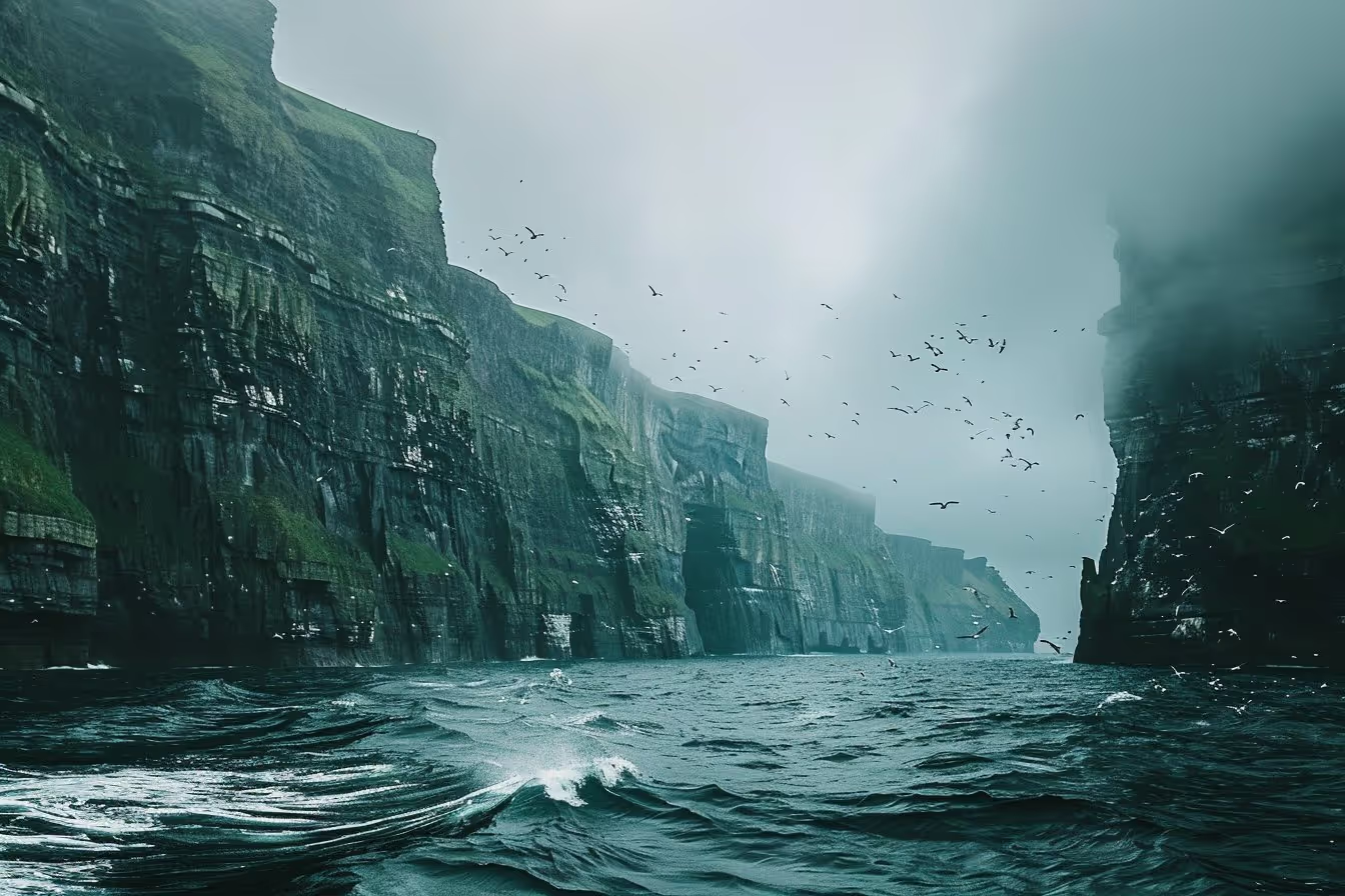
From Galway: Aran Islands and Cliffs of Moher Tour & Cruise
A day from Galway combining the Aran Islands with a cruise below the Cliffs of Moher, in a single booking.
Check availabilityGeology and geopark status explained
The Burren and Cliffs of Moher UNESCO Global Geopark contains nine geosites, areas of particular geological significance, each with its own on-site visitor and interpretation information (13). Among them are Poulnabrone, on the high limestone plateau, and the Carron Polje, the largest enclosed depression in Ireland at about 4.5 km², whose disappearing lake is a turlough (13). The Geopark sits on the Wild Atlantic Way, where glacially smoothed karst hills meet the sea cliffs of the Atlantic coast (15).
The vocabulary is worth knowing because it is what you are actually looking at:
- Clints and grikes: the flat limestone blocks (clints) separated by deep vertical cracks (grikes) that define the pavement. The grikes are where the plants live, sheltered and moist.
- Turloughs: seasonal lakes that fill and drain through the porous rock.
- Karst: terrain shaped by water dissolving soluble rock.
UNESCO status is not permanent; it is periodically reviewed. According to the Geopark’s operations plan, the status was revalidated in 2024 for a further four-year period (6).
Recent finds show the science is still live. In May 2026, two National Parks and Wildlife Service staff and a local guide reported teeth and a fin spine from 330-million-year-old fossil sharks, in finds made in Burren National Park and in Donegal (2).
History and prehistory in the landscape
The region is not only a natural landscape; it carries layers of human occupation. Read it purely as geology and botany and you miss half of what is there. Poulnabrone, one of the Geopark’s geosites (13), sits out on the limestone plateau, part of the same surface you walk across, and stone walls, tombs and forts share the landscape with the wildflowers.
That combination, deep geological time beneath and thousands of years of human use on top, is what makes a monument or two worth factoring into a walk. Ask at the Corofin Information Point, where guides can point you to sites near your chosen trail (3).
Practical tips before you go
Book ahead for anything guided. The national park’s events are free, but booking is essential because places are limited (3). Visitors who assume free entry means walk-up access to guided walks can miss out.
- Time your visit for the flora, but don’t write off other seasons. Spring and early summer are the showpiece months for wildflowers; autumn and winter visits trade the colour for fewer people and the same geology.
- Don’t confuse the park with the region. The park covers about 1,500 hectares within roughly 350 km² (14). Plan to see both the protected core and the wider landscape: the caves, the geosites, the coast.
- Respect the walk times. Park trails run from 30 minutes to 3.5 hours (3), and uneven, slippery limestone makes routes slower than they look.
- Verify the shuttle each year. It remains a pilot scheme, so confirm the current season before relying on it (1).
It’s also a working conservation landscape, not just a scenic one. A Burren biodiversity project that encourages landowners to make space for nature was reported in 2026 to have been rolled out 5,000 times across 15 counties (5). Tread lightly, stay on marked routes, and leave the grikes and their flowers as you found them.
Frequently Asked Questions about the Burren
- What is so special about the Burren?
- It combines limestone karst laid down 350 million years ago with an unusual mix of Arctic-alpine and Mediterranean plants growing side by side.
- What is the Burren in Ireland?
- A limestone karst region of about 350 km² in northwest County Clare, with a national park of about 1,500 hectares in its southeastern corner.
- Why do they call it the Burren?
- The name comes from the Irish 'An Bhoireann', meaning a rocky place, after the exposed limestone terrain.
- Is Burren National Park free to enter?
- Yes, admission is free, but guided events must be booked in advance because places are limited.
- What is the best time of year to visit the Burren?
- Late spring and early summer show the wildflowers at their best, and the free park shuttle runs through the summer season.
Start at Corofin and build out from there
This landscape rewards visitors who understand what they are looking at: limestone that is ancient below and alive above, still being carved, with a garden growing out of bare rock. Get that, and the trip organises itself.
Two practical first steps make the rest easier. Begin at the Burren National Park Information Point in Corofin, open year-round, where you can collect maps and get a trail matched to your time and the weather (3). Then check whether the Burren & Cliffs Explorer shuttle is running for the season you’re visiting: it takes the parking problem off the table and links the park, the caves and the coastal villages in a single day, though as a pilot scheme it needs verifying each year (1). Sort those two things, book any guided walk in advance, and you have the framework for a proper visit rather than a drive-by of a small corner of the landscape.