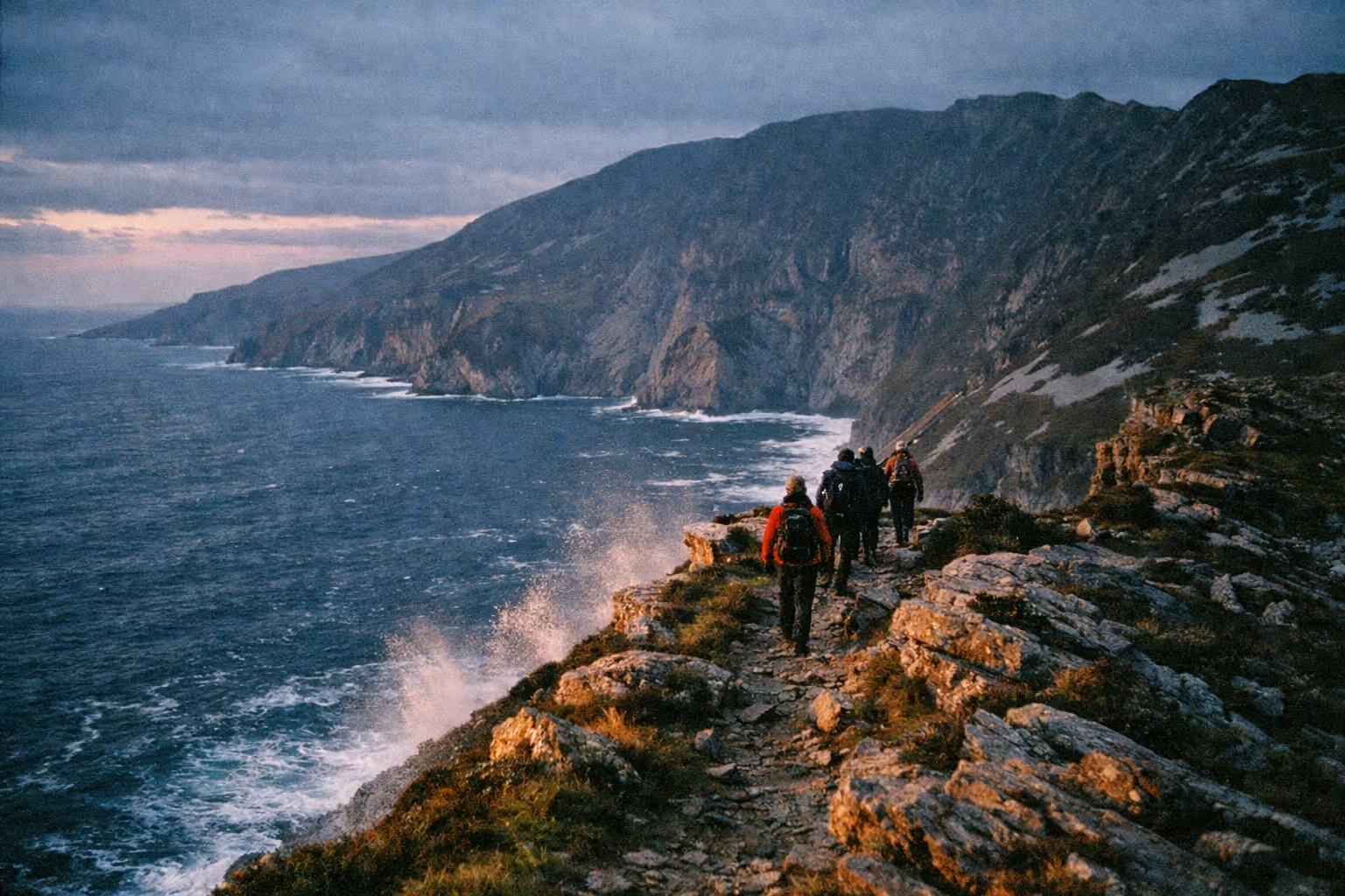
At 601 m, the Slieve League cliffs in southwest County Donegal stand almost three times the height of the Cliffs of Moher (1)(5). Most visitors still turn up expecting a drive-up viewpoint with a bus on hand, and whether that works depends entirely on the month. Here is how to reach them, which walk to pick, and when to go so the drive along single-track roads actually pays off.
What Makes the Slieve League Cliffs Worth the Trip
The cliffs rise 601 m (1,972 ft) above the Atlantic (1), and after Croaghaun on Achill Island they are the second-highest sea cliffs in Ireland (2). That is nearly three times the drop of Moher for the same effort of standing at a viewpoint, and on most days with a fraction of the crowds (2)(5).
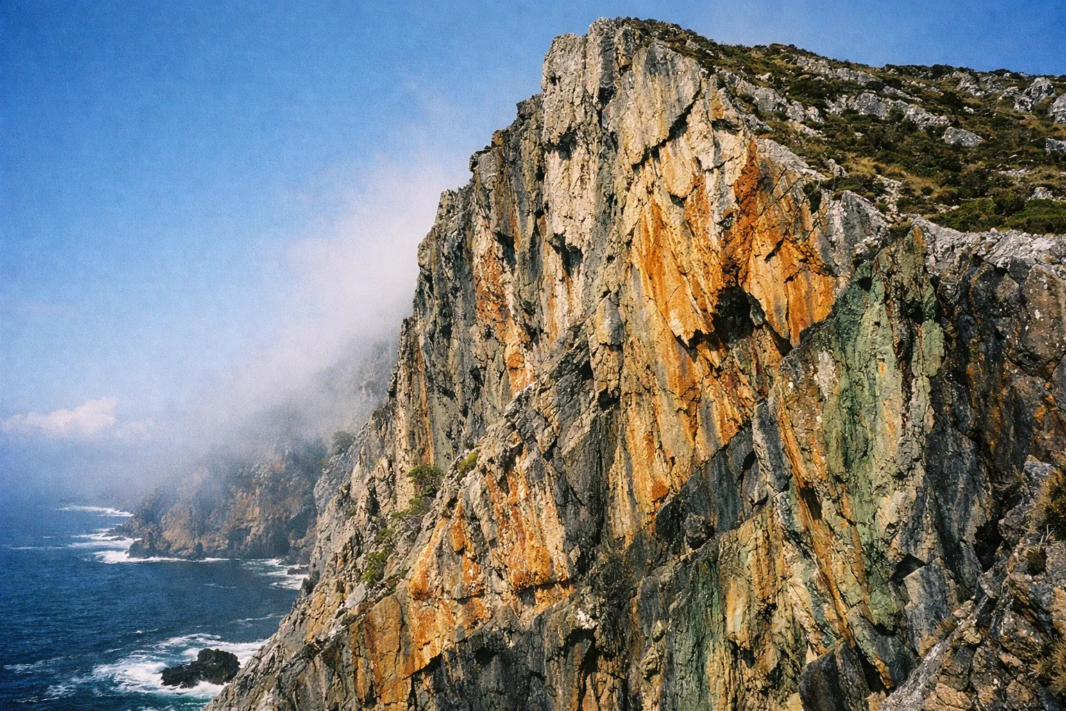
The cliffs sit on the Wild Atlantic Way in southwest Donegal, their face falling sheer into the Atlantic (1)(2). From the Bunglass viewing point the view runs back across Donegal Bay (2), with bands of ochre, grey and green mineral staining across the rock (8). The Irish name, Sliabh Liag, means the mountain of the grey flagstones (1). On the headland on the way up you’ll pass a Napoleonic watchtower built by the British in 1804, one of a chain built around the Irish coast during the war with France (1).
The trade-off for this scale is remoteness. Slieve League needs planning that Moher does not: a seasonal shuttle, paid parking close to the cliffs, changeable weather at altitude, and no bus to the top. Get the logistics right, though, and you get one of the quieter high-cliff experiences in the country.
✓ Pros
- Among Ireland's highest sea cliffs
- Far less crowded than Cliffs of Moher
- No entry fee for the cliffs and trails (shuttle and Ranger Station parking are paid)
- Multiple trail options for different fitness levels
- Shuttle service in July, August and September
- Boat tours offer a sea-level perspective
✗ Cons
- Remote location requires careful planning
- Seasonal vehicle rules can surprise drivers
- Weather at altitude is highly changeable
- No bus service to the cliffs
- No toilets at the viewing point
Location and Getting to Slieve League
The Sliabh Liag Visitor Centre is on Bunglas Road, Lergadaghtan, Teelin, F94 W8KC, roughly 4 hours from Dublin, 3.5 hours from Galway and 3 hours from Belfast by road (1).
By car, take the N56 from Donegal Town to Killybegs, then the R263 to Carrick. In Carrick, turn left at the Slieve League Lodge and continue for 2 km, pass the Rusty Mackerel pub on your left, and take the next right: the Visitor Centre is on the right (1). The road beyond is narrow and single-track in stretches, with passing bays rather than two clear lanes (2). Take it slowly.
Here is the trap that catches public-transport users: there is no bus to the cliffs. Bus Éireann route 490 and TFI Local Link route 293 both run from Donegal Town to Carrick, but they stop in the village (2)(10). From Carrick you still need a taxi or a walk to reach the Visitor Centre. LaidBack Trip’s guide puts it plainly: “There is no bus to Slieve League” (10).
Parking, Shuttle, and Getting Up to the Bunglass Viewpoint
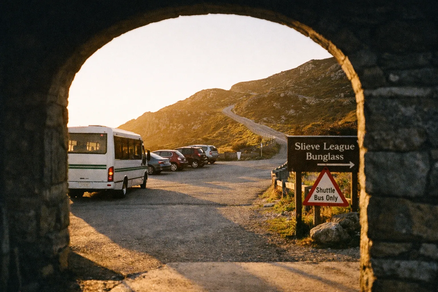
How you get up to Bunglass depends on the season. In July, August and September the shuttle runs from the Visitor Centre; outside those months, cars can drive up to the viewing area once a parking ticket has been bought at the Ranger Station car park (1). The main viewing point, at the top car park, is wheelchair accessible, and special access vehicles can reach it all year round (1).
Shuttle season, timetable and fares
The summer shuttle runs during July, August and September, and on most bank holiday weekends through the year (1). Buses leave the Visitor Centre every 40 minutes from 10:10 to 16:50, and the last bus back down leaves the viewing platform at 17:10 (1). Drivers are Fáilte Ireland-approved and give a commentary on the way up (7).
The Sliabh Liag Visitor Centre’s booking page prices shuttle tickets at €9 for adults, €8 for students and seniors, €7 for children, and €28 for a family (7). Pre-booking is advisable in peak season, online or by phone to the Visitor Centre (1).
One thing to plan around: miss that 17:10 bus and you are walking the 4 km back down to the Visitor Centre car park (1).
Parking costs and what’s actually free
You can park at the Visitor Centre, 4 km from the cliffs, at no cost (1). The Ranger Station car park, 2 km from the cliffs, costs €10 for 2 hours, or €15 for 4 hours or a full day (1). Outside shuttle season, that Ranger Station ticket is also what lets you drive on to the viewing area (1). There are toilets at the Visitor Centre and the Ranger Station, but none at the viewing point (1).
Budget-conscious visitors can skip both the shuttle fare and the parking fee by walking up from the free Visitor Centre car park, but it’s 4 km uphill each way (1). Paying the shuttle buys that time back for the cliffs.
Slieve League Hiking Trails: Matching the Route to Your Fitness
The Visitor Centre lists three walks, from a 2.5 km cliff path to a 13 km loop over the ridge for experienced hillwalkers (1). One of them is worth prioritising for most visitors; one should be skipped unless you know what you are getting into. Pick before you arrive, because the difference between them is large.
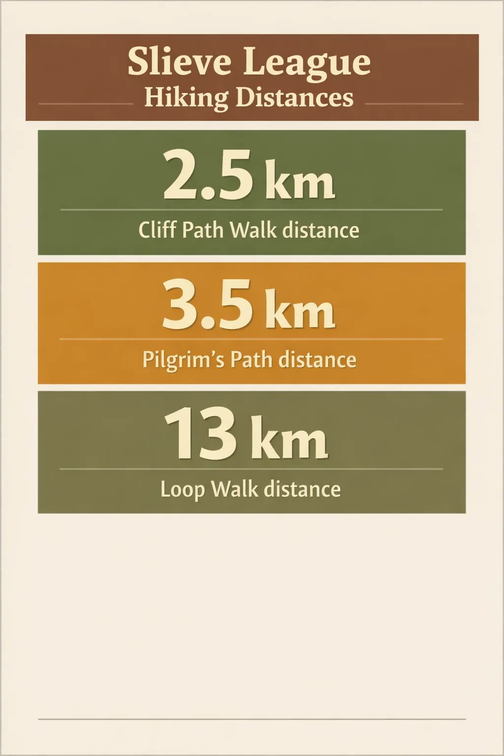 Distances for Slieve League hikes: Cliff Path Walk 2.5 km; Pilgrim’s Path 3.5 km; Loop Walk 13 km.
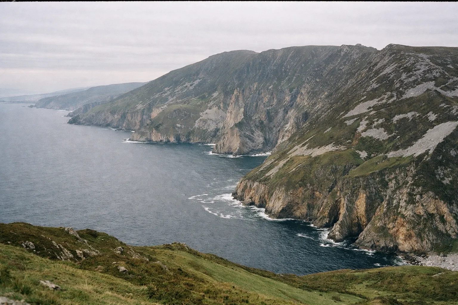
Cliff Path Walk (2.5 km): worth it for almost everyone
The Cliff Path Walk starts at the viewing area and climbs the mountain for 2.5 km, taking about 2.5 to 3 hours there and back (1). It delivers the headline sea-cliff panorama without committing to a mountain day, and for most people it is enough. Start early in the day, when there are fewer visitors (5).
Pilgrim’s Path (3.5 km): worth the detour if you want the summit
The Pilgrim’s Path is a more sheltered, inland approach (6) of about 3.5 km, taking 3 to 3.5 hours depending on ability and fitness (1). It follows an old route to a monastic site whose remains can be seen near the top plateau (9).
For the trailhead, the My Donegal Walks route description has you turn off the Teelin road onto a small country road after 2.3 km; if you pass the Rusty Mackerel pub, you have missed the turn (9).
Loop Walk over One Man’s Pass (13 km): experienced walkers only
The 13 km Loop Walk takes about 4 to 5 hours (1). Combining the Pilgrim’s Path ascent with the ridge over One Man’s Pass and a descent to Bunglass, it crosses exposed, sometimes narrow terrain (2). Skip it if you are short on time, and skip it entirely without good footing, navigation skills and a head for heights. The ridge has drops on both sides, and it is no place to be in strong winds or low visibility (2)(3)(6).
For mixed-ability groups, the most practical split is to send fitter walkers up the Pilgrim’s Path while everyone else takes the shuttle or drives to Bunglass, then meet at the viewpoint or along the Cliff Path Walk.
Slieve League Hiking Trails Comparison
| Cliff Path Walk | Pilgrim's Path | Loop Walk (One Man's Pass) | |
|---|---|---|---|
| Distance | 2.5 km | 3.5 km | 13 km |
| Duration | 2.5 to 3 hours there and back | 3 to 3.5 hours | 4 to 5 hours |
| Difficulty | Easy to moderate | Intermediate | Experienced walkers |
| Start Point | Bunglass viewing area | Small road off the Teelin road | Pilgrim's Path trailhead |
| Best For | Families, older visitors, photographers | Walkers seeking a quieter, sheltered route | Experienced hillwalkers comfortable with exposure |
Best Time to Visit Slieve League Cliffs
Best month to visit: June. Daylight is at its longest, you can still drive up to the viewing area with a Ranger Station parking ticket because the shuttle-only months haven’t started, and you arrive ahead of the July to September season (1). If you’d rather leave the car at the free Visitor Centre car park and ride up, pick September instead: the shuttle is still running and the school holidays are over (1).
Weather is the wild card. At 601 m, fog, strong winds and rain can arrive fast, cutting visibility and making exposed paths dangerous (2)(3). Conditions at the car park tell you nothing about what the ridge is doing, so check the forecast before committing to any cliff-edge or summit walk.
A still, bright morning at Bunglass tends to be calmer and less crowded than the afternoon (2)(5).
What to Expect on the Day: Practical Tips and Safety
For anything beyond the Cliff Path Walk, bring proper gear: sturdy boots and layered, windproof and waterproof clothing, given how quickly the weather on the mountain turns (2)(3). When the wind is up or visibility drops, keep off the upper trails and stick to the lower paths (2).
The heritage on the mountain rewards the climb: the Pilgrim’s Path leads past the remains of a monastic site near the summit plateau (9). Below the cliffs, gannets pass in lines over the water where the sea works at the base of the rock (8).
For a completely different perspective, boat trips from Teelin harbour view the cliffs from sea level (5), and you can pair one with a cliff-top visit to see the same rock face from both angles in a day.
Slieve League Cliffs: Frequently Asked Questions
- Which is better, Cliffs of Moher or Slieve League?
- Slieve League is almost three times higher and less crowded, but more remote and weather-dependent; Moher is easier to reach with fuller facilities.
- How long does it take to walk the Slieve League cliffs?
- The Cliff Path Walk takes 2.5 to 3 hours there and back, the Pilgrim's Path 3 to 3.5 hours, and the 13 km Loop Walk 4 to 5 hours.
- Do you need tickets for Slieve League Cliffs?
- No ticket is needed for the cliffs themselves. You pay for the shuttle in season or for parking at the Ranger Station; the Visitor Centre car park is free.
- Is Slieve League higher than the Cliffs of Moher?
- Yes. Slieve League reaches 601 m, almost three times the height of the Cliffs of Moher.
- When does the Slieve League shuttle run?
- In July, August and September and on most bank holiday weekends, every 40 minutes from the Visitor Centre starting at 10:10.
- Can I take a boat tour?
- Yes, boat trips run from Teelin to view the cliffs from sea level, and can be combined with a cliff-top visit.
Before You Go
One thing most guides underplay: the Slieve League cliffs are not a simple drive-up viewpoint. From July to September the shuttle takes over, parking close to the cliffs is paid, and the ridge walks need proper gear and a weather check. Treat it like a half-day mountain outing, not a roadside stop.
Three decisions settle a good visit. First, access: in shuttle season, park free at the Visitor Centre and ride up; outside it, buy a Ranger Station ticket and drive to the viewing area. Second, trail: the Cliff Path Walk covers the view for most visitors, the Pilgrim’s Path if you want the summit, and the Loop Walk only if you are an experienced hillwalker comfortable with exposure. Third, timing: go early in the day and check the mountain forecast, because the weather at 601 m is what makes or breaks it.