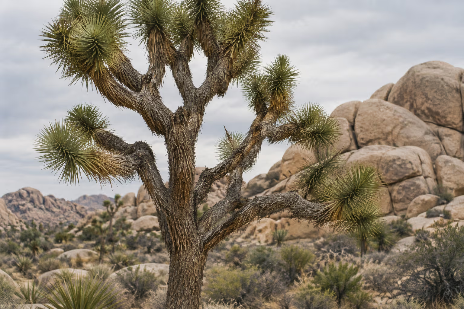
Joshua Tree National Park never closes. It is open 24 hours a day, 365 days a year (3), and in December full darkness arrives around 5 p.m. (9). That pairing makes winter nights as much of a draw as the granite boulder piles that pull in hikers and climbers by day. This guide covers the short hikes worth your time, how Joshua Tree camping reservations work, what the entrance pass costs, where the rock formations came from, and how to plan a cold, dark night of stargazing.
✓ Pros
- Short walks deliver varied scenery without requiring a full-day hike.
- The park combines exposed granite, desert plants, and dark-sky viewing in one trip.
- Round-the-clock access makes it possible to plan around daylight and night skies.
✗ Cons
- Limited services inside the park make advance planning essential.
- Popular camping and trailhead parking can constrain flexible arrival plans.
- Most trails are off-limits to dogs, narrowing options for visitors with pets.
- Winter stargazing means standing outdoors in near-freezing conditions.
Joshua Tree National Park at a Glance
Joshua Tree National Park is a southern California desert park where the Mojave and Colorado deserts meet, open around the clock, with granite formations, short hikes, camping, and dark skies (3)(8). It is managed by the National Park Service and sits near Desert Center, California (8), east of the Coachella Valley and Palm Springs.
Where Joshua Tree sits and how big it is
The park spans a large block of wilderness in southern California (8), with entry points on the north side near the towns of Joshua Tree and Twentynine Palms and a southern entrance on Pinto Basin Road. The park covers about 795,000 acres (16). The scale shows in its infrastructure: roughly 500 campsites spread across the park (1), and four visitor centers rather than one. The Joshua Tree Visitor Center is at 6554 Park Boulevard in the town of Joshua Tree, the Joshua Tree National Park Visitor Center is at 6533 Freedom Way in Twentynine Palms, the Cottonwood Visitor Center sits near the southern entrance on Pinto Basin Road, and the smaller Black Rock Nature Center is inside Black Rock campground in Yucca Valley (3).
Elevation shifts with the terrain. Black Rock campground sits at 4,000 ft (1,219 m) and Cottonwood at 3,000 ft (914 m) (1), and that difference shows up in temperatures and plant life.
Plan for the park’s emptiness. There are no gas stations, restaurants, grocery stores, or hotels inside the park, and no water in the interior (6). Water jugs can be filled at the West Entrance Station, the Indian Cove Ranger Station, Black Rock and Cottonwood campgrounds, and park headquarters, and bottle fill stations sit at the Black Rock Nature Center, the West Entrance Station, and the Joshua Tree National Park Visitor Center (3). Cell reception is very limited (6), so download maps and book campsites before you drive in.
Access is round-the-clock. When entrance stations are unstaffed at night, the gates stay open and you can drive in and out freely (3). A closed fee booth does not mean entry is free: you may be asked to show your pass or pay the fee on the way out (6).
Getting there: from Interstate 10, exit 117 leads to California Highway 62 and the West and North entrances, Black Rock, and Indian Cove; exit 168 leads to the South Entrance near Cottonwood (8). Inside the park, the drive from the West Entrance to the North Entrance takes about 45 minutes, and from the West Entrance to the South Entrance about 1 hour 30 minutes (3).
Why it’s called Joshua Tree
The park takes its name from the Joshua tree, a branching yucca that grows across the Mojave half of the park. The most widely repeated origin story credits Mormon pioneers, who saw the tree’s upstretched limbs as the arms of the biblical Joshua leading them to the promised land (3). The tale has never been substantiated in the record (3), but the name stuck.
The Joshua trees themselves are easiest to see in the northwest, along Park Boulevard and Keys View Road (3). Drive south toward Cottonwood and they thin out (3), giving way to the ocotillo and teddy bear cholla of the Colorado Desert (16).
Mojave meets Colorado: two deserts in one park
In Joshua Tree you can drive from one desert ecosystem into another in a single crossing: the drive from the North Entrance to the South Entrance takes about an hour (3). The Mojave and the Colorado, two distinct desert ecosystems, come together inside the park boundary (8). The Mojave side is higher, cooler, and home to the Joshua tree forests and the big granite piles. The Colorado Desert, a western extension of the larger Sonoran Desert, occupies the southern and eastern parts of the park (16), along Pinto Basin Road.
That split is what makes the park special. In a single day you can walk among boulder piles at Hidden Valley, then drop into the open Pinto Basin with its cholla flats and almost no artificial light. Strong winds and occasional heavy rain shaped both landscapes (8), and flash floods remain a hazard in any season (3).
Best Short Hikes for Every Visitor
The best short Joshua Tree hikes are four scenic loops of around 1 mile each: Hidden Valley, Barker Dam, Arch Rock, and Discovery Trail (3). Each takes about an hour or less (14), so you can string two or three together in a single day without wearing yourself out.
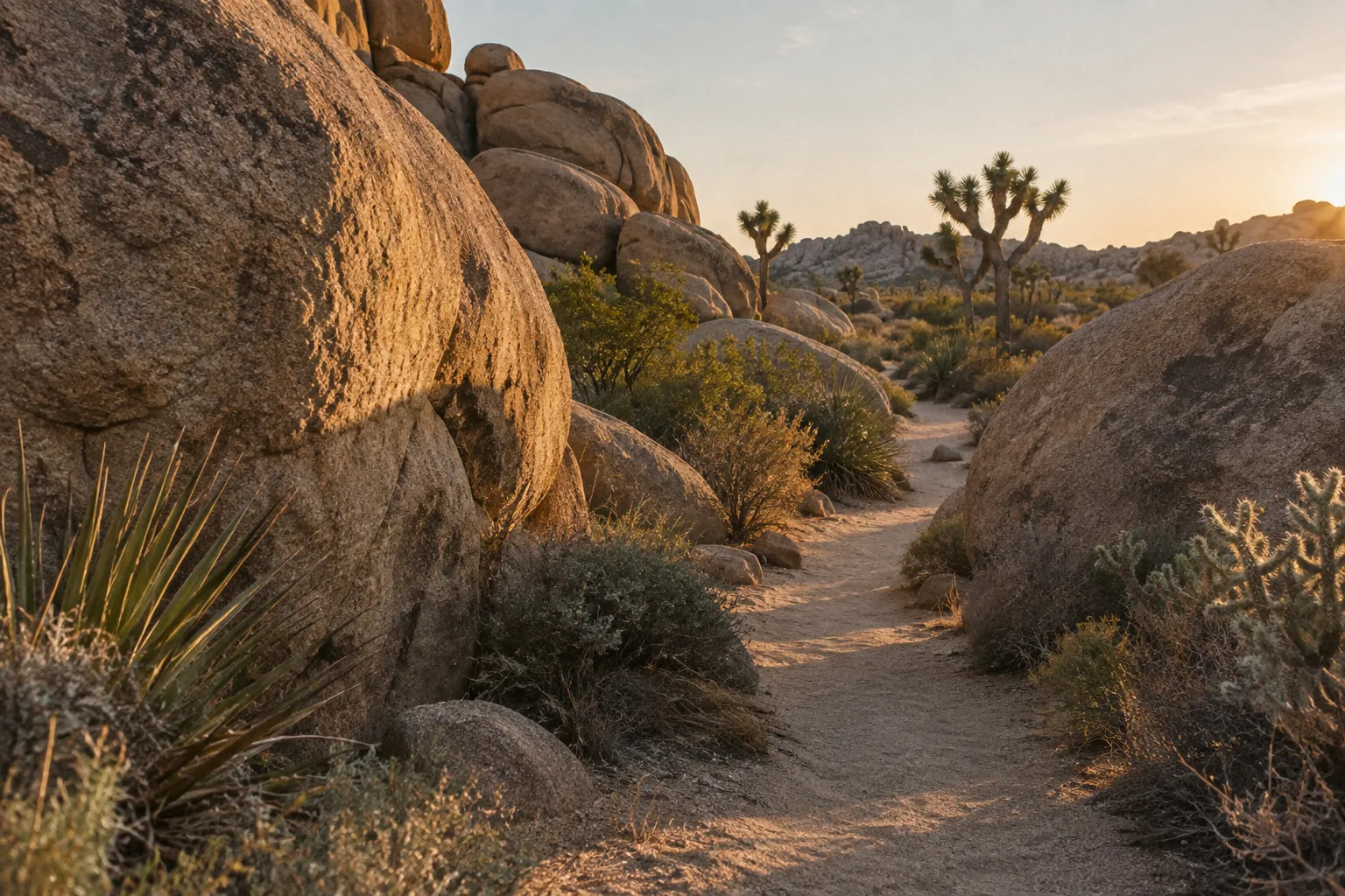
Four scenic loops around one mile
All four are short, mostly flat, and sit close to the main park road. Ranked by payoff:
Worth the detour:
- Hidden Valley. A loop through a rock-walled basin surrounded by granite piles. It is flat and easy, and works with a stroller (10). If you only have time for one hike, make it this one. Arrive early: Hidden Valley is also a campground, a climbing hub, and a designated stargazing lot (9), so the parking lot fills.
- Barker Dam. A loop past a water tank built by early cattle ranchers (14). After a wet winter there may be standing water, which draws birds and occasionally bighorn sheep (3). In a dry year it is a quieter walk through boulders, still worth doing.
Good if you’re nearby:
- Arch Rock. Starts from the Twin Tanks parking lot, also called the Arch Rock Trailhead, and runs 1.4 miles as a lollipop loop, with the arch halfway around the loop (14). The arch is the payoff.
- Discovery Trail. A 0.7-mile loop from the Skull Rock parking area that links the Skull Rock and Split Rock trails at Face Rock (14). Pleasant, but if you’re short on time, the drive-up view of Skull Rock gives you most of the payoff without the walk.
None of these four requires a permit or reservation. What they do require is water you bring yourself, since the interior has none (6).
Accessible and paved routes for strollers and wheelchairs
Hidden Valley gets most of the attention as the easy, stroller-friendly loop (10), but it is not paved. For wheelchair users, two paved routes work better: the Oasis of Mara near the park headquarters in Twentynine Palms and the Lower Keys View Overlook (3).
The Oasis of Mara is a 0.5-mile paved loop around a desert oasis, with benches along the way (13). As of November 2026, an NPS alert lists the trail as closed past the oasis after a flood, so check current conditions before you go (15). At Keys View, the path to the lower viewpoint is 0.1 miles of paved sidewalk with minimal elevation gain, while the path to the upper viewpoint is steep (13). Both look out over the Coachella Valley (13), without any hiking.
Where rock climbers go
Climbers come for the same monzogranite that shapes the scenery: the park counts more than 8,000 climbing routes and 2,000 boulder problems, known for traditional-style crack, slab, and steep face climbing (17). Hidden Valley, Jumbo Rocks, Indian Cove, and the Wonderland of Rocks are the main climbing areas.
One regulation catches visiting climbers: a Bolting Permit is required to place, remove, or replace bolts and fixed anchors, in both wilderness and non-wilderness areas (4). Most visitors climbing established routes will never need one, but route developers do.
Hiking with dogs: the one exception
Dogs are not allowed on any Joshua Tree hiking trail except the Oasis of Mara, and even there they must stay leashed and within 100 feet (30 m) of a road (3). Travelers with pets should not expect any other trail access. The 100-foot rule applies everywhere in the park, so a dog can come along on scenic drives, at campsites, and in parking lots, but not on the Hidden Valley or Barker Dam loops. Summer pavement and sand also heat up fast, which is another reason to leave dogs at home if you’re visiting outside winter.
How Joshua Tree’s Rock Formations Took Shape
Joshua Tree’s boulder piles formed when groundwater weathered jointed monzogranite underground and erosion later exposed and loosened the blocks (2). The process started more than 100 million years ago (2).
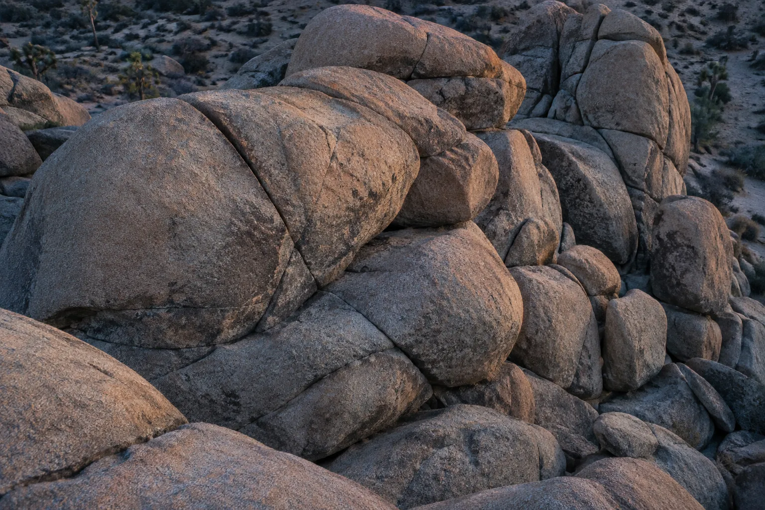
How the boulder piles formed
The story begins underground. More than 100 million years ago, molten rock pushed upward through the Earth’s crust and cooled before reaching the surface (2). That rock is monzogranite, a granitic rock that makes up most of the formations you see from the trails.
As the monzogranite cooled and the miles of overlying rock, a layer called gneiss (pronounced “nice”), eroded away, the granite developed a system of rectangular joints (2). One set of cracks runs roughly horizontally. A second set runs vertically, and a third is also vertical but cuts the second at a high angle (2). The result was granite divided into rough rectangular blocks while still buried.
Groundwater then did the sculpting. Water percolating through the joint fractures turned some of the hard mineral grains into soft clay (2), eating away at the corners and edges of each block faster than the faces. When surface erosion finally stripped away the softer material around them, the rounded blocks were left stacked in the piles you see today (2).
This explains a detail many visitors miss. The rounded shapes did not come from wind sanding exposed rock. Most of the rounding happened underground, before the boulders ever saw daylight.
Jumbo Rocks, Wonderland of Rocks, and Split Rock
Three spots show the joint system most clearly (2), and each rewards a different amount of time.
- Jumbo Rocks sits along the main park road and has a campground of the same name. The formations crowd right up to the campsites, and the Skull Rock loop can be reached from inside the campground (14). Worth the detour, especially at golden hour.
- Wonderland of Rocks is a sprawling maze of granite north of the main road; the Boy Scout Trail goes deep into it and the Willow Hole trail follows its edge (14). The full area takes serious route-finding and is better suited to experienced hikers and climbers, but even the edges show how the joints break granite into stacked, rectangular blocks.
- Split Rock has its own picnic area and a 2.5-mile loop that takes 1.5 to 2.5 hours (14). A good stop if you’re already passing through. Skip it if short on time.
Joshua Tree Camping: Reservations vs First-Come Sites
The decision rule for Joshua Tree camping is simple: if you need a guaranteed site, reserve up to 6 months ahead on Recreation.gov (1). If your plans are flexible, try the three first-come campgrounds (Hidden Valley, Belle, and White Tank) but arrive well before Friday afternoon on weekends (3).
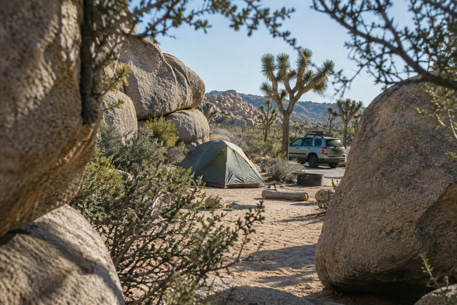
Nine campgrounds, two booking systems
The park counts nine campgrounds (9), and the majority of its roughly 500 campsites are available by reservation (1). For planning, what matters is the booking split:
- Reservation campgrounds: Indian Cove, Black Rock, Jumbo Rocks, Ryan, and Cottonwood, plus three group campgrounds (1)(3).
- First-come, first-served: Hidden Valley, Belle, and White Tank (3).
As of November 2026, reservation sites cost $35 per night at Black Rock, Cottonwood, and Indian Cove and $30 at Jumbo Rocks and Ryan, and group sites at Sheep Pass start at $55 (1). Here’s how the main options compare.
Black Rock has 99 sites at 4,000 ft (1,219 m), with water, flush toilets, tables, fire grates, and a dump station (1). It sits at the park’s northwest corner near Yucca Valley, so it’s the best pick if you want amenities and quick access to town. It also hosts the Black Rock Nature Center (3).
Cottonwood has 62 sites at 3,000 ft (914 m), with water and flush toilets (1). It sits near the southern entrance and is the closest campground to the dark Pinto Basin Road corridor, and the park names it the campground with the darkest skies (9).
Indian Cove sits on the north edge of the park among granite formations, with its own access road. It’s a good fit for climbers who want a reserved site.
Jumbo Rocks and Ryan sit in the heart of the park along the main road, surrounded by the boulder piles. Jumbo Rocks puts you within walking distance of Skull Rock (14), and Ryan is close to the Ryan Mountain parking area (14), one of the designated stargazing lots (9).
Hidden Valley, Belle, and White Tank are the first-come options. Hidden Valley is the climbers’ campground, central and surrounded by routes. White Tank is near the Arch Rock trailhead. Belle is small and sits closer to the Pinto Basin side.
Reserving a guaranteed site on Recreation.gov
Reservations can be made on Recreation.gov or by phone, anywhere from the same day up to 6 months in advance, subject to availability (1)(3). Book before you enter the park, since cell service inside is very limited (1).
The park recommends reserving if you plan to camp on a holiday, a weekend, or any day of the week in spring (1). The park describes its busy season as running from October to May (1), which covers almost the entire comfortable-weather window. For a weekend trip anywhere in that stretch, open your booking window as early as you can. Weekday stays are your best chance at short-notice availability.
Two seasonal notes affect summer and early-fall trips. Reservation campgrounds are typically open year-round, but partial or full closures can happen in the summer months (1). An annual campfire ban runs from June 15 until October 1 (1), so bring a camp stove if you’re visiting in that window.
First-come sites: Hidden Valley, Belle, and White Tank
The three first-come campgrounds are the gamble. On weekends they are typically full by Friday afternoon, and competition is fierce on holidays and in spring (3). They fill most weekends from October to April and during holiday weeks such as Thanksgiving (16), so arriving on Saturday morning usually means finding them full.
If you’re going first-come, arrive Thursday or early Friday, have a backup plan, and check all three campgrounds on the way in.
Do not plan to sleep in your car as a fallback. Vehicle sleeping is allowed only at a lawfully occupied designated campsite, not at trailheads, roadsides, or parking lots (3). If every site is full, your options are camping on Bureau of Land Management land outside the park, a private campground, or lodging in the gateway towns of Joshua Tree, Twentynine Palms, or Yucca Valley (1).
Paying for a first-come site
At first-come campgrounds, you claim a site first, then register and pay within one hour (3). Campsite payments are debit or credit only (3), so cash won’t help you. As of November 2026, the fee at the three first-come campgrounds is $25 per night (1).
Joshua Tree Campgrounds at a Glance
| Black Rock | Cottonwood | Indian Cove | Jumbo Rocks | Ryan | Hidden Valley | Belle | White Tank | Group campgrounds | |
|---|---|---|---|---|---|---|---|---|---|
| Booking | Reservation | Reservation | Reservation | Reservation | Reservation | First-come, first-served | First-come, first-served | First-come, first-served | Reservation; group sites |
| Location or setting | Northwest corner, near Yucca Valley | Southern entrance | North edge, reached by its own access road | Central park, along the main road | Central park, along the main road | Central park | Closer to the Pinto Basin side | Central park | Cottonwood, Indian Cove, and Sheep Pass |
| Standout feature | Water, flush toilets, and a dump station | Closest campground to the Pinto Basin dark-sky corridor | Granite setting suited to climbers | Skull Rock is within walking distance | Close to the Ryan Mountain stargazing lot | Climbing hub and designated stargazing lot | Small campground | Near the Arch Rock trailhead | Group sites for 10 to 60 people |
Joshua Tree Entrance Fee and Getting Into the Park
The Joshua Tree entrance fee for a private, non-commercial vehicle is $30 USD for a 7-day permit as of November 2026 (5), and no reservation is required just to enter (4). You only need a valid pass.
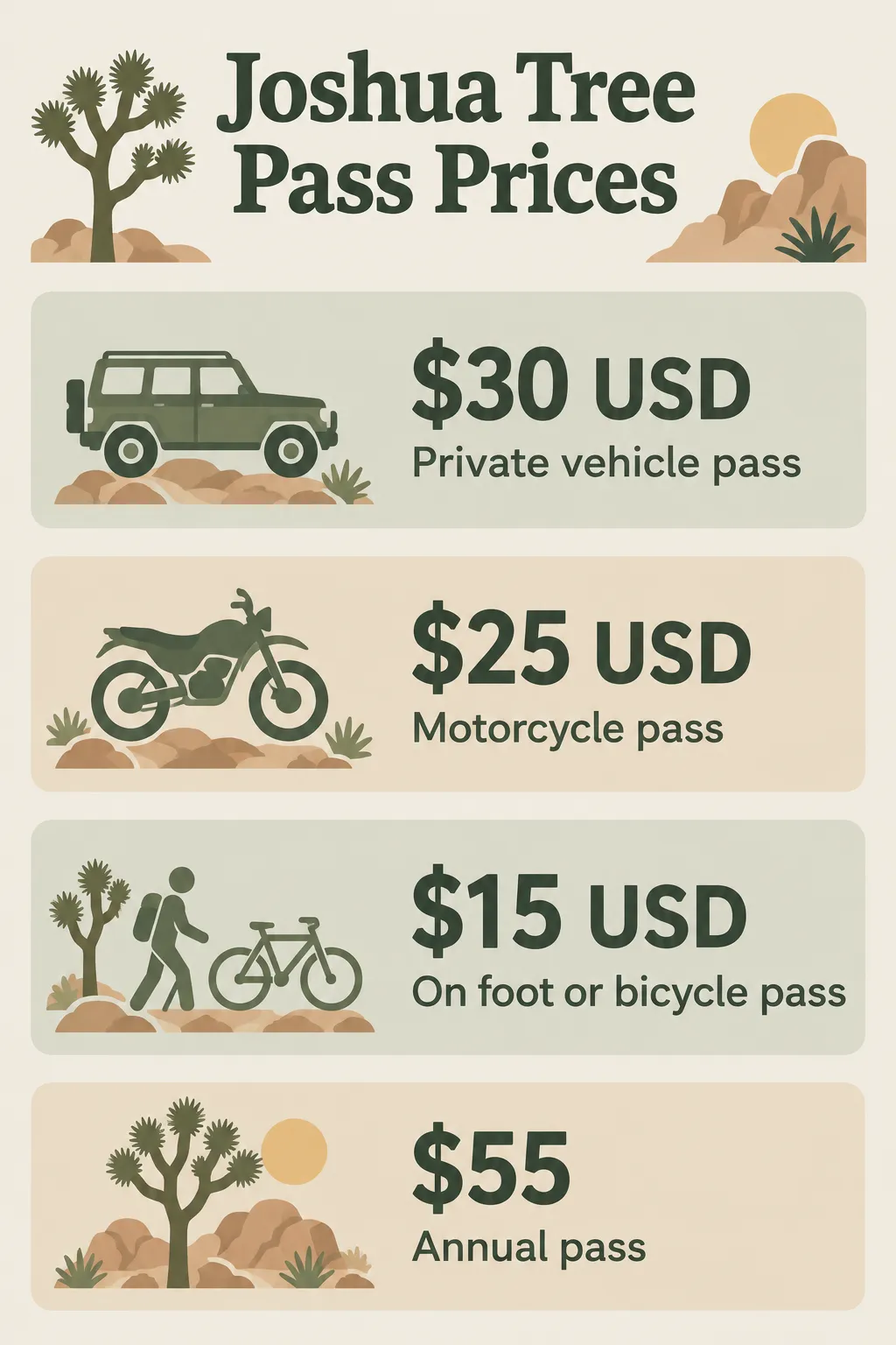 As of November 2026, Joshua Tree passes cost $30 USD for a private vehicle, $25 USD for motorcycles, $15 USD on foot or by bicycle, and $55 for an annual pass.
Entrance pass prices by vehicle type
As of November 2026, the standard 7-day passes cost (5):
- Private vehicle: $30 USD for a 7-day permit covering passengers in one private, non-commercial vehicle.
- Motorcycle: $25 USD for a 7-day pass, covering up to two private motorcycles and four total passengers.
- On foot or bicycle: $15 USD for a 7-day pass for one person.
All passes are valid for seven days, so a weekend trip with a return visit midweek is covered by one purchase.
Buying your pass ahead of time
You can buy an entrance pass at the entrance stations or at a visitor center (4)(6), but the park recommends buying it ahead on Recreation.gov to speed up the wait at the entrance (6). This matters most on spring weekends, holidays, and during spring break season from March through mid-April, when the park warns of long lines and limited parking (6).
Other pass options
If you plan to visit Joshua Tree more than once in a year, the park’s annual pass, sold to US citizens and residents, costs $55 as of November 2026 (5). If you’re visiting several national parks or federal recreation sites, the America the Beautiful pass is the only entrance pass you need (5). Seniors, military members, visitors with a permanent disability, and families with a fourth grader qualify for a free or discounted version (5).
Reservations are separately required for Keys Ranch tours, booked on Recreation.gov, while other ranger programs are free and need no reservation (4). Keys Ranch tours typically run from October to April, with tickets sold only on Recreation.gov up to 60 days ahead and no walk-ups (3); as of November 2026 they cost $10 to $20 per visitor (5). Backcountry overnight stays require a permit, available on Recreation.gov, by phone, or at the Twentynine Palms headquarters (4).
How to Enter Joshua Tree National Park
Buy or arrange your entrance pass, choose an entrance, and have the pass ready when you reach the station.
- 1
Get your pass before you arrive
Buy it on Recreation.gov, or get one at an entrance station or visitor center. Check that you have the right pass for your vehicle or party.
- 2
Choose an entrance
Use the west entrance near Joshua Tree, the north entrance near Twentynine Palms, or the south entrance on Pinto Basin Road near Cottonwood.
- 3
Allow for busy-day lines
On busy days, arrive early; the park warns of long lines and limited parking during spring weekends, holidays, and spring break.
- 4
Show your pass
Have it ready at the entrance station. If the booth is unstaffed when you enter, you may be asked to show or pay for your pass on the way out.
- 5
Enter prepared
Fill up on gas and bring food and water before driving in, since those supplies are not sold inside the park.
Winter Stargazing: Where to Go and What to Expect
The best winter stargazing in Joshua Tree is along Pinto Basin Road between Cholla Cactus Garden and Cottonwood, the park’s darkest and least trafficked area (3). Winter adds early sunsets and near-freezing nights. Joshua Tree is a designated International Dark Sky Park by DarkSky International (9), and many visitors see the Milky Way here for the first time (9).
Winter timing works in your favor. In December, sunset can come as early as 4:30 p.m., with full darkness around 5 p.m. (9). You can have a full night of stars and still be back at camp or a motel at a reasonable hour.
The darkest stretch: Pinto Basin Road
Pinto Basin Road runs south from the center of the park toward the Cottonwood entrance, dropping into the Colorado Desert. The stretch between Cholla Cactus Garden and Cottonwood is the darkest and least trafficked (3), shielded from the glow of the northern towns. Cottonwood campground at the south end is the most practical base if dark skies are the main reason for your trip.
Pull over only where it’s legal and safe, and keep your vehicle off the soft shoulder. Traffic is light after dark, but drivers don’t expect people standing on the road.
Four designated stargazing lots
The park designates four parking lots for stargazing: Quail Springs, Hidden Valley, Cap Rock, and Ryan Mountain (9). These sit in the northern and central part of the park, closer to the west and north entrances, so they’re easier to reach if you’re staying in Joshua Tree or Twentynine Palms. The trade-off is slightly more light from the towns on the northern horizon.
The park asks that you stay awake and within 20 feet (6 m) of your vehicle at these lots (9). They are viewing areas, not overnight parking, which lines up with the rule against sleeping in vehicles outside a designated campsite (3).
The park also runs an annual Joshua Tree National Park Night Sky Festival (9), worth checking if your dates are flexible.
What to pack for near-freezing nights
Winter nights in the park drop near or below freezing, while daytime highs usually run around 60°F (15°C) (3). The swing catches people who drove in wearing a light jacket. Temperatures fall quickly after sunset (9), and you’ll be standing still for an hour or more.
Pack:
- Insulated jacket and a warm base layer under your hiking clothes
- Warm hat and gloves
- A blanket or camp chair, so you’re not sitting on cold rock or sand
- Hot drinks in a thermos, plus food and water, since there is no running water in most areas of the park (9)
- A red light (more on that below)
Check the moon phase and moonrise and moonset times before you pick a night (3). A full or bright gibbous moon will wash out the Milky Way no matter how dark the location. The best nights fall around the new moon, or after moonset if the moon goes down early.
Letting your eyes adjust
It takes 20-30 minutes for the human eye to fully adapt to very low light (12)(9). Arrive at your spot before full darkness and give your eyes that time to adjust. Bright lights, a phone screen included, delay the process (9)(12).
Use only red lights. White flashlights, headlamps, and phone screens wreck your night vision and that of people around you (12). Outdoor stores sell red headlamps, or you can cover a regular flashlight with red cellophane, red tape, red fabric, or red construction paper (12). Keep your phone off and tucked away (12).
Best Time to Visit Joshua Tree and Whether It’s Worth It
The best time to visit Joshua Tree is fall or spring, when daytime highs usually run 70-85°F (21-29°C) and lows sit around 50°F (10°C) (3). Spring is also the most crowded season, so fall is the better bet.
Best months for hiking and mild temperatures
If you can pick one month, make it November. Fall offers the same comfortable temperature range as spring (3), you avoid the spring break crush from March through mid-April (6), and evenings are getting dark early enough for stargazing after a day of hiking. Weekdays in November are the sweet spot. Weekends still fall inside the October-to-May busy period (6).
The rest of the year breaks down like this:
- Spring (March to May): Comfortable weather, but springtime and holidays are the busiest times of year, and the park can be very crowded (3). Expect long entrance lines, limited parking, busy trails, and full campgrounds (6).
- Winter (December to February): Highs around 60°F (15°C), with nights near or below freezing and occasional snow at higher elevations (3). Best season for stargazing, good for short hikes, and quieter on weekdays outside the holidays.
- Summer (June to September): Highs typically top 100°F (38°C), with lows near 75°F (24°C) (3). The park advises against hiking between 10 a.m. and 5 p.m. (14), some campgrounds close fully or partly (1), and the campfire ban applies until October 1 (1).
Wind and flash floods can affect the park in any season (3), so check weather before heading onto exposed trails or washes.
Why Joshua Tree is worth the trip
Joshua Tree is worth the trip if you want short, high-payoff hikes, unusual geology, and some of the darkest skies in Southern California (9), a 3- to 4-hour drive from Los Angeles depending on traffic (10). Two deserts in one park (8), boulder piles shaped underground from granite that formed more than 100 million years ago (2), and round-the-clock access (3) make it a strong reason to visit the region.
It is less impressive if you show up on a spring Saturday with no campsite, no pass, and no water. The park’s reputation comes from its quiet nights and empty Pinto Basin, not from the queue at the west entrance. It also isn’t a long-trail destination for most visitors: the core experience is short loops, scrambling among boulders, and sky-watching, rather than multi-day treks.
The thing most guides get wrong: they treat Joshua Tree as a day trip you can wing. Day trips work, but the park’s best hours are after dark, and the logistics (no food, no gas, no water, limited cell signal) punish improvisation (6). Plan at least one night, either at a reserved campsite or in a nearby town, so you can stay for the stars.
Frequently Asked Questions
- What makes Joshua Tree different from other California desert parks?
- Joshua Tree brings two desert ecosystems and extensive granite formations together, with short trails and night-sky viewing accessible from the park roads.
- Which month is the best choice for a first visit?
- November is a strong first-visit choice for comfortable hiking weather and fewer spring-break crowds; choose weekdays to reduce the chance of busy trails and entrances.
- Is Joshua Tree worth visiting if you only have one day?
- Yes, if you prioritize one short hike and prepare supplies before entering; a day trip will not include the park's full nighttime experience.
- Can I count on finding a campsite without a reservation?
- No; first-come sites can fill before Friday afternoon on weekends, so keep nearby lodging as a backup rather than relying on a late arrival.
- Which entrance should I use for a visit focused on the southern park?
- The south entrance on Pinto Basin Road near Cottonwood is the direct access point for the southern portion of the park.
- What should I do if weather closes a road or trail?
- Check National Park Service alerts shortly before departure and again when possible; wind, flash floods, and other changing conditions can affect access.
- Can I stargaze from a designated lot and then sleep in my vehicle there?
- No; the designated viewing lots are not overnight parking areas, and vehicle sleeping is allowed only at an occupied designated campsite.
Planning Your Joshua Tree Trip
Buy your entrance pass online before you leave, fill the tank and the water jugs in town, and check the NPS alerts page and your Recreation.gov booking a few days before you go. Campground status, closures, and seasonal rules change, and the park’s limited cell service makes it hard to check once you’re inside.