Getting to Peachtree Rock Heritage Preserve: What You Actually Need to Know
Peachtree Rock Heritage Preserve sits about 25 minutes southwest of Columbia, and it’s the closest worthwhile hike most Midlands locals haven’t done yet. The preserve covers 460 acres in Lexington County, co-managed by The Nature Conservancy and the South Carolina Department of Natural Resources, and it holds the only naturally occurring waterfall in the South Carolina Midlands (2). This is not a hard hike. It’s also not the manicured boardwalk some visitors expect.
Short version: bring water, wear long pants, skip the sandals, and pick your loop before you leave the trailhead.
I hiked the Blue Trail in spring 2024 after a wet week - which, for the record, is the right time to see the waterfall actually running. Here’s what you need to know before you go.
✓ Pros
- Unique sandstone formations and the only natural waterfall in the Midlands
- Free entry with no reservation or fees
- Multiple loop options from easy family walks to longer conditioning hikes
- Quiet trails with low to moderate crowds even on weekends
- Active habitat restoration benefiting rare species like the red-cockaded woodpecker
✗ Cons
- No facilities or bathrooms on site
- Waterfall flow highly dependent on recent rainfall
- Not stroller or wheelchair accessible
- Limited parking with no EV charging or water
- Climbing on rock formations is prohibited and enforced
How to Get to Peachtree Rock: Directions and Parking
Plug 883 Peachtree Rock Road, Lexington, SC 29073 into your GPS - that’s the trailhead, not a visitor center (3, 4). There’s no gatehouse, no ranger, no sign-in kiosk. You pull into a small gravel lot, find a spot among maybe a dozen cars on a busy weekend, and walk to the trailhead.
From downtown Columbia, the drive is roughly 18-22 miles depending on which side of town you start from. Take US-1 South or SC-6 West out of town and follow the local roads in. Budget 25-30 minutes door to door (3, 4).
A few practical notes on how to get to Peachtree Rock:
- Parking is limited. The lot fits maybe 12-15 cars. On mild-weather weekends in spring and fall, arrive by 9:30 a.m. or you’ll be parking along the road shoulder.
- No EV charging, no bathrooms, no water spigot. Use a restroom before you leave Columbia or Lexington. There isn’t even a porta-potty on site (3, 4).
- Cell service is spotty once you’re in the preserve. Download your map before you arrive - don’t count on pulling it up at the trailhead.
- Free entry. No fee station, no parking pass, nothing to scan (2, 3, 4).
If you’re coming from outside the area, the preserve pairs well with a Columbia weekend - the city’s museums, Congaree National Park (about 45 minutes east), and Lake Murray are all reachable from the same base.
Overview: What You’re Actually Hiking
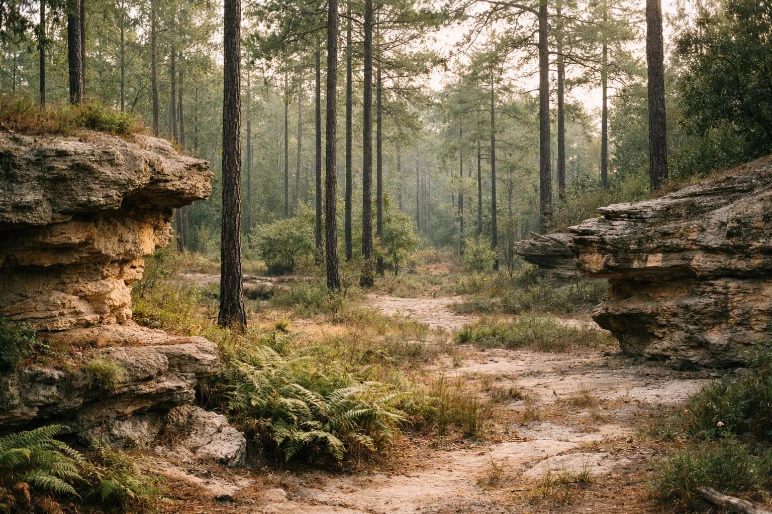
Peachtree Rock Heritage Preserve protects an unusual chunk of South Carolina Midlands geology: layered sandstone formations left behind when the Atlantic Ocean covered this region. The original Peachtree Rock - the inverted sandstone pyramid the preserve is named for - collapsed years ago from a combination of natural erosion and people climbing on it. The remains are still there, along with Little Peachtree Rock and the small waterfall (2).
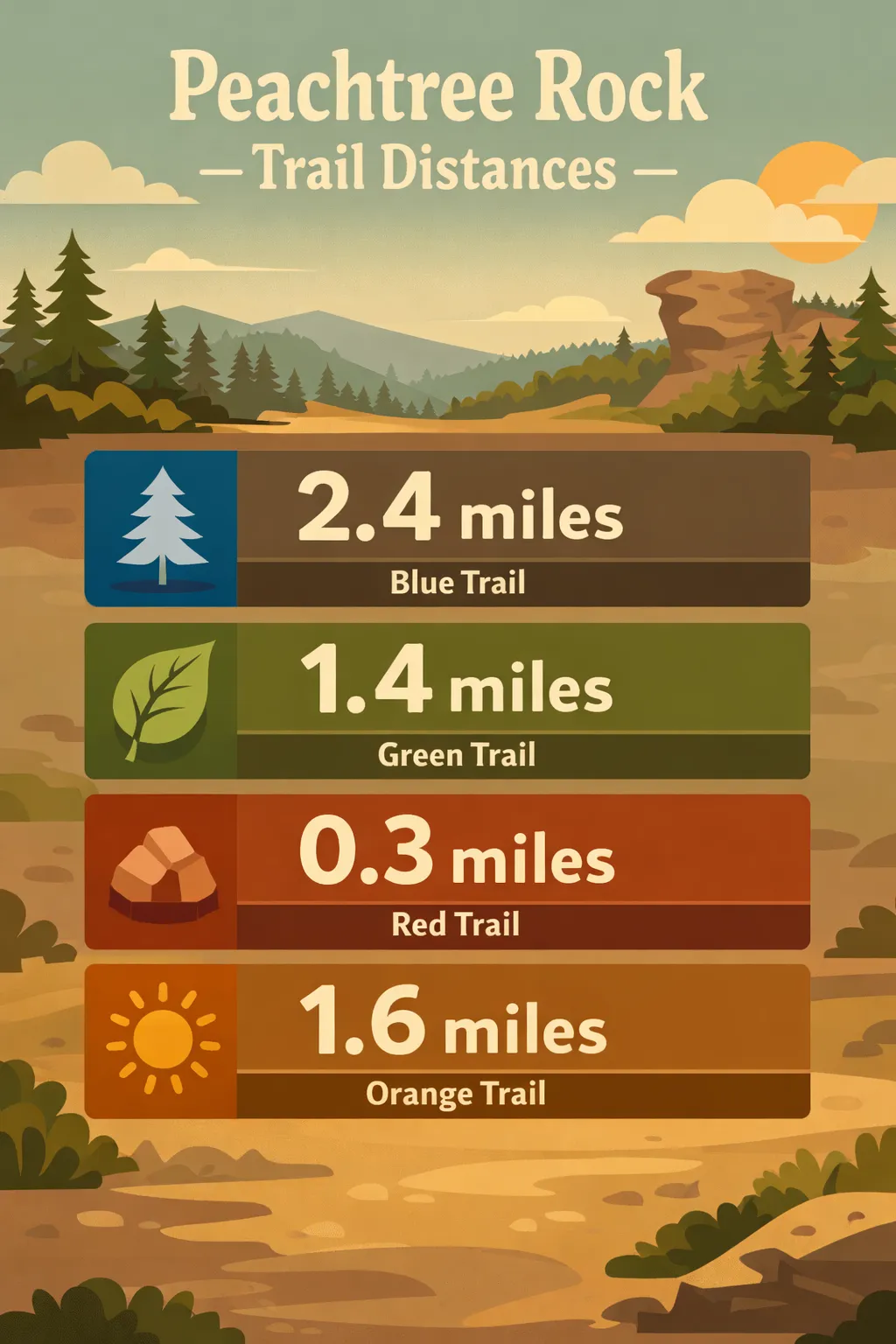 Trail distances: Blue 2.4 miles; Green 1.4 miles; Red 0.3 miles; Orange 1.6 miles on Peachtree Rock trails.
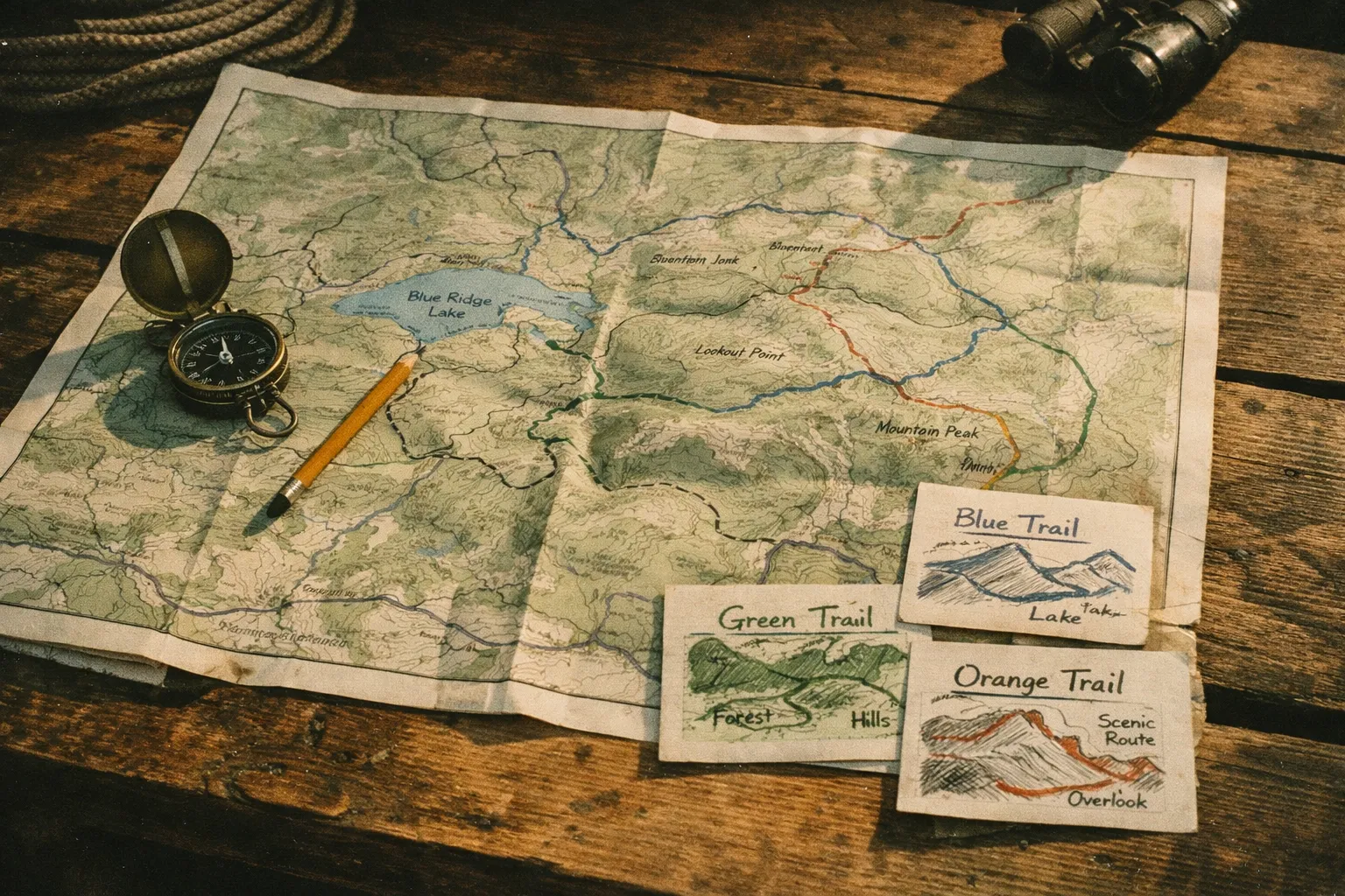
The trail system uses color-blazed loops. Official distances from The Nature Conservancy (2):
- Blue Trail - 2.4 miles. Passes Peachtree Rock, the waterfall, and Little Peachtree Rock. This is the one you came for.
- Green Trail - 1.4 miles
- Red Trail - 0.3 miles
- Orange Trail - 1.6 miles
- Yellow Trail - 0.1 miles
- Black Trail - 1.8 miles
Combining segments can stretch your day out to roughly 7.5 miles of total walking if you want it (4). Most people don’t - the main attractions cluster on the Blue Trail, and you can see them in about an hour.
Difficulty is easy to moderate. The Blue Trail starts with a steady descent from the parking lot, which means you’ll finish on an uphill - not steep, not long, but enough that tired kids will complain (1). The footing is sandy dirt with exposed roots and occasional rocky stretches. It is not stroller or wheelchair accessible (4).
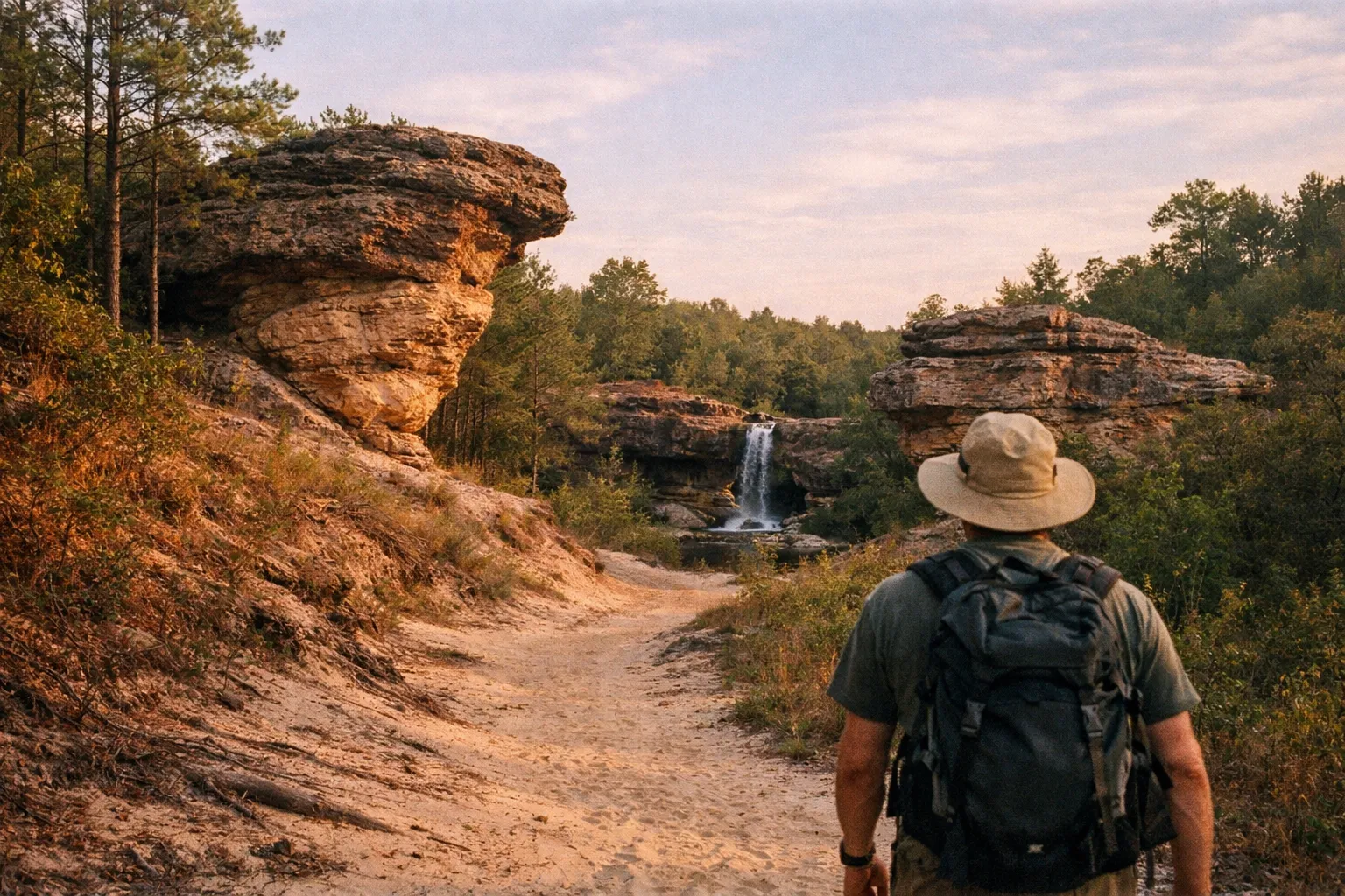
The Blue Trail at Peachtree Rock: What You’ll See on the Main Loop
The Blue Trail is the peachtree rock trail worth your time if you only do one loop. Park, walk down a sandy descent for about half a mile, and you’ll reach the rock formation and waterfall area in roughly 10-15 minutes from the car (4).
What’s actually out there:
- Peachtree Rock (the remains). The original pyramid is gone, but the layered sandstone base and surrounding outcrops show you what the formation looked like and why it eroded the way it did. Don’t climb on it. TNC is explicit about this - climbing accelerates the erosion that brought the original rock down (2).
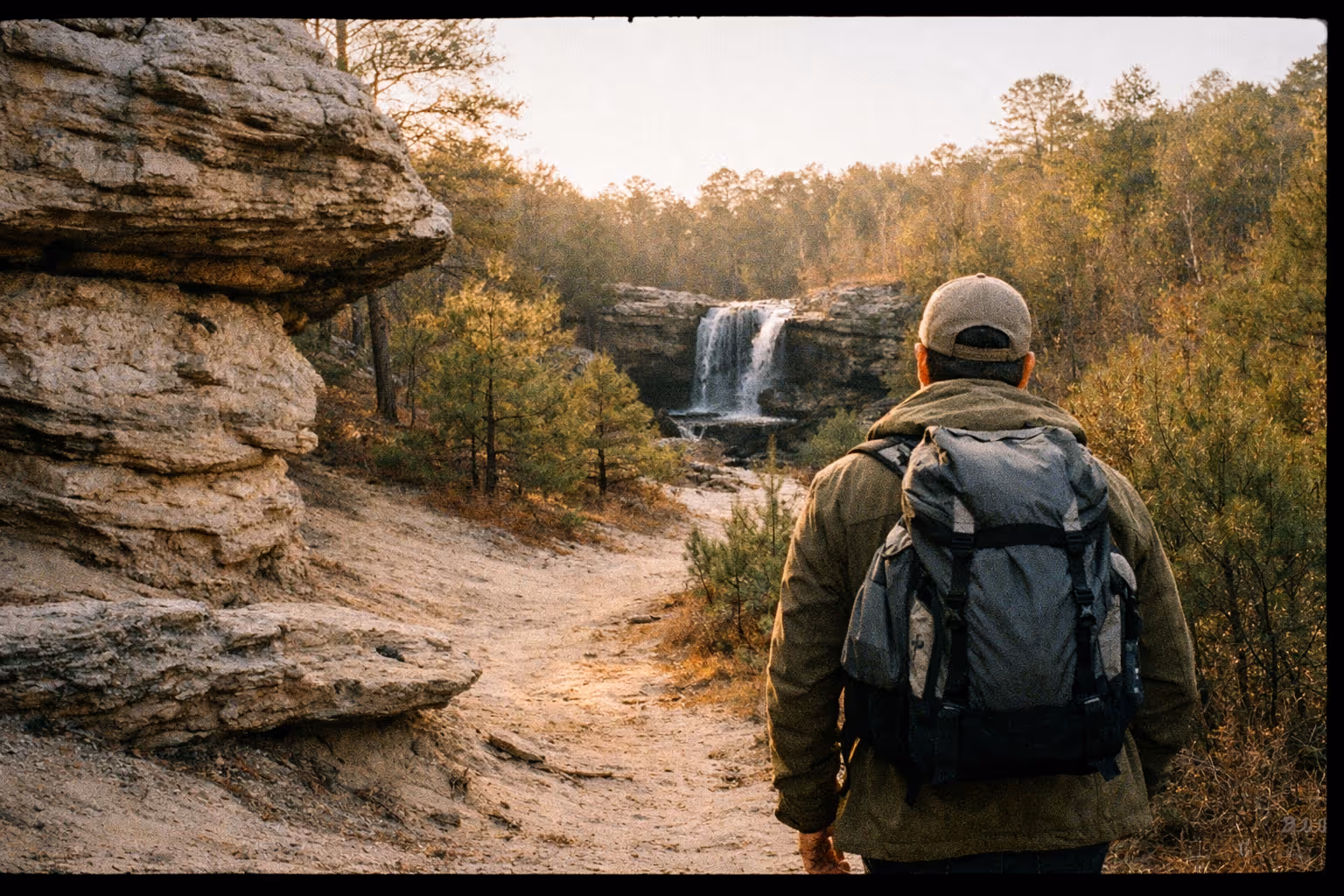
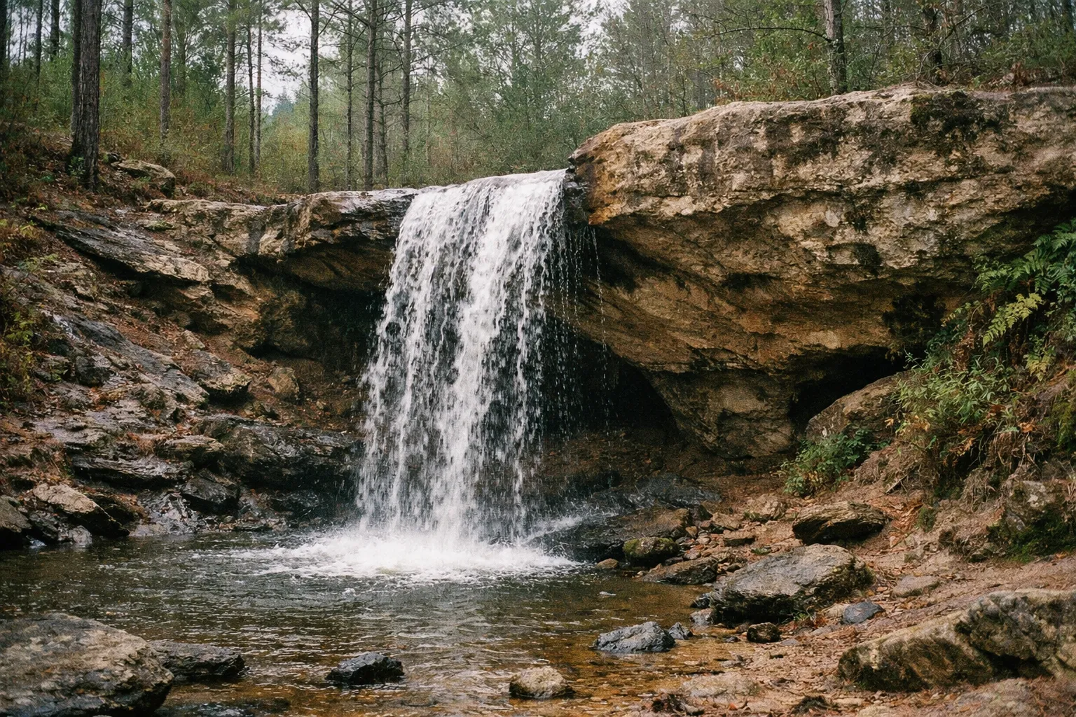
- The waterfall. Roughly 12-20 feet depending on which source you trust, and the only natural waterfall in the Midlands (1, 4). It’s not Yosemite. It’s a respectable cascade after rain and a sad trickle in a dry August. More on timing below.
- Little Peachtree Rock. A smaller formation along the Blue Trail loop. Less photographed, structurally more intact than the main rock.
- Fossils in the sandstone. Look at the rock ledges as you walk. You’ll see shell impressions and marine fossils from when this was ocean floor (1, 2, 4). Kids love this if you point it out. Photograph them - collecting is not allowed.
- Longleaf pine forest. Open, sandy understory with turkey oaks and sparkleberry. Quieter than dense hardwood forest and easier on the eyes for spotting birds (2).
The full Blue Trail loop runs 2.4 miles and takes most hikers 1 to 1.5 hours at a relaxed pace with photo stops.
When to Visit the Waterfall at Peachtree Rock
The peachtree rock waterfall is the single biggest variable in whether you’ll think the hike was worth it. After a dry spell, it’s a damp wall. After heavy rain, it runs cleanly over the sandstone lip and pools below.
Timing rules I’d give a friend:
- 1 to 3 days after moderate rain is the sweet spot. Enough flow for a real cascade, enough drying time that the trails aren’t a mud slide (4).
- Immediately after heavy storms, expect slick rocks near the falls and muddy ruts on the descent. Doable, but skip it if you’re hiking with small kids in sneakers.
- Late summer through early fall is the gamble - humid heat, low water, and ticks. The hike is fine; the waterfall may disappoint.
- Winter and early spring generally produce the best flow and the lowest crowds.
For photography, an overcast morning a day after rain gives you even light on the cascade without harsh contrast through the pine canopy. I shot the falls on a gray April morning in 2024 and the light was genuinely good - no blown highlights, no deep shadows cutting through the frame.
Peachtree Rock Hike: Three Routes for Three Kinds of Visitors
Pick your loop at the parking lot kiosk before you start walking. The biggest mistake people make at Peachtree Rock is heading out without a plan and turning a 1-mile family walk into an accidental 5-mile slog because they keep taking turns “to see what’s down there” (3).
Peachtree Rock Trail Loop Options
| Short Family Loop | Most Popular Standard Blue Trail Loop | Combined Loops | |
|---|---|---|---|
| Distance (miles) | 1 | 2.4 | 4-7.5 |
| Estimated Time | 45-75 minutes | 1-1.5 hours | 2.5-3.5 hours |
| Difficulty | Easy | Easy to Moderate | Moderate |
| Notes | Out-and-back to Peachtree Rock and waterfall; suitable for kids who can handle uneven dirt | Full circuit hitting main attractions; recommended for most adult visitors | Stack Blue, Black, Orange, and Green trails for longer conditioning hike |
A note on difficulty in context: Peachtree Rock is not the hardest hike in South Carolina - not even close. That title goes to climbs like Table Rock or Pinnacle Mountain in the Upstate, which involve 2,000+ feet of gain on rough granite. Peachtree Rock is what you do when you want a real outdoor walk close to Columbia without driving three hours to the mountains.
Is Peachtree Rock SC Worth Visiting?
Short answer: yes, if you’re within 90 minutes of Columbia. Maybe, if you’re driving in from out of state.
What makes Peachtree Rock SC worth a stop:
- Free entry, leashed dogs allowed, no reservation system (2, 3, 4).
- Genuinely unusual geology for the Midlands - sandstone formations and the only natural waterfall in the region (2, 4).
- Quiet. AllTrails averages around 4-4.5/5 across roughly 400 reviews, and TripAdvisor sits at about 4.2/5 (5, 6). Most visitors report low to moderate crowds even on weekends (4, 6).
- Short enough for kids, long enough (if you combine loops) for adults who want a real walk.
What might disappoint you:
- The “waterfall” is small. If you’ve hiked in western North Carolina, calibrate expectations downward.
- No facilities. None. Plan accordingly.
- After dry weeks, the falls run thin and the main draw loses some punch.
For a Columbia local, this is a default weekend morning hike. For a visitor on a tight Carolina itinerary, it’s a worthy stop if you’re already in the area - not a destination worth a major detour.
Preserve History: How Peachtree Rock Got Protected
The Nature Conservancy’s South Carolina chapter started in 1977, and Peachtree Rock was its first land protection project in the state (2). That history matters because it shaped what the preserve looks like today.
The original Peachtree Rock - the inverted pyramid the place is named for - formed over millions of years as the Atlantic Ocean retreated from what’s now the South Carolina Midlands. Softer sandstone eroded faster than harder cap rock, leaving a top-heavy pyramid balanced on a narrower base. Decades of foot traffic, climbing, and natural weathering finished what erosion started. The rock collapsed. What you see today are the remnants and the surrounding formations that survived (2).
In 2007, TNC and SCDNR pulled 74 acres of non-native slash pine out of the preserve and replanted with longleaf pine seedlings, using controlled burns to manage the understory (2). Longleaf was the dominant tree across the Southeast coastal plain before logging and fire suppression nearly wiped it out. The restoration here is small but part of a broader regional push to bring longleaf ecosystems back.
The preserve also sits near several historical features on adjacent private land - including The Narrows (ancient stone steps), Smithsonian’s Ancient Route Trail #81, the oldest in situ house in Lexington County (c. 1760s), and sites where Sherman’s troops camped during the Civil War (3). These aren’t all publicly accessible. Treat them as context, not as stops you can add to your hike.
Life at Peachtree Rock: Plants, Wildlife, and Seasonal Changes
The plant and animal communities at Peachtree Rock are more interesting than the rock formations if you slow down enough to notice. The preserve protects three rough zones: dry longleaf pine uplands, wetter ravines around the waterfall, and the sandstone outcrops themselves (2).
What grows here:
- Uplands: Longleaf pine, turkey oak, sparkleberry, wiregrass.
- Wetter areas: Mountain laurel, crane-fly orchid, ferns, maple-leaf viburnum (2).
- Sandstone ledges: Lichens and drought-adapted vegetation that survives the thin soil.
What lives here:
- Northern red salamanders in the moist creek areas.
- Skinks on the sun-warmed rocks.
- Songbirds - chickadees, tufted titmice, cardinals, yellow-billed cuckoos.
- The federally threatened red-cockaded woodpecker, which depends on mature longleaf pine and is the reason the restoration work matters (2).
Best wildlife viewing is early morning, roughly 8-9 a.m. Bring 8x binoculars if you have them. Stand quietly near the longleaf pines and listen for tapping - woodpeckers announce themselves before they show themselves.
Seasonal changes are real here. Spring brings wildflowers and bird activity. Summer is hot, buggy, and the waterfall slows. Fall offers cooler temperatures and color from the hardwoods in the ravines. Winter is the quietest time on the trail and often the best for waterfall flow.
Safety note: If you visit during a controlled burn season, sections of trail may be closed or smoky. Check TNC or SCDNR updates before driving out - this isn’t a situation where you want to show up and improvise.
The Nature Conservancy’s Impact and What That Means for Hikers
TNC’s ongoing management shapes your visit in concrete ways. The 2007 longleaf replanting and the controlled burn program keep the upland forest open and walkable - without periodic fire, the understory thickens, the wildflowers fade, and the woodpeckers leave (2).
Co-management with SCDNR means rules are enforced more consistently than at some less-active preserves. Expect:
- Leash requirements for dogs - actually followed, not just suggested (2, 3, 4).
- No climbing on Peachtree Rock or other formations - posted and reiterated across visitor materials (2).
- Stay-on-trail expectations to protect rare plants and minimize erosion (2, 3).
- Pack-it-out trash policy - minimal receptacles on site.
Recent trail-marking improvements have made the preserve easier to navigate. Earlier reviews complained about confusing intersections; current visitors note plenty of color blazes and clearer signage (3). If you hiked here five years ago and got turned around, it’s worth another look.
What to Pack for Peachtree Rock
For the short loop with kids:
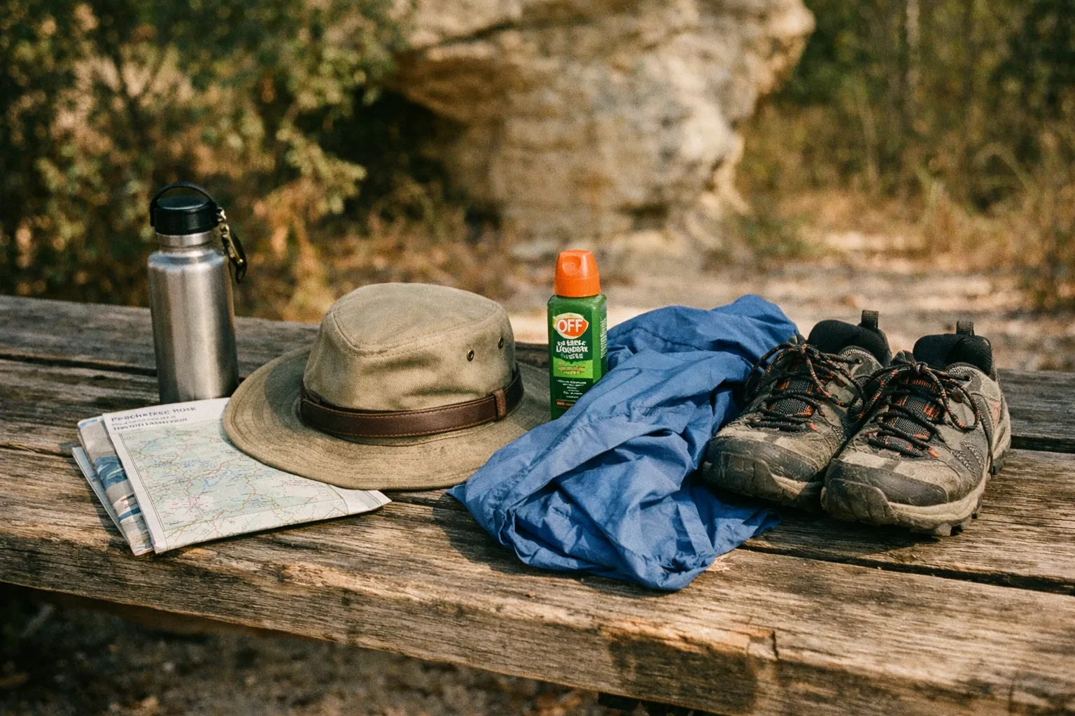
- 0.5-1 liter of water per person
- Snacks - no concessions on site
- Bug spray (DEET or picaridin)
- Closed-toe shoes - trail runners or light hikers, not sandals
- Long pants if it’s tick season (spring through early fall)
- Phone with offline map - TNC’s trail map saved as a photo works
For longer loops or summer days, add:
- 1.5-2 liters of water per person
- Hat and sunscreen
- Small first-aid kit
- Light snack or lunch if you’re out for 3+ hours
Gear-specific notes: I wore Altra Lone Peak 7s on a damp spring day and the lugs handled the sandy descent and wet rocks around the falls without slipping. The stock insole kept my feet dry through the wetter sections near the waterfall. Any decent trail runner with real tread will do the job. Skip flat-soled street sneakers - the sandstone slabs near the waterfall are slick when wet, and that’s not a fun way to end a morning.
Common Mistakes Visitors Make
These come up over and over in trip reports and reviews (3, 4, 6):
- Skipping the trail map and accidentally hiking 5 miles when they planned 2. Read the kiosk, pick a loop, photograph the map.
- Showing up in flip-flops and shorts. Trails are narrow, foliage brushes your legs, ticks are real, and the sandstone gets slick.
- Not using a bathroom beforehand. There are no facilities on site. None.
- Letting dogs off leash. Required to be leashed, enforced by other visitors and posted signs.
- Climbing on the rock formations. Don’t. The original Peachtree Rock came down partly because people kept doing this.
- Visiting the waterfall in August after three dry weeks and being disappointed. Check recent rainfall before you commit.
- Bringing a stroller. Roots, sand, and narrow paths. It won’t work (4).
Sample Itineraries
Sample Itineraries for Peachtree Rock
Up to 6 hoursChoose an itinerary based on your group and time available.
- 1
Half-day with kids
9:00 a.m. - Arrive at the trailhead 9:15 a.m. - Walk Blue Trail down to Peachtree Rock and waterfall 10:30 a.m. - Snack break, fossil hunting, photos 11:15 a.m. - Hike back to the car 12:00 p.m. - Lunch in Lexington or back in Columbia
- 2
Full-day Midlands loop
8:30 a.m. - Peachtree Rock Blue Trail (2.4 miles, ~1.5 hours with stops) 11:00 a.m. - Drive to Columbia (30 minutes) 12:00 p.m. - Lunch downtown 1:30 p.m. - Columbia Museum of Art or South Carolina State Museum 4:00 p.m. - Riverwalk along the Congaree
- 3
Fitness-focused day
7:30 a.m. - Arrive early, beat the heat 7:45 a.m. - Combined Blue + Black + Orange loop (~6-7 miles, ~2.5 hours) 10:30 a.m. - Drive back to Columbia Afternoon - Pickleball, Lake Murray paddleboarding, or brewery stop
If you’re visiting around June, Columbia hosts Juneteenth events worth pairing with a morning hike - a good way to combine outdoor time with the city’s cultural calendar.
Visit the Preserve: Practical Summary
- Address: 883 Peachtree Rock Road, Lexington, SC 29073
- Hours: Daylight hours, daily. No staffed gate (2)
- Cost: Free
- Dogs: Allowed, leash required (2)
- Bathrooms: None
- Cell service: Spotty
- Best season for the waterfall: Late winter and early spring, 1-3 days after rain
- Best season for hiking comfort: October-April
- Difficulty: Easy to moderate
- Best trail for first-timers: Blue Trail (2.4 miles)
Pairing Peachtree Rock with Other Stops in South Carolina
If you’re building a broader South Carolina trip, Peachtree Rock works as a half-day stop on the way to or from other Midlands destinations:
- Congaree National Park (45-60 minutes east) - Boardwalks through old-growth bottomland hardwood forest. Different ecosystem, longer walks, more mosquitoes.
- Lake Murray (30 minutes north) - Swimming, paddling, fishing.
- Columbia downtown - Museums, the South Carolina State House, Riverwalk.
- Sesquicentennial State Park (45 minutes northeast) - Easier walking, more facilities.
For Upstate hikes - Table Rock, Caesars Head, the Foothills Trail - you’re looking at a 2.5-3 hour drive from Lexington. Worth it, but that’s a separate trip.
Frequently Asked Questions
- Is Peachtree Rock a good hike for families with young kids?
- Yes, the short family loop of about 1 mile is manageable for kids who can walk uneven dirt trails. Just bring snacks and expect some complaints on the uphill return.
- Can I climb on Peachtree Rock or other sandstone formations?
- No. Climbing accelerates erosion and is prohibited. The original Peachtree Rock collapsed partly due to climbing damage, and the preserve enforces no climbing rules.
- What should I do if I want to see the waterfall running at its best?
- Plan your visit 1 to 3 days after moderate rain for the best flow without muddy trails. Avoid visiting right after heavy storms or during late summer dry spells.
- Are dogs allowed on the trails?
- Yes, dogs are allowed but must be kept on leash at all times. This rule is actively enforced to protect wildlife and other visitors.
- Is the trail suitable for strollers or wheelchairs?
- No. The trails have sandy dirt, roots, and rocky sections that make them unsuitable for strollers or wheelchairs.
- How do I navigate the trail system without cell service?
- Download or photograph the official trail map before you arrive. The preserve has improved trail markings, but cell service is spotty.
- What gear do you recommend for hiking Peachtree Rock?
- Trail runners with good tread like Altra Lone Peak 7s work well, especially for wet rocks near the waterfall. Avoid sandals and flat-soled shoes.