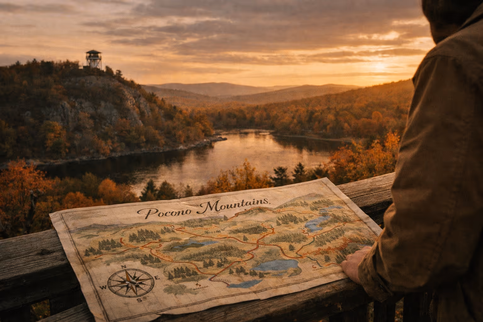
The Maple Pass Loop trail is a 6.4-to-7.6-mile alpine ridge hike at Rainy Pass on Washington’s North Cascades Highway. It packs 2,000+ feet of climb, exposed ridge views between Heather Pass and Maple Pass, and golden larches in late September into early October. Here’s what matters before you go.
Trail Stats at a Glance
- Distance: 6.4 to 7.6 miles depending on GPS device and side trips (3)(5)(6)
- Elevation gain: 2,000 to 2,400 feet (2)(3)(5)(6)
- Highest point: ~6,650 ft at Maple Pass (6)
- Trailhead elevation: ~4,875 ft at Rainy Pass
- Time: 4 to 6 hours for most hikers (4)(8)
- Difficulty: Moderate to strenuous
- Type: Loop
- Dogs: Not recommended - the trail crosses into North Cascades National Park where dogs are prohibited (3)
- Pass required: Northwest Forest Pass ($5/day or $30/year), America the Beautiful pass (standard $80/year, Senior $20/year, or Military free), or $5 cash for the day-use envelope at the trailhead fee station (3)(8)
- Best season: Mid-July through early October
If you only retain one number from this section, make it 2,000 feet of gain over about 7 miles. That’s the workload.
✓ Pros
- Well-maintained trail with clear signage - no route-finding required on the main loop
- Counter-clockwise direction gives a gradual climb and a knee-friendlier forested descent
- WTA hosts over 1,342 trip reports (according to WTA), so current conditions are almost always available within the last 7 days
- Rainy Lake (2 mi round trip, paved) at the same trailhead is a solid bail-out or warm-up option
- Larch season in late September turns the ridge gold for roughly 7 to 10 days - one of the better fall color windows in Washington
✗ Cons
- Parking lot holds only ~50 vehicles and fills by 7-8 am on summer weekends; shoulder parking adds hassle at the start of a long day
- No reliable treated water on the loop - you carry 2 to 3 liters from the trailhead or filter from Lake Ann via a spur
- The ridge is fully exposed for ~2 miles with no shelter; afternoon thunderstorms in summer make an early start non-negotiable
- Microspikes required in June and often early July; driving 3 hours from Seattle without checking WTA trip reports first is a common mistake
- Washington Discover Pass is not valid here - a detail that catches enough people to generate $50-$100 citations every season
Hiking the Maple Pass Loop Trail via Heather Pass
The loop starts at the Rainy Pass Picnic Area on the south side of SR-20. From the parking lot, you’ll hit the first junction within a few hundred feet: Rainy Lake Trail 310 goes straight (paved, flat, 2 miles round trip to a lake - a reasonable bail-out option), and Maple Pass Trail 740 splits off left and right, forming the loop (4).
Most hikers - and most blogs - recommend going counter-clockwise: take the right-hand split toward Lake Ann (3)(4). The grade is more gradual on the way up, and the steep descent happens through forest on the way down, which is easier on the knees than dropping the same vertical on exposed switchbacks. Counter-clockwise also puts morning sun behind you for the best ridge views.
Going counter-clockwise, here’s roughly what you get:
- Mile 0 to 1.5: Gentle climb through forest. You’ll pass a spur down to Lake Ann at about mile 1.3 - skip it on the way up unless you specifically want lakeshore time, because you’ll be looking down at Lake Ann from above for the next two hours anyway.
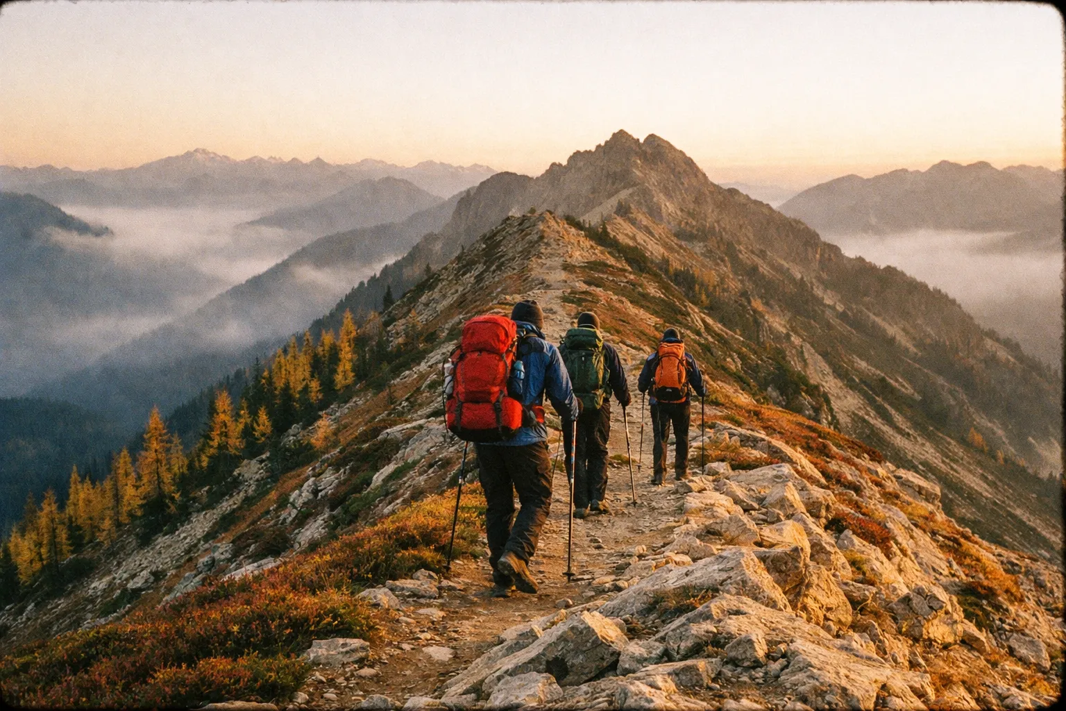
- Mile 1.5 to 3: Switchbacks lead up to Heather Pass (~6,150 ft). Trees thin out, blueberry and heather take over, and Lake Ann opens up below you.
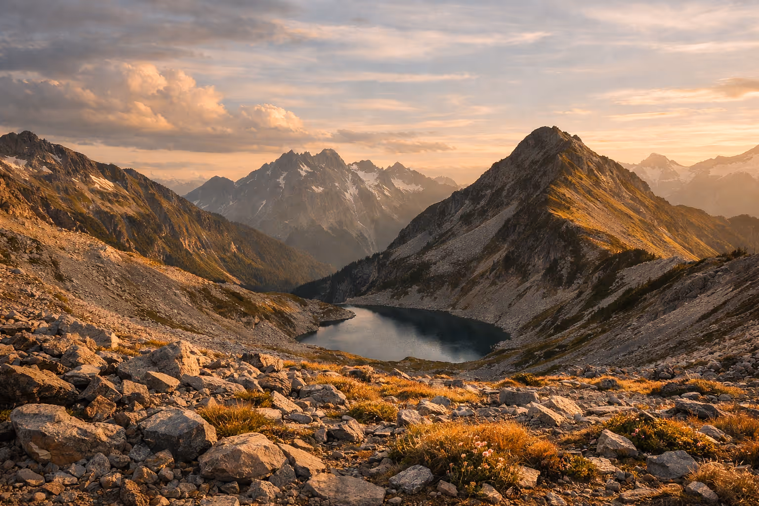
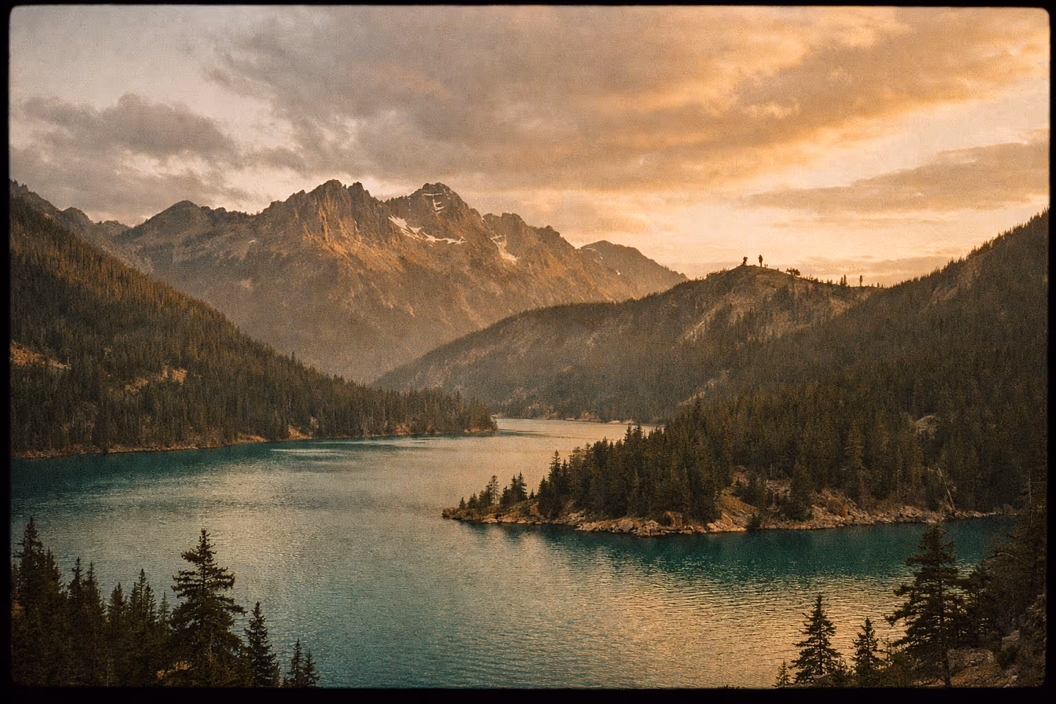
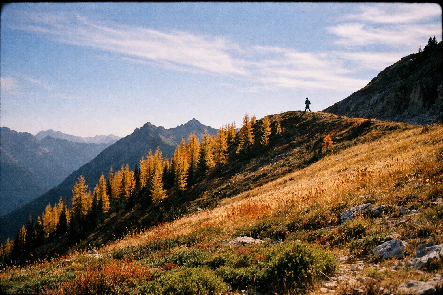
- Mile 3 to 4: The traverse to Maple Pass. Open ridge, views down to Rainy Lake on one side and Lake Ann on the other, with the bulk of the North Cascades to the west. This is the section people show up for.
- Mile 4: Maple Pass at ~6,650 ft. The high point. On clear days, Glacier Peak is visible to the south.
- Mile 4 to 7: Long descent on switchbacks down to Rainy Lake, then a short flat stretch back to the parking lot.
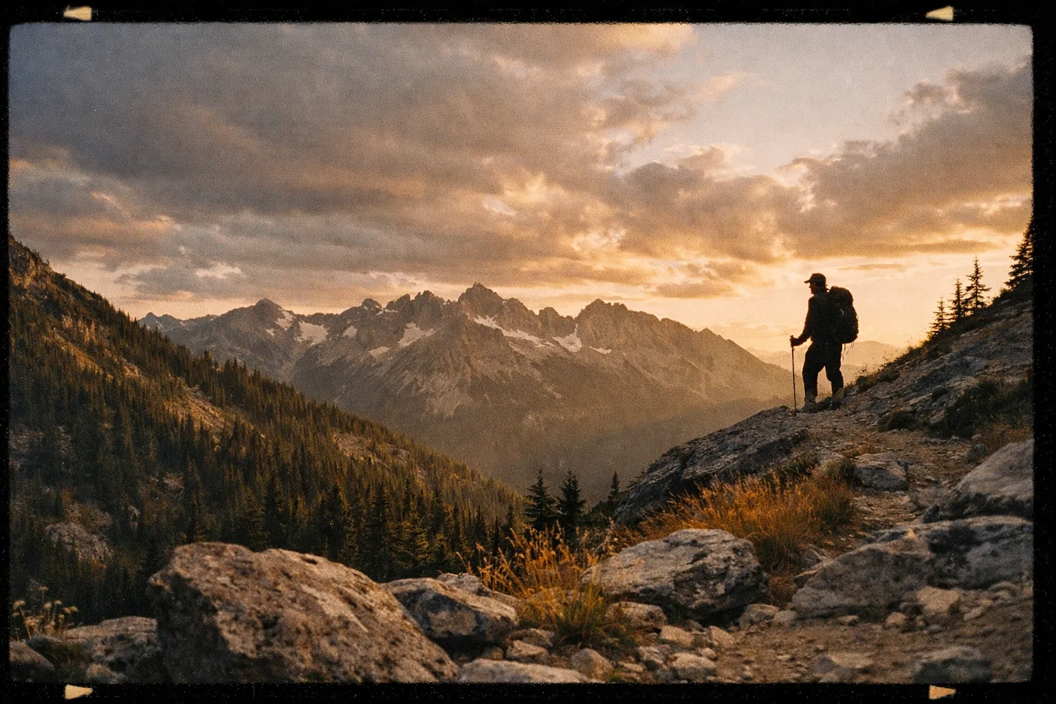
Safety note: The ridge between Heather and Maple is fully exposed. No tree cover, no water, and nowhere to shelter if a storm moves in. Plan to be off the ridge by early afternoon in summer when thunderstorms are most common.
How Long Does It Take to Hike Maple Pass Loop?
Most hikers finish the maple pass loop hike in 4 to 6 hours including breaks. Faster hikers running the loop with minimal stops can do it in 3 to 3.5 hours (8). A 2-minute video guide on YouTube lists 4 hours for fit hikers covering 6.4 miles (5), and Serena’s Lenses logged 5 hours for 7.5 miles with photo stops (4). According to WTA, the trail sees consistent traffic across that full range, with slower parties often adding 30 to 60 minutes for the Lake Ann spur and pass stops (9).
A useful time budget:
- 3 to 4 hours moving time at 2 mph
- 30 to 60 minutes at the passes for snacks and photos
- 15 to 30 minutes of miscellaneous stops
If you’re driving from Seattle, the round-trip car time alone is 6 hours. Add 5 hours on trail and you’re looking at a 12 to 14-hour day. Worth doing, but not casually.
How Difficult Is the Maple Pass Loop Hike?
Moderate to strenuous. The trail isn’t technical - no scrambling, no exposure beyond a normal ridgeline trail, and the tread is well-maintained - but it climbs 2,000 feet over the first 4 miles, much of it above 5,500 feet where the air is noticeably thinner. If you live near sea level and rarely climb sustained grades, expect to feel it.
Honest fitness gut-check: if you can climb 1,500 vertical feet in under 90 minutes on a local trail without stopping every five minutes, you’ll handle Maple Pass fine. If you can’t, you can still do it - just start early, pace yourself, and don’t be shy about turning around at Heather Pass (mile 3) if you’re cooked. The views from Heather are excellent on their own.
What Pass Do I Need for Maple Pass Loop?
You need one of the following at the Rainy Pass trailhead (3)(8):
- Northwest Forest Pass - $5/day or $30/year. Sold at REI, ranger stations, and online.
- America the Beautiful Pass - $80/year. Covers all federal recreation sites nationwide.
- Day-use envelope - $5 cash at the trailhead fee station.
The Washington Discover Pass is not valid here (8). This catches people every year because Discover Passes cover state parks, but Rainy Pass sits on Okanogan-Wenatchee National Forest land. Citations for unpaid parking typically run $50 to $100.
No permit or reservation is needed for day hiking - just the parking pass.
Before You Go
A short checklist that prevents most bad days on this trail:
- Check SR-20 status with WSDOT. The North Cascades Highway closes every winter - typically late November through April or May - due to avalanche risk. Some years it opens as late as June. If SR-20 is closed at Ross Dam or Mazama, you cannot reach Rainy Pass from either direction (6).
- Read recent WTA trip reports. Washington Trails Association hosts over 1,342 trip reports on this loop (9), and filtering the last 7 to 14 days tells you exactly what to expect: lingering snow, mosquito intensity, blowdowns, larch color.
- Check the weather forecast for 6,500 ft, not the valley. Mountain Forecast or NOAA point forecasts pulled for Maple Pass coordinates give a realistic temperature and wind read. It can be 80°F in Winthrop and 45°F with wind at the pass.
- Confirm your pass. Either buy a Northwest Forest Pass in advance or bring $5 cash for the envelope station.
- Tell someone your plan. Cell service on SR-20 is spotty between Marblemount and Mazama.
Getting There
The Rainy Pass trailhead sits on the south side of SR-20 (the North Cascades Highway) at milepost 158. It’s marked with a brown sign reading “Rainy Pass Picnic Area.”
- From Seattle: I-5 north to Burlington, then SR-20 east - roughly 130 miles and 3 hours (1).
- From Spokane: US-2 west to Wenatchee, then US-97 and SR-20 - about 200 miles and 4 hours (1).
- From Winthrop/Mazama: SR-20 west, 35 miles, 45 to 50 minutes.
- From Marblemount: SR-20 east, ~60 miles, 1.5 hours.
The trailhead has a paved parking lot, vault toilets, and information signage. There is no water available. The lot holds maybe 50 vehicles and fills by 7:00 to 8:00 am on summer and fall weekends (5)(6). I’ve pulled in at 8:30 am on a September Saturday and had to park on the shoulder - it’s not a disaster, but it adds time and hassle you don’t need at the start of a long day. During larch season (late September to early October), assume the lot is full before sunrise on weekends.
Diablo Lake: Worth the Stop on the Drive In
Diablo Lake sits about 35 miles west of Rainy Pass on SR-20, which makes it a natural stop on the drive in or out from the I-5 side. The lake’s turquoise color comes from glacial flour - finely ground rock suspended in the meltwater feeding the reservoir. It’s the kind of color that looks oversaturated in photos and then turns out to be exactly right in person.
Three ways to experience it:
- Diablo Lake Overlook (Vista Point): A pullout on SR-20 with parking, vault toilets, and the postcard view. No pass required for the overlook itself. Takes 10 minutes.
- Diablo Lake Trail: ~7.5 miles round trip with 1,400 to 1,800 feet of gain along the north shore. A full day on its own - don’t try to combine this with Maple Pass.
- Kayak or paddleboard: Guided half-day tours run roughly $80 to $150 per person through local outfitters in Marblemount.
If you’re trying to do both Diablo Lake and the maple pass loop trail in one trip, the realistic itinerary is: drive up the day before, sleep in Marblemount or Winthrop ($80 to $250/night depending on season), hike Maple Pass at sunrise, stop at the Diablo Lake Overlook on the drive home. Trying to cram both major hikes into one day is how you end up driving SR-20 in the dark.
Gear: What to Actually Bring
A standard 3-season day-hike kit works here. Specific picks:
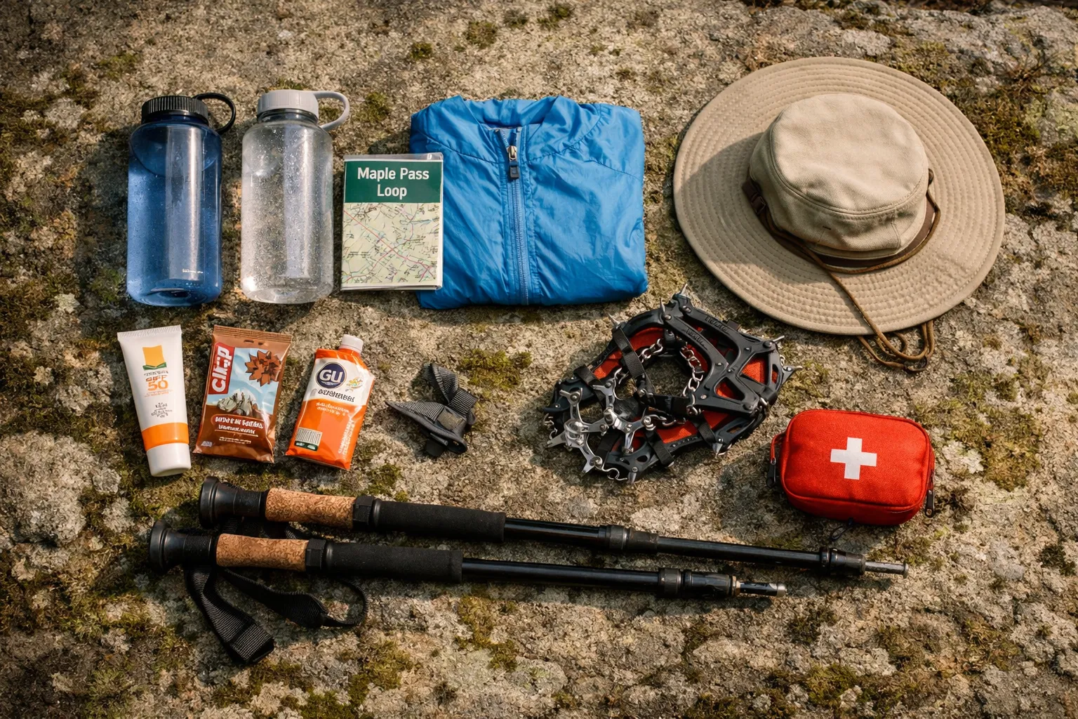
- Water - 2 to 3 liters per person. There is no reliable treated water on the loop. Lake Ann is accessible via a short spur but requires a filter.
- Food - 500 to 1,000 kcal. Sandwich, bars, trail mix. Maple Pass at the high point is the obvious lunch spot.
- Layers. A wind shell and a light insulating layer are non-negotiable on the ridge even in August. Temperatures at 6,500 ft routinely run 20°F colder than the valley, and wind can push the wind chill into the 30s.
- Trail runners or light hikers. The trail is well-graded - heavy boots are overkill. Altra Lone Peak 7 or similar trail runners handle the descent fine; the outsole grip is enough for the switchbacks even when damp.
- Trekking poles. The 3-mile descent from Maple Pass back to the trailhead beats up your knees over time. Black Diamond Trail poles (~$120) or similar.
- Microspikes if snow is present. Kahtoola MICROspikes (~$75). Required in June and sometimes early July when snowfields linger on the north-facing traverse between Heather and Maple.
- Sun protection. SPF 30+ sunscreen, sunglasses, brimmed hat. The ridge has zero shade for 2 to 3 miles.
- Bug spray. Mosquitoes near Lake Ann are intense in July. DEET or picaridin both work.
- Offline map. Gaia GPS, AllTrails+, or paper Green Trails Mt. Logan No. 49 / Washington Pass No. 50 (6).
Safety note: The ridge between Heather and Maple is fully exposed to lightning. If thunderstorms are in the forecast, start at dawn and be off the high ridge by noon. There is no safe place to shelter on the traverse itself.
Direction, Pacing, and Side Trips
Counter-clockwise vs clockwise. Counter-clockwise (right at the first split, toward Lake Ann) is the standard recommendation (3)(4), and it’s the right call for most people. The climb is more gradual, the descent runs through forest, and morning light is better for the ridge views. Clockwise puts the steep climb up front, which some hikers prefer for efficiency, but the descent on the Lake Ann side is harder on knees.
Side trips worth your time:
- Lake Ann spur - 0.5 mi round trip, ~200 ft down and back up. Worth it if you want to touch the water.
- Heather Pass only - 6 to 7 miles round trip out-and-back to Heather Pass, skipping the full loop. A solid option for hikers not ready for 2,000 ft of gain or those who lose weather at the pass.
- Lewis Lake and Wing Lake - Off-trail extension past Heather Pass for strong hikers. Adds significant distance and route-finding (7).
Other hikes from the same trailhead area if Maple Pass is full or socked in:
- Rainy Lake - 2 mi round trip, paved, nearly flat. Same parking lot.
- Blue Lake - 4.4 mi round trip, ~1,050 ft gain. Trailhead a few miles east on SR-20.
- Cutthroat Pass via PCT - 10 mi round trip, ~2,000 ft gain. Good larch hike, slightly less crowded than Maple Pass.
- Washington Pass Overlook - 0.25 mi paved walk. A no-effort view if weather has shut down your hiking plans entirely.
When to Hike: Season-by-Season
Late June to early July: Snow lingers on the ridge, especially on the north-facing traverse between Heather and Maple. Bring microspikes and check WTA reports the week before. Wildflowers start blooming in lower meadows.
Mid-July to late August: Prime conditions. Mostly snow-free, peak wildflowers in early-to-mid August, long daylight hours. Also peak mosquito season near Lake Ann - bring repellent.
September: Cool, stable weather. Bug pressure drops. Crowds stay heavy on weekends but the trail is noticeably more pleasant than August.
Late September to early October: Larch season. The subalpine larches turn gold for roughly 7 to 10 days, typically the last week of September through the first week of October - timing varies year to year. This is the busiest period on the trail by a significant margin. Parking fills before sunrise on weekends. Check WTA trip reports for real-time foliage status before you drive out.
October to late November: The window closes fast. Early snowstorms can shut down SR-20 with little warning. By mid-November the highway typically closes for the winter.
Late November through May or June: SR-20 closed. The trailhead is unreachable from either side. Some skiers and snowshoers access portions of the area from the closure gate, but that’s a different kind of trip entirely.
Common Mistakes
- Underestimating distance. People plan for 6.4 miles and end up at 7.5 miles with GPS drift plus side trips. The extra mile matters when you’re tired (3)(4).
- Bringing the wrong pass. Discover Pass doesn’t work here. Bring an NW Forest Pass, America the Beautiful, or $5 cash (3)(8).
- Starting too late. The lot fills by 7 to 8 am on peak weekends (5)(6). After 10 am you’re parking on the shoulder.
- Bringing a dog. The trail crosses into North Cascades National Park at the high passes, where dogs are not allowed (3). Sources conflict on the lower sections - easiest to leave the dog at home.
- Not checking SR-20 status. Especially in early summer and late fall. WSDOT publishes current conditions (6).
- Cotton clothing. Cotton plus sweat plus wind at 6,500 ft equals a real hypothermia risk, even in summer.
- Missing the junction. The first split from the parking lot has three options: Rainy Lake (paved, straight ahead), and the two arms of the Maple Pass loop. Look for “Maple Pass TR 740” signage and go right for counter-clockwise (4).
Using WTA Trip Reports as a Planning Tool
The Washington Trails Association maintains the most useful current-condition resource for this hike. Over 1,342 trip reports have been filed on the heather maple pass loop (9), and the volume means you can almost always find a report from the last 7 days during summer and fall.
What to look for in recent reports:
- Snow line and traction needs. Reports in June and early July routinely note whether microspikes are necessary.
- Bug pressure. July reports mention mosquito intensity near Lake Ann.
- Larch status. Late-September reports include foliage color updates - useful for timing your visit within the peak window.
- Parking lot fill time. Recent reports often note what time the lot filled, which helps you set your alarm.
- Trail damage. Blowdowns or washouts get flagged quickly.
WTA also lists the heather maple pass loop trail with up-to-date pass requirements and SR-20 status warnings, which is faster than checking three separate agency sites (9).
Costs: A Realistic Budget
For a day trip from Seattle, solo:
- Gas: $40 to $60 round trip
- Parking pass: $5 day-use or $30 annual
- Food: $15 to $25 for trail food and one stop
- Total: ~$60 to $90
For a two-day trip with one night in Winthrop:
- Lodging: $120 to $250
- Meals: $40 to $80
- Gas: $40 to $60
- Passes: $5 to $30
- Optional Diablo Lake kayak tour: $80 to $150 per person
- Total: ~$300 to $600+
Splitting gas with two or three other hikers cuts the day-trip cost meaningfully.
Frequently Asked Questions
- Can I bring my dog on the Maple Pass Loop?
- Dogs are prohibited on the upper sections of the trail inside North Cascades National Park. The lower sections' dog policy is unclear and enforcement boundaries are not obvious, so it's safest to leave dogs at home.
- What should I do if SR-20 is closed?
- If SR-20 is closed due to avalanche risk or snow, the Rainy Pass trailhead is inaccessible from either side. Check WSDOT for current highway status before planning your trip.
- Are microspikes necessary for the Maple Pass Loop?
- In June and often early July, yes - snowfields linger on the north-facing traverse between Heather and Maple Pass. Check WTA trip reports from the previous 7 to 14 days before you drive out; conditions vary significantly year to year.
- How early should I arrive to find parking on busy weekends?
- Earlier than you think. The lot fills by 7:00 to 8:00 am on summer and fall weekends. During larch season in late September, it fills before sunrise. Shoulder parking works but adds time and hassle at the start of a long day.
- Is there water available on the Maple Pass Loop trail?
- There is no reliable treated water on the loop itself. You can filter water from Lake Ann via a short spur, but plan to carry 2 to 3 liters per person from the trailhead.
- Can I do Diablo Lake and Maple Pass Loop in the same day?
- Attempting both hikes in one day is not recommended due to long drive times and hike durations. A better plan is to stay overnight near the trailhead and do the hikes on separate days.
- What pass do I need to park at Rainy Pass?
- One of the following: Northwest Forest Pass ($5/day or $30/year), any America the Beautiful interagency pass (standard $80/year, Senior $20/year, or Military free), or $5 cash for the day-use envelope at the trailhead fee station. The Washington Discover Pass is not valid here - that one covers state parks, not national forest land.