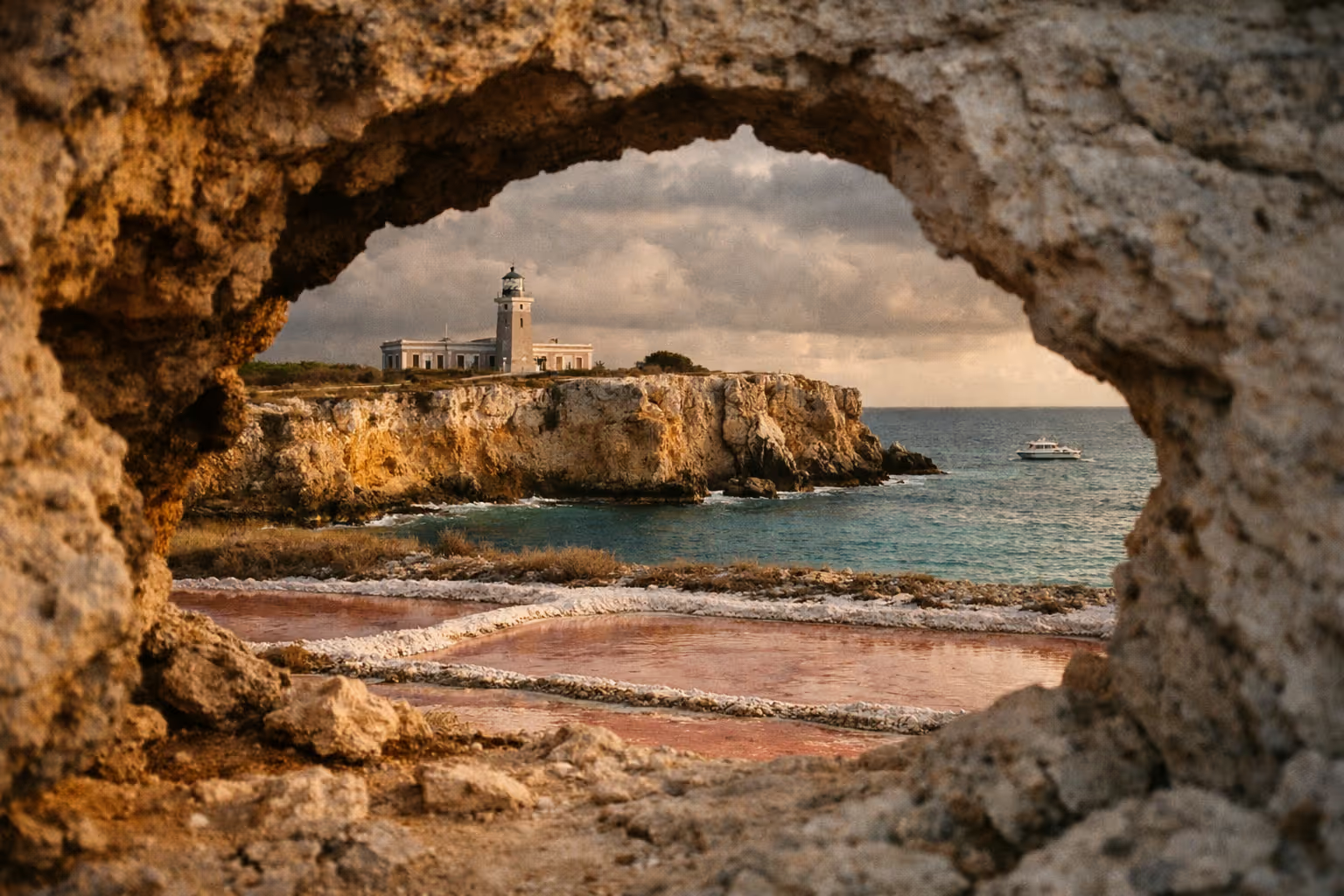
The pink water at Las Salinas in Cabo Rojo, Puerto Rico is not a beach. Show up with a towel and a swimsuit and you’ll leave confused - this is a working salt flat inside a federal wildlife refuge, not a swimming hole. The southwest corner of the island packs two anchor attractions into a single half-day: the hypersaline pink lagoons of Las Salinas and the Los Morrillos Lighthouse perched on limestone cliffs at the literal end of the road. Get the timing right and it’s worth the drive. Get it wrong and you’ll walk a mile in full sun to look at a brownish pond.
✓ Pros
- One of the few pink salt flat landscapes accessible in the Caribbean
- Free entry to the wildlife refuge and lighthouse trail
- Combines ecology, history, and dramatic coastal scenery in a single half-day
- Three distinct hiking trails through mangrove and dry forest
- Observation tower provides elevated views without a strenuous hike
✗ Cons
- Pink color is not guaranteed - rain and seasonal shifts can mute it significantly
- No swimming allowed in the salt ponds (common source of visitor disappointment)
- Minimal shade on the access road and flats; heat exposure is real
- Inner gates sometimes closed; visitors may walk about 1 mile on the access road to reach viewpoints
- Requires a rental car - no practical public transit option
What Cabo Rojo, Puerto Rico Is Actually Famous For
Cabo Rojo sits at Puerto Rico’s southwestern tip, roughly 2.5 to 3 hours by car from San Juan. The name translates to “red cape,” a nod to the reddish mineral tint of the coastal waters that Spanish sailors logged centuries ago. Locals also call it “El Pueblo de Cofresí,” after the Puerto Rican pirate Roberto Cofresí, who was born here - a detail that doesn’t come up much in travel content but that locals will mention unprompted.
The two things most visitors come for are Las Salinas de Cabo Rojo - the pink salt flats inside the Cabo Rojo National Wildlife Refuge - and Los Morrillos Lighthouse (El Faro), which stands about 200 feet (60 m) above sea level on limestone cliffs at the island’s southwestern point. The salt flats are the cotton-candy pink landscape that fills Instagram feeds, while the lighthouse anchors the southwestern point with wide-open views across the Caribbean.
Beyond those two, the municipality is known for Playa Sucia, the Boquerón beach and its weekend grilling scene, the seafood strip at Joyuda, and tarpon fishing. But the salt flats and lighthouse are the visual centerpiece and the reason most travelers make the drive. If you’re weighing whether this detour fits your itinerary, a broader look at things to do in Puerto Rico can help you prioritize the southwest against the island’s other anchor attractions.
On the airport question: fly into Luis Muñoz Marín International Airport (SJU) in San Juan - the main international gateway - or into Rafael Hernández Airport (BQN) in Aguadilla, which sits only about 40 to 45 minutes north of Cabo Rojo. Either way, a rental car is non-negotiable. Nothing here is reachable by transit.
The Pink Salt Flats: What You’re Actually Looking At
Las Salinas is a working commercial salt operation covering about 1,249 acres of hypersaline lagoons inside the Cabo Rojo National Wildlife Refuge, according to the U.S. Fish & Wildlife Service. The main lagoons run only about 18 inches (45 cm) deep - engineered shallow to concentrate the brine for salt extraction. This is not a natural swimming hole and never was.
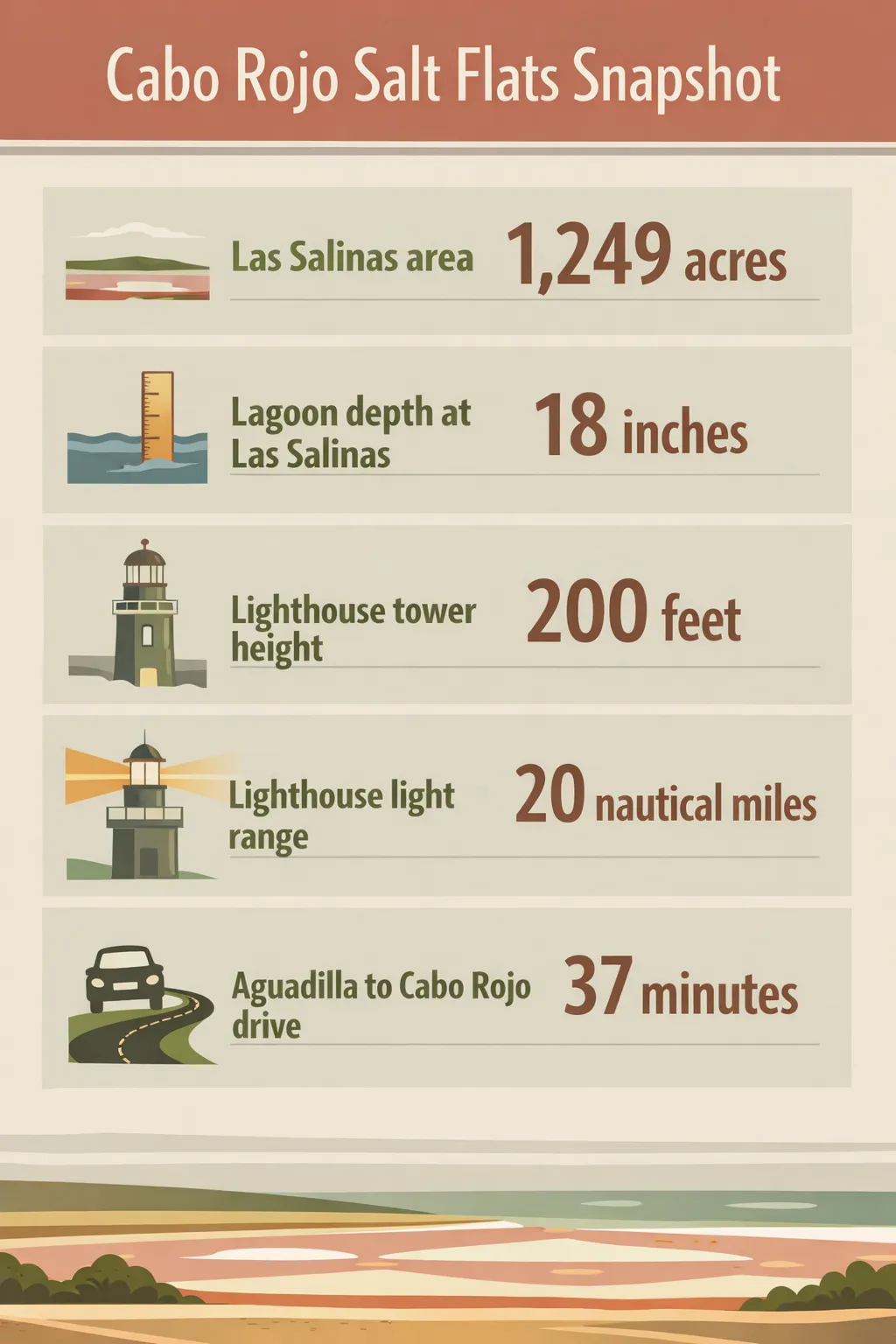 Las Salinas covers 1,249 acres; lagoons are 18 inches deep; the Los Morrillos Lighthouse stands about 200 feet above sea level with a 20 nautical mile light range; Aguadilla to Cabo Rojo drive is about 45 minutes.
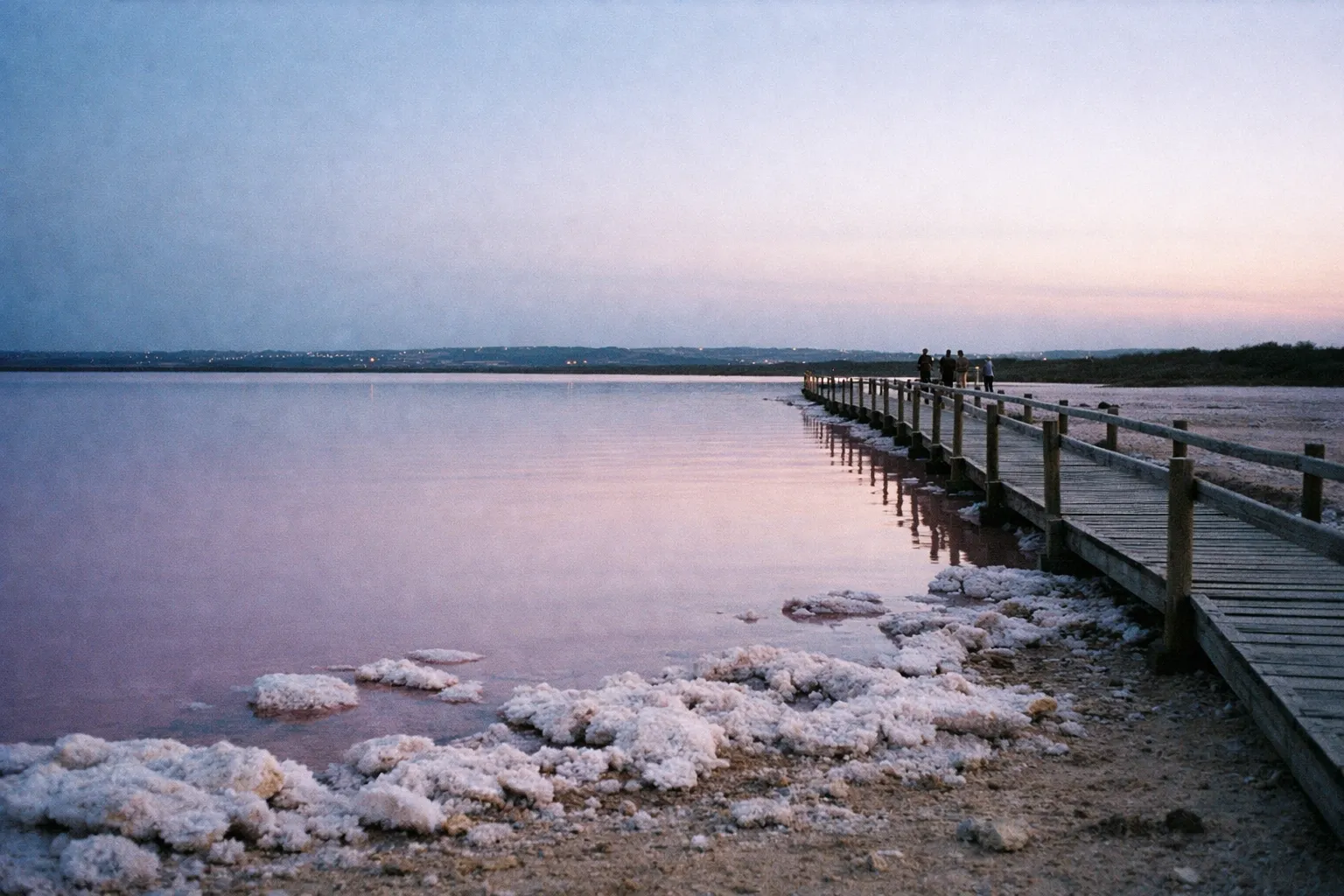
The pink and red color comes from a mix of Dunaliella salina microalgae, halophilic bacteria, brine shrimp, and extreme salinity. In the most concentrated basins, salinity can exceed ten times that of normal seawater, and those microorganisms produce the vivid pink and red hues visitors come to photograph. The more concentrated the brine, the more intense the color.
Salt extraction here goes back more than 500 years. Taíno communities harvested salt at Las Salinas before Spanish colonizers formalized commercial production in the 1500s, making it one of Puerto Rico’s earliest continuous industries. Today the salt largely feeds pharmaceutical manufacturing rather than the dinner table.
Two things follow from that history. First, this is an active production site: no swimming, no wading into ponds, no crossing fences. The salt crusts are fragile and the operations are ongoing. Second, the industrial salt pans and piles are part of the landscape you’re looking at, not an eyesore to edit out - they’re the reason the place exists.
Why the Color Changes (and When to Visit for the Best Pink)
Dry-season months, roughly December through March, give you the best odds of vivid pink at Las Salinas. Higher evaporation drives up salinity, which intensifies the color. After heavy rain, the diluted brine can turn ponds brownish-red or cloudy white until evaporation re-concentrates them.
I’ve seen the flats look genuinely spectacular in mid-January - the kind of saturated pink that makes you think your camera’s white balance is broken - and I’ve also seen them look like rust-colored puddles after a wet week. Time your visit for mid-morning or late afternoon; harsh midday sun flattens the color contrast. Before you commit to a two-hour drive specifically for the color, check recent visitor photos online. Even in dry season there’s no guarantee. Treat it as a high-probability window, not a certainty.
Los Morrillos Lighthouse: The Cliffs at the End of the Road
Los Morrillos Lighthouse (Faro Los Morrillos de Cabo Rojo) was built by the Spanish in 1882 and is recognized as the third lighthouse constructed on Puerto Rico. It’s a neoclassical structure with green window trim, still an active navigational aid with a light range of about 20 nautical miles (37 km). The tower sits on limestone cliffs roughly 200 feet (60 m) above sea level at the island’s extreme southwestern point, near coordinates 18°06′N, 67°05′W.
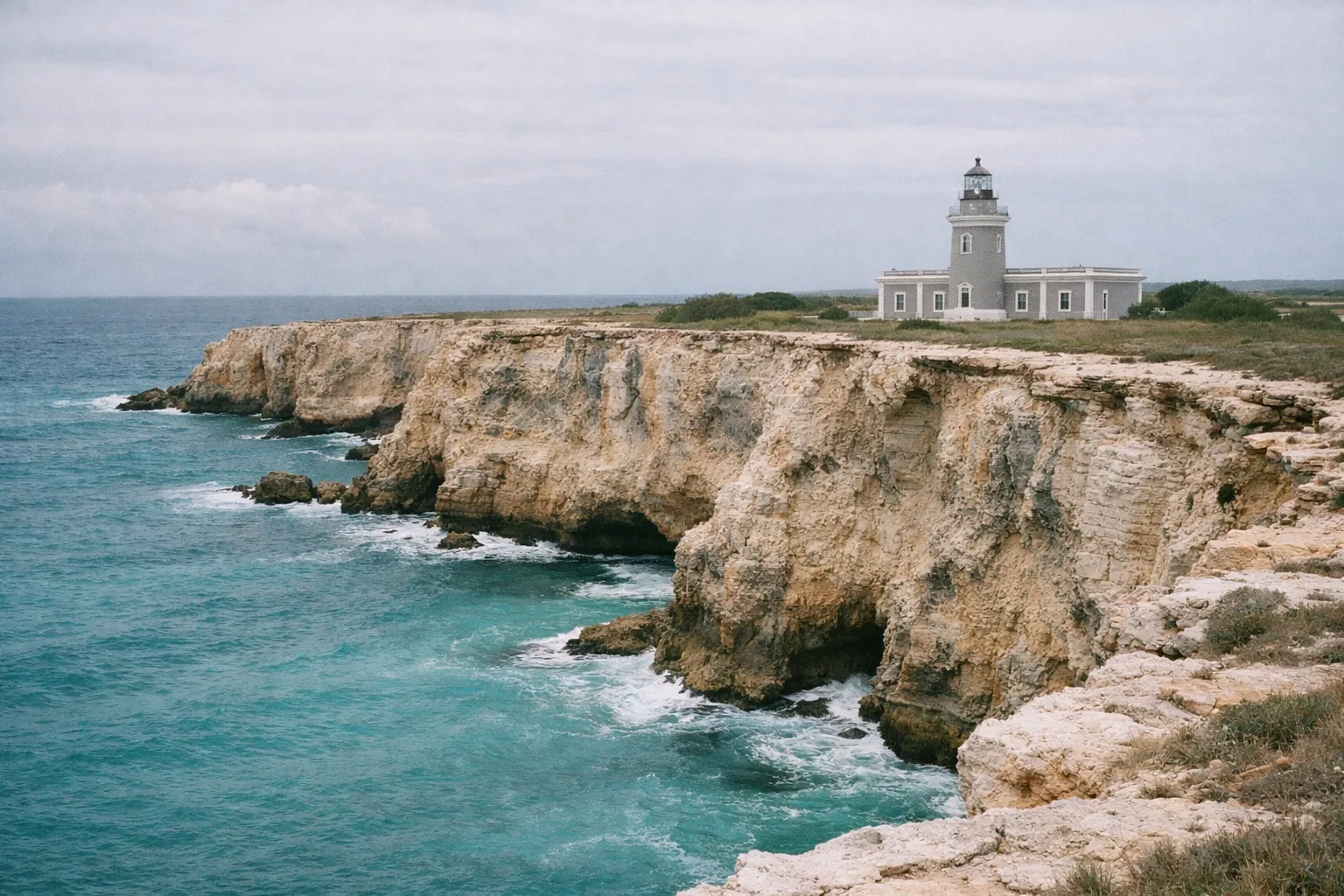
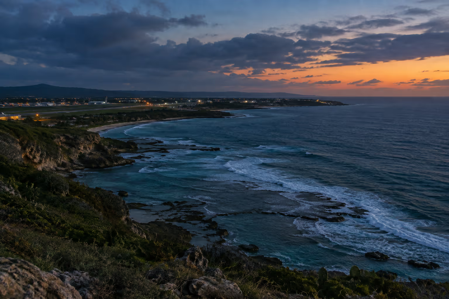
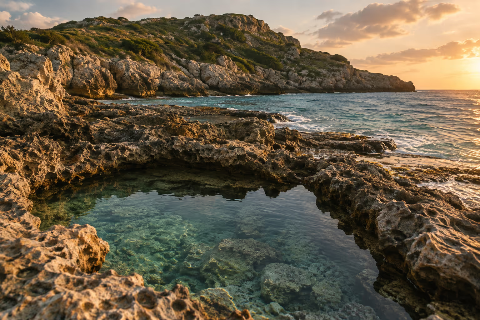
From the cliff edge, views stretch across the Caribbean Sea in one direction and back toward the salt flats in the other. The kind of view that makes you stop walking. Turquoise water sits directly below the white tower, and on a clear afternoon the color contrast between the cliffs, the tower, and the water is as good as anything on the island’s coast.
Access is via the same PR-301 corridor. Most visitors park near the road terminus and walk to the lighthouse. A hiking guide from Oceanwide Explorers describes the trail as a 1.5-mile (2.1 km) round-trip across uneven, rocky terrain with a few short steep sections - not technical, but not flip-flop territory either.
Golden hour is the most photographed window. Late-afternoon sun hits the white tower and the water simultaneously, and the cliffs photograph dramatically as the light drops. If you’re chasing the lighthouse at golden hour, note that the salt flats gates close earlier - you can’t do both at their best on the same evening without planning around the hours.
Playa Sucia: The Beach Below the Lighthouse
Playa Sucia sits directly below the Los Morrillos cliffs and is the swimming component of this trip - the thing Las Salinas is not. It’s one of the more secluded beaches in the southwest, backed by cliffs with clear, gently sloping water. Discover Puerto Rico describes the water as generally swimmable in normal conditions, though the area is open to Caribbean swells, so check tide and surf forecasts before you go.
Most visitors walk the flats and the lighthouse first, then descend to Playa Sucia for a swim. Time it for a low-tide window and the shoreline is wider and easier to walk. There are no permanent facilities here - no vendors, no restrooms, no shade you didn’t bring. Pack your own water, food, and sun protection. For context on how Playa Sucia stacks up against the island’s other top shorelines, the best beaches in Puerto Rico guide covers the full range of options across the island.
Inside the Cabo Rojo National Wildlife Refuge: Trails and Wildlife
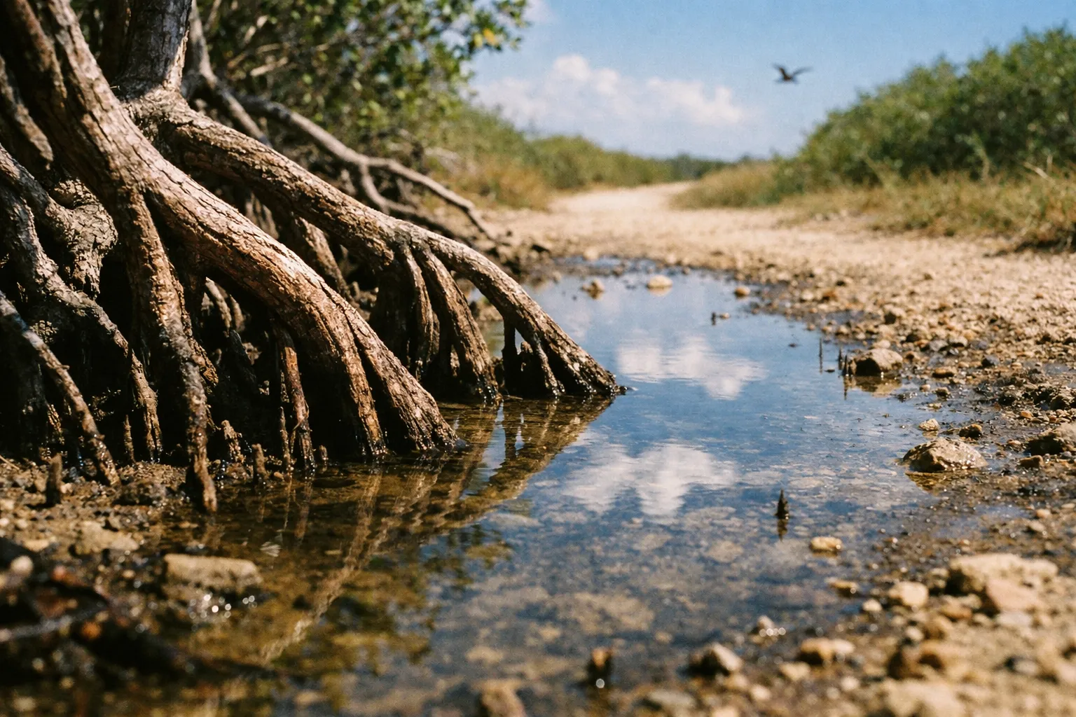
The Cabo Rojo National Wildlife Refuge covers approximately 1,836 acres split between upland dry forest and the Salt Flats Unit, and it’s the part of this trip most guides skip entirely. The Salt Flats Unit offers three distinct hiking trails that pass through all four mangrove species found in Puerto Rico - red, black, white, and buttonwood - plus subtropical dry forest. This is more than a lagoon-edge photo stop if you want it to be.
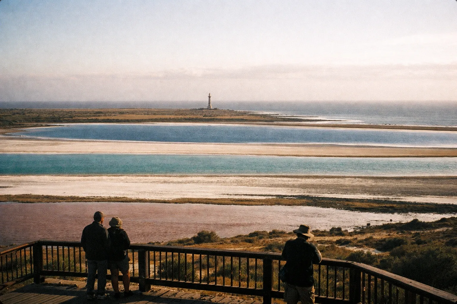
The Salt Flats Observation Tower is the single best platform for wide-angle photography, giving you a panoramic view over multiple color bands across the lagoons and the industrial salt pans. Climb it for orientation before you walk, or come back to it for the wide shot. Either way, don’t skip it.
The refuge is serious bird habitat. The U.S. Fish & Wildlife Service identifies it as supporting over 40 species of shorebirds and waterbirds, and Caribbean flamingos occasionally feed in the lagoons - their pink coloration comes from the same carotenoid pigments in the algae and brine shrimp that tint the water. Bring 8× or 10× binoculars if you’re serious about birding, and arrive early: shorebird activity peaks around sunrise, human traffic is lowest, and the light is better.
The Interpretive Center is open Wednesday through Saturday, 8:00 AM to 3:30 PM, with exhibits on Taíno salt use, Spanish-era salt commerce, and modern pharmaceutical applications. Guided tours are available by advance arrangement. If the center is open on your visit day, start there - the history makes the flats read differently once you’re standing in front of them.
Getting There and Getting Around the Southwest Corner
Driving is the only realistic way to reach Cabo Rojo’s salt flats and lighthouse. Rent a car at SJU in San Juan or at BQN in Aguadilla, and build your day around it.
From San Juan, the drive covers roughly 173 to 175 km (about 108 miles). Rome2Rio clocks the raw driving time at around 2 hours 12 minutes, and 1Map puts it at about 2 hours 15 minutes - but factor in traffic and stops and you’re realistically looking at 2.5 to 3 hours each way. Rome2Rio estimates fuel and toll costs of $19 to $28 for that one-way trip, according to Rome2Rio’s San Juan to Cabo Rojo listing. The standard route runs PR-52 south from San Juan, then PR-2 west, PR-100 south, and finally PR-301 toward Playa Sucia and the lighthouse.
If you’re flying in specifically for the southwest, BQN is the smarter airport. Rome2Rio lists the Aguadilla-to-Cabo Rojo route at about 51 km (32 miles) with a drive time near 45 minutes, and Discover Puerto Rico similarly places BQN roughly 45 minutes from Cabo Rojo. Sub-hour access versus 2-plus hours from the capital - that’s a meaningful difference if you have flexibility on routing. The northwest coast town of Isabela is also within easy reach of BQN, and things to do in Isabela make it a natural add-on if you’re basing yourself in that corner of the island.
On PR-301 itself, the Las Salinas gate and informal roadside parking appear before the road terminus, which ends near the lighthouse parking area. Most visitors do both stops in sequence: flats first, then drive on to the lighthouse and Playa Sucia.
One navigation warning worth repeating: enter “Las Salinas de Cabo Rojo” or “Cabo Rojo National Wildlife Refuge Salt Flats Unit” into your GPS. Searching “pink beach” or vague terms can misdirect you to other spots along the coast and cost you the interpretive center entirely.
Hours, Access, and What to Expect at the Gate
The Salt Flats Observation Tower is open Monday through Saturday, 8:00 AM to 3:30 PM, and the Interpretive Center is open Wednesday through Saturday, 8:00 AM to 3:30 PM, per the U.S. Fish & Wildlife Service. There is no entrance fee for the refuge, including the Salt Flats Unit, the tower, and the main walking trails.
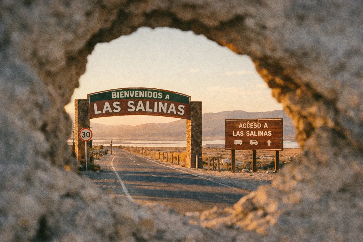
Plan to arrive by 9:00 to 10:00 AM for a comfortable half-day. Gates typically close around 4:00 to 5:00 PM, so arriving after 3:00 PM risks limited tower access and a longer walk back in fading light. This isn’t a place to wing on a late-afternoon whim.
Expect to walk. Vehicle gates to the interior service roads are often closed to protect sensitive habitat and ongoing salt operations, which means you’ll typically cover about 1 mile from the access point along a flat but fully exposed road to reach the primary lagoon viewpoints. The terrain is easy. The sun is not. Hats and water are explicitly recommended.
The lighthouse area works differently. There’s no formal gate, ticket booth, or fee - you park near the end of PR-301 and walk the uneven path to the building and cliffs. Access is governed by daylight and weather rather than posted hours.
How to Plan Your Visit: Half-Day Itinerary and Route Options
Plan on 3 to 5 hours to combine the salt flats, the observation tower, the lighthouse, and Playa Sucia. The salt flats walk and tower alone run about 1 to 2 hours; adding the lighthouse trail and a beach swim brings the total to a half-day outing.
Here’s how the variations stack up, ranked by how much they deliver relative to the effort:
- Standard half-day (3-5 hours, roughly 3-4 miles total walking) - worth the detour: Best for first-timers. Arrive by 9:00-10:00 AM, walk to the lagoon viewpoints, climb the tower, drive to the lighthouse, then descend to Playa Sucia for a swim. Hits all three anchors.
- Photography-focused - worth the detour in dry season: Shoot the flats from the tower at mid-morning, then position at the lighthouse for golden hour on the cliffs - accepting you’ll be at the flats early and the lighthouse late. The payoff is real if the timing aligns.
- Nature-focused (3-4 hours on foot) - worth it if birding is the point: Use the three refuge trails through mangrove and dry forest, prioritize early morning for shorebird activity, and go lighter on the lighthouse. Skip this variant if you’re not genuinely interested in the habitat.
- Family-friendly (under 2 miles walking) - fine, not essential: Focus on the boardwalks and tower at the Salt Flats Unit plus the lighthouse viewpoint, and skip the more rugged descent to Playa Sucia. Covers the highlights without the harder terrain, but you lose the beach payoff.
To turn this into a full day, pair it with Joyuda. The seafood restaurant strip along PR-102 sits about 20 minutes north of Cabo Rojo town, and lunch or dinner there makes a complete 8 to 10 hour day from most western Puerto Rico bases.
How to Spend a Half-Day at Las Salinas and Los Morrillos
3 to 5 hoursStep-by-step itinerary for visiting the salt flats, observation tower, lighthouse, and Playa Sucia beach.
- 1
Arrive by 9:00-10:00 AM
Park roadside near the Las Salinas gate at the Salt Flats Unit on PR-301.
- 2
Walk about 1 mile
Follow the access road to the main lagoon viewpoints, staying behind fences and on designated paths.
- 3
Climb the Observation Tower
Open Monday to Saturday, 8:00 AM to 3:30 PM, for elevated views over the color-banded flats.
- 4
Visit the Interpretive Center
If open Wednesday to Saturday, learn about Taíno and Spanish salt history before walking the flats.
- 5
Drive to the road terminus near Playa Sucia
Park and walk the uneven cliff path to Los Morrillos Lighthouse.
- 6
Spend time at the lighthouse and cliff edge
Photograph views toward the Caribbean Sea and back toward the salt flats.
- 7
Descend to Playa Sucia for a swim
This is the only swimming component of the day, weather and tide permitting.
- 8
Depart by 2:00-3:00 PM
Leave to clear the gates and avoid the walk back in peak afternoon heat.
What to Bring: Gear and Practical Prep
The salt flats are exposed and highly reflective, so pack for sun and heat first. The U.S. Fish & Wildlife Service recommends carrying at least 1.5 to 2 liters of water per person for a half-day here, with a specific warning that heat stress is a genuine risk in late morning and midday. Bring more than you think you need.
- Sun protection: A broad-brimmed hat, SPF 30+ sunscreen (reef-safe for Playa Sucia), and lightweight long-sleeve clothing. Shade along the access road and lagoon viewpoints is minimal to nonexistent.
- Footwear: Closed-toe hiking shoes or sturdy sandals with grip. Surfaces range from gravel roads to boardwalks to rocky cliff paths, and flip-flops are a bad call for the Los Morrillos trail.
- Camera gear: The Observation Tower is your best platform for wide-angle lagoon shots. If you’re shooting the cliffs at golden hour, plan to be at the lighthouse by roughly 4:30-5:00 PM and accept that the flats gates will already be closing.
- Binoculars: 8× or 10× for shorebirds, waterbirds, and the occasional flamingo, most of which you’ll spot at distance from designated points.
- Cash and supplies: No vendors or facilities exist at the flats or lighthouse. Bring snacks and water from town.
On accessibility: the Observation Tower and some boardwalks are more manageable than the lighthouse trail, which includes uneven terrain and short steep sections and is not fully wheelchair-accessible.
Common Mistakes That Ruin the Visit
Expecting guaranteed pink water. The color shifts with rainfall, salinity, and microbial activity. After storms or during wetter months, lagoons can go brownish-red or pale. Visit in dry season, check recent photos, and accept the variability rather than banking on cotton-candy pink.
Treating it as a beach. Las Salinas is an active commercial salt production site inside a federal wildlife refuge. Swimming, wading into ponds, and crossing fences are prohibited. The swimming beach is Playa Sucia, a separate stop at the end of PR-301 - bring your swim gear for that, not the flats.
Arriving after 3:00 PM. The Observation Tower and Interpretive Center close at 3:30 PM, and inner gates often close by late afternoon. Show up late and you risk curtailed access plus a long walk back in fading light.
Underestimating the heat. Midday on the flats, with high surface reflectivity and no shade, is genuinely punishing. This is the mistake that sends people back to the car early and miserable. Carry extra water and avoid peak sun hours where you can.
Trespassing into production areas. Crossing fences or wading in for a closer photo is prohibited - commercial operations, fragile salt crusts, and safety all factor in. The views from legal vantage points are strong enough on their own.
Bad GPS search terms. “Pink beach” and generic markers misdirect. Use “Las Salinas de Cabo Rojo” or “Cabo Rojo National Wildlife Refuge Salt Flats Unit” to land at the right segment of PR-301.
Safety and Practical Realities in the Southwest
Cabo Rojo’s southwest corner - the refuge, lighthouse, and beaches - is low-risk for visitors, with the main hazards being environmental rather than security-related. Heat, sun exposure, and uneven cliff terrain are what actually hurt people here. Safety overviews consistently characterize Cabo Rojo and the surrounding southwest municipalities as relatively quiet and low-crime compared with urban centers.
The town of Cabo Rojo itself is a normal Puerto Rican municipality where standard travel awareness applies: don’t leave valuables visible in a parked car, stay aware of your surroundings after dark. These are the same precautions you’d take anywhere, not a special warning about this region.
Is it worth visiting? Yes - if you’re already on the west or southwest coast of Puerto Rico. The combination of pink lagoons, limestone cliffs, and a secluded beach in a single half-day is hard to replicate elsewhere on the island. It’s a weaker pitch as a standalone day trip from San Juan, where the 5 to 6 hour round-trip drive eats most of the day.
One climate advantage works in your favor: the southwest is Puerto Rico’s driest region, with substantially lower annual rainfall than the northeast and the El Yunque corridor. That dryness is exactly why the salt flats exist and why the area is reliably sunnier for visitors. The exception is hurricane season - the Atlantic season runs June 1 to November 30, peaking late August through October, and major storms can temporarily close access roads and refuge gates. Check current status if you’re visiting in that window.
Frequently Asked Questions
- What airport do you fly into for Cabo Rojo, Puerto Rico?
- Most visitors fly into Luis Muñoz Marín International Airport (SJU) in San Juan, about 2.5-3 hours east by car. Rafael Hernández Airport (BQN) in Aguadilla is closer, about 45 minutes north. A rental car is required; no practical transit serves the salt flats.
- Is the pink color at Las Salinas always visible?
- No. The vivid pink requires high salinity, low water levels, and active microorganisms. Dry season (December through March) offers the best odds. After rain, lagoons can turn brownish-red or pale white. Check recent photos before visiting for the color.
- Can you swim at the Cabo Rojo salt flats?
- No. Las Salinas is an active commercial salt production site inside a wildlife refuge. Swimming, wading, and crossing fences are prohibited. Playa Sucia beach nearby is the designated swimming spot.
- How safe is Cabo Rojo, Puerto Rico?
- The refuge and lighthouse areas are low-risk, with environmental hazards like heat and uneven terrain. The town is a normal municipality; standard travel precautions apply. The southwest coast is quieter and less tourist-dense.
- How long does a visit to the salt flats and lighthouse take?
- Salt flats with viewpoints and tower take 1-2 hours. Adding the lighthouse and Playa Sucia extends it to a half-day (3-5 hours). Expect about 1-mile walking each way to lagoons and a short uneven hike to the lighthouse. Arrive by 9:00-10:00 AM.
- Are there flamingos at the Cabo Rojo salt flats?
- Occasionally. Caribbean flamingos feed in the lagoons, attracted by algae and brine shrimp pigments. Sightings aren't guaranteed. The refuge hosts over 40 shorebird species; bring binoculars and visit at sunrise for best birdwatching.
Making the Trip Worthwhile
Cabo Rojo’s southwest tip gives you a working salt landscape 500 years in the making, an 1882 lighthouse on limestone cliffs, and a secluded swimming beach - all in a single half-day, if you time it right and go in with accurate expectations. Two variables decide whether it works: arrive before 3:00 PM so you’re not fighting the gates, and visit in dry season for the best odds on vivid pink.
Don’t drive out expecting a guaranteed cotton-candy lagoon or a place to swim among the salt. Expect a walk in full sun to real vantage points, a genuinely dramatic lighthouse, and a beach that delivers the swimming the flats never will. Plug “Las Salinas de Cabo Rojo” into your GPS, rent the car you already knew you needed, and build the rest of the day around the lighthouse, Playa Sucia, and a seafood lunch in Joyuda.